Winter storm, cold and snow SE Australia

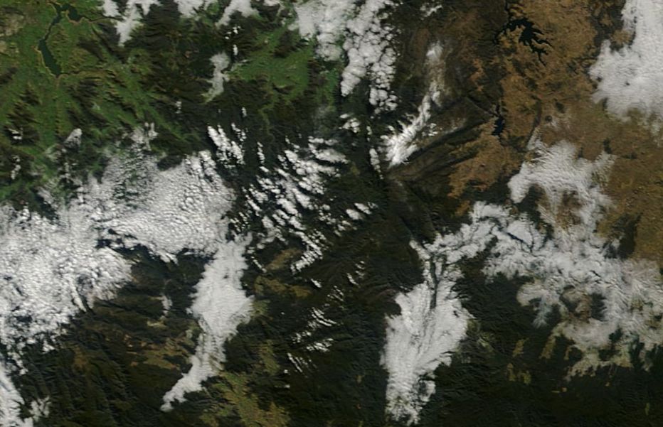
The attached satellite photo acquired from NASA of the Snowy Mountains and the high country of North east Victoria dated 8 July 2015 is showing little snow cover across elevated regions. Light snow fell on July 3 across the higher areas and there is an official cover of 8 cm at Spencers Creek (Snowy Hydro). The snow season has been described as poor due to lack of natural snow cover.
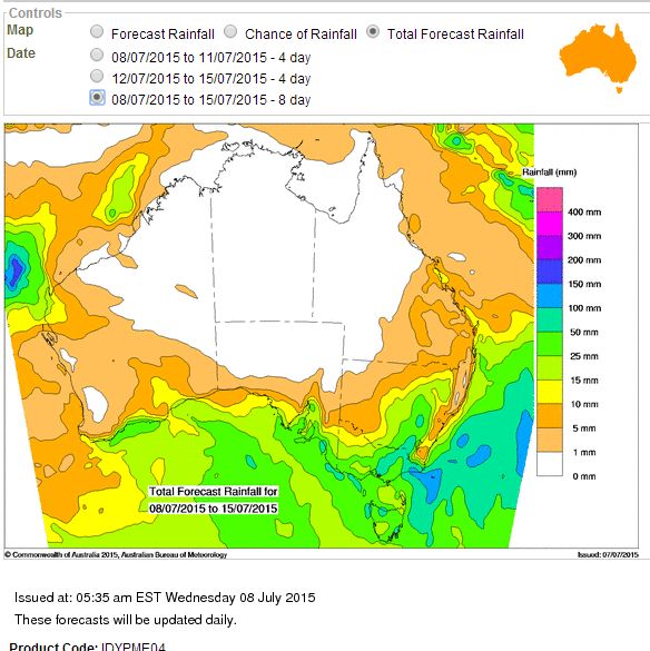
However, a very significant weather system according to various weather models is expected to pass over south east Australia commencing on Thursday and Friday with the main system and cold air coming through on Sunday and Monday. This system should it eventuate will result in some rainfall across the central and southern inland of New South Wales and much of Victoria especially the east and north east. The best falls for New South Wales are expected to occur over the central west slopes (The hillier regions) and the south west slopes (The hillier regions) with precipitation occurring as snow at higher levels. The attached model from the Water and Land (BOM 8/7/15) is the forecast rain covering the whole event. The model also suggests a distinct rain shadow along the coastal fringe.
Weather models point to a major surge of cold air from the south and south west as the system passes over. The models suggest that the air is so cold that there is the potential for snow to occur right along the ranges to low levels. So much so, forecasts are being made for some snow to fall at Lithgow, Oberon, Crookwell and Katoomba for Sunday and Monday.
Some suggested early forecast maximum temperatures for Sunday and Monday include:-
Katoomba - Sun - Max 6C. Mon - Max 7C.
Orange - Sun - Max 3C. Mon - Max 5C.
Lithgow - Sun Max 5C. Mon - Max 6C.
Goulburn - Sun Max 5C. Mon - Max 7C.
Cooma - Sun Max 6C. Mon - Max 8C.
Crookwell - Sun Max 4C. Mon - Max 5C.
Oberon - Sun - Max 3C. Mon - Max 4C.
Oberon sits at 1,177 metres above sea level and there are hills that are higher in elevation nearby. It would be reasonable to suggest that more snowfall would fall across the Oberon Plateau given its elevation.
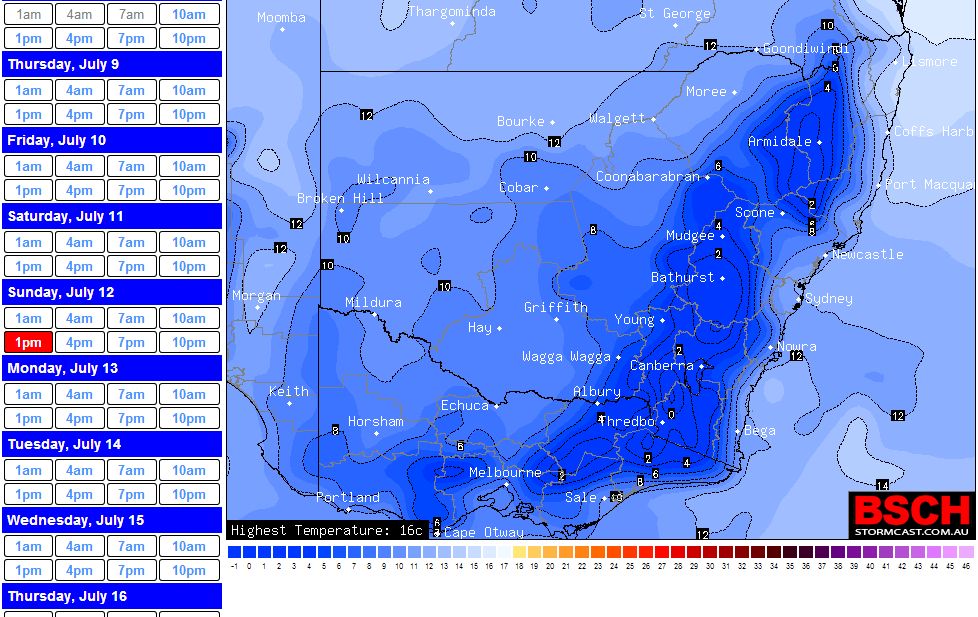
Even Sydney will feel the cold outbreak where maximum daily temperatures are forecast to be within the range of 13C to 15C with cold south to south west winds prevailing.
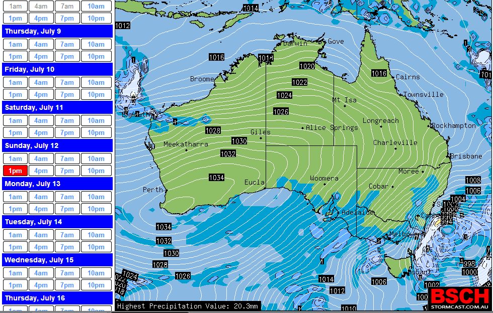
The attached synoptic chart from the BSCH (GFS - acquired 8/7/15) suggests an intense low pressure cell off south east Australia (1 pm period Sunday afternoon) driving very cold south and south west winds over the whole of the south east. A temperature plot suggested for the same 1 pm period (BSCH) equally shows the cold temperatures.
This event should it eventuate would provide a significant boost to the snow cover for the ski resorts. However when conditions settle down, another bout of very cold overnight conditions are likely to occur across the south east as the next high pressure cell moves across.
Hi Harley,
Looking forward to this cold system – widespread snowfalls is a certainty if it comes through. I would say snowfalls into southern Queensland as well. Widespread severe frosts to follow!
The first of the fronts has passed through New South Wales during Friday which dropped some helpful rainfall across portions of the state, mainly the Central West Tablelands, the hillier regions of the Central West and South West slopes.
The heaviest totals from 9 am to 9 pm 10/7/15 include 15.6 mm at Bathurst and 14.6 mm at Orange. There was also a fall of 12.4 mm at Cowra and 9 mm at Parkes while Canberra received 7.2 mm during the same period.
The first of the fronts produced some snowfall across higher regions during the same period including 11.4 mm of precipitation at the Mt Ginini rain gauge and 9.6 mm of precipitation at the Falls Creek rain gauge. Given the temperatures being below freezing level at both stations, this would have fallen as snow.
The cold front and cold surge following its wake should now cross New South Wales during Saturday and reaching Sydney overnight resulting in much colder conditions and likely snow at higher elevations.
Forecasts of snow is still being made for places such as Orange, Oberon Plateau, Lithgow and Crookwell with some lighter falls for the elevated areas of the Blue Mountains.
It is even identified that snow is in the forecast for Guyra and Armidale region of the Northern Tablelands.
For higher regions, forecasts are being for at least 50 cm of snow to fall at the ski resorts which would turn around a poor start to the winter ski season.