

As shown in the various synoptic charts and models including images acquired from CIMSS and NASA (Rapid Lance) and dated 5 July 2015, the western Pacific Ocean is an active region with at least three tropical storms or typhoons in existence at the same time. This is showing a dynamic period and a vast region favourable for such storms. From west to east these are:-
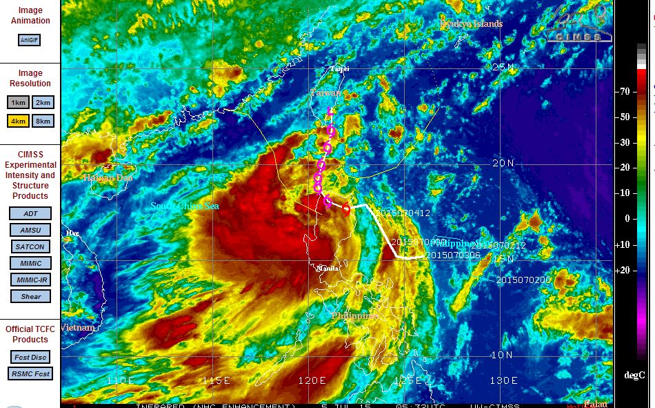
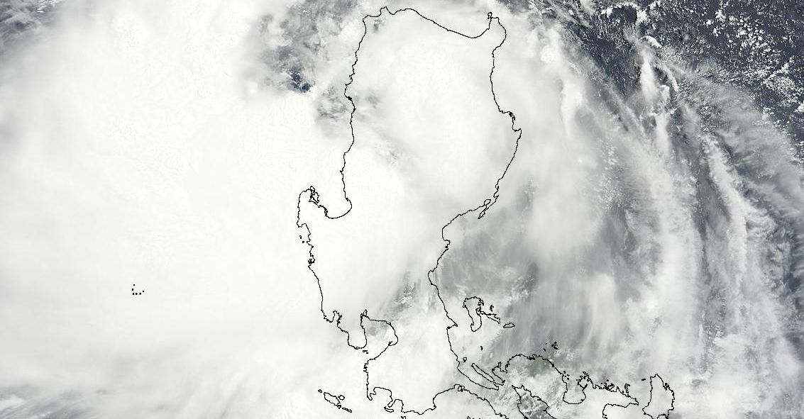
STORM 1 being Egay (Lindfa). The western most storm today crossed over northern Luzon Island. According to PAGASA (Philippines), this storm is determined as being a very active storm and potentially dangerous. Wind speeds have increased to 95 km/h at its centre with some gusts being recorded to near 120 km/h. This storm is now passing back out to sea and likely to approach the south east coast of China in coming days. A satellite photo is attached showing its location with Luzon Island super imposed over the top to demonstrate its size relative to the island.
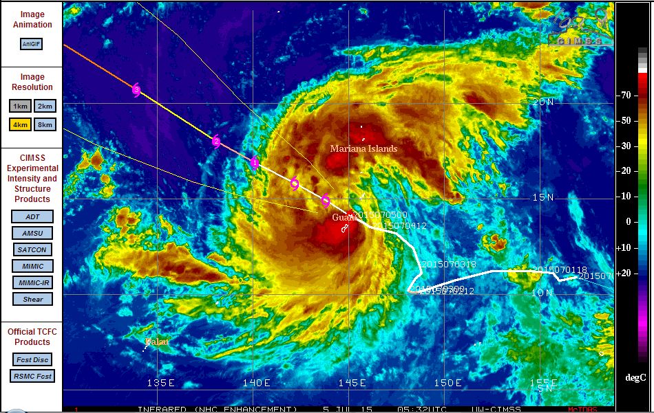
STORM 2 being Chan Hom. The storm (Centre) is a dynamic storm as well as it takes a north west path. The storm passed over Guam Island that brought peak wind gusts to 46 miles per hour (Approximately 74 km/h) at Rota at 2.36 pm (5/7/2015). A weather station on Guam recorded 8.81 inches (Approximately 224 mm) of rain over the past 2 to 3 days from this storm until 4.32 pm 5/7/2015. This storm is expected to become a typhoon in coming hours but remain over open ocean. A satellite photo of the storm with Guam superimposed across the image shows the true nature of the storm.
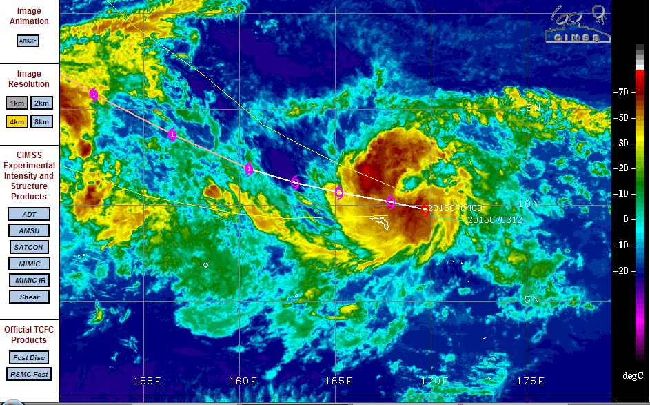
STORM 3 being Nangka. The eastern most storm formed during Friday and Saturday and is very dynamic. It is currently near the Marshall Islands but weather stations on the island currently do not show significant conditions occurring. Winds at the centre are reaching 50 knots and winds are expected to increase rapidly to 65 knots in 24 hours and a typhoon shortly after. This storm is expected to travel north west over open ocean.
This shows a dynamic region with three major storms occurring at the same time in a region that favours such storms.
Hi Harley,
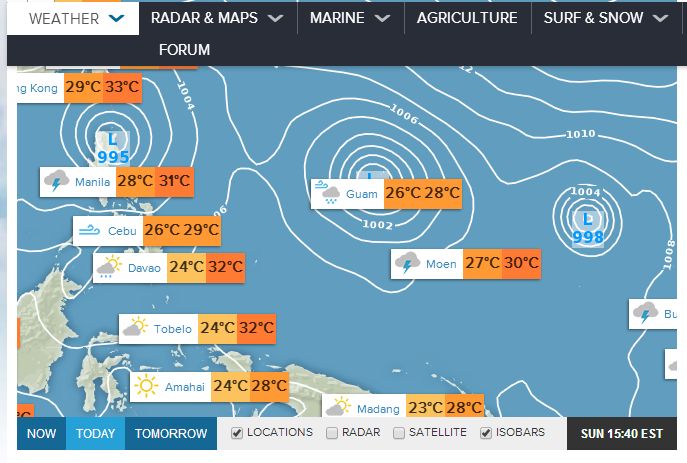
I found it fascinating having three tropical lows in close proximity and forming typhoons as well as the one North East of Australia. The Philippines is in the firing line!
The storm Egay (Lindfa) that impacted the Philippines has now cleared the coast and is now tracking towards the Chinese coast although in a weakened form with wind speeds of between 40 and 50 knots.
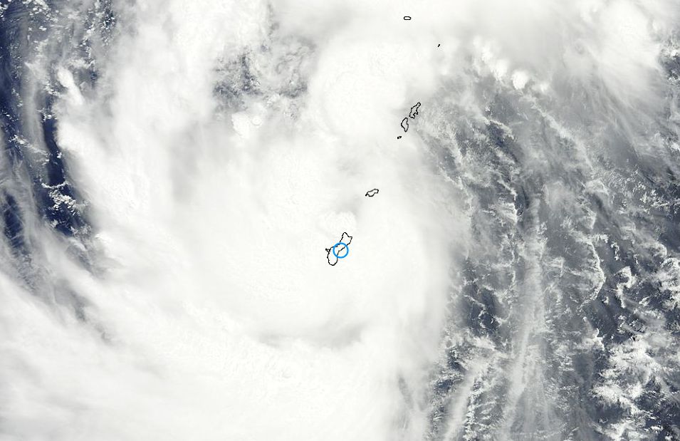
The storm that is noteworthy is Nangka which is now west of the Marshall Islands . Tropical Storm Nangka has developed into a typhoon and is now known as Typhoon Nangka. Typhoon Nangka is in a favourable environment to develop further. An eye has also developed confirming its status as a typhoon. Winds at the centre are now between 60 and 70 knots with gusts estimated to 75 knots.
The Joint Typhoon Warning Centre verifies a storm with a central pressure of 975.3 MB and has an eye and currently located 12.2 degrees north and 158.38 degrees east.
The storm is expected to develop wind gusts to 85 knots within 12 hours and to 100 knots within 24 hours as it tracks north west across open ocean.
The latest image of Typhoon Nangka is attached below.
Chan Hom has maintained its course as a tropical storm although it is close to the threshold of being a typhoon.
A spectacular satellite image acquired from NOAA is showing all three storms as they now move north westwards towards the Tropic of Cancer. The MTSAT image shows the true nature of all three storms at 7 July 2015.
Storm 1 – Egay (Lindfa) showed signs of re intensifying but it is now very close to the southern Chinese coast. The storm is at Tropical Storm status sustaining winds from 40 to 50 knots at its centre. Its life will end soon as it makes land fall.
Storm 2 – Chan Hom has now officially become a typhoon sustaining winds of 75 knots at the centre. An eye has also developed and forecast models suggests wind gusts to 85 knots at the centre within 12 hours and a powerful Category 4 storm in 36 hours. This storm has moved closer to the Philippines but given its location, should not threaten the country. This is now a sizeable storm.
Storm 3 – Nangka. Now a substantial Category 3 typhoon with wind gusts of 110 knots close to the centre. Nangka is threatening the Mariana Islands and models suggest a powerful Category 4 storm in the vicinity of the islands.
The satellite photo is attached showing all three storms as separate entities.