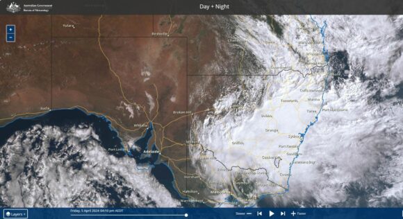
As indicated within a previous post, a significant rain event was anticipated to unfold across Friday and Saturday 5 and 6 April 2024. At that time, weather models anticipated an event that would result in rainfall reaching 100 to 125 mm.
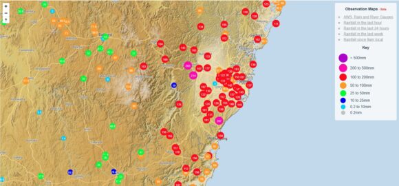
As anticipated, this event has unfolded across the two days with 2 day rainfall accumulations exceeding forecast models at that time and with accumulation exceeding 200 mm at numerous locations.

I have a rain gauge and my figures for the event were:
- Friday morning to 9 am - 60.4 mm.
- Saturday morning to 9 am - 116.2 mm.
This totals 176.6 mm across the 2 day period which is well in excess of what was initially expected.
The official figures for Penrith far exceed this and are impressive as follows:
- Friday morning to 9 am - 85.4 mm.
- Saturday morning to 9 am - 167 mm.
This totals 252.4 mm across the 2 day period.
Sydney Observatory Hill
- Friday morning to 9 am - 111 mm.
- Saturday morning to 9 am - 145 mm.
This totals 256 mm across the 2 day period.
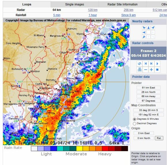
If one did this across other official stations, it would become clear that cumulative totals have topped 200 mm across several areas of Sydney.
The system gradually developed across Sydney during Thursday with light showers steadily increasing from mid morning tending to light to moderate rain by Thursday night. The rainfall increased in intensity resulting in some strong overnight rainfall. By 9 am Friday morning, Hornsby received 115 mm and Kurrajong Heights received 111 mm.
Much of Sydney received solid totals of greater than 50 mm with 50 to 90 mm being common. However, an area along the foot of the Blue Mountains to the west of the city received slightly higher falls of 70 to 90 mm which is likely to be a result of orographic rainfall.
Rainfall eased during Friday (Daybreak) with some short breaks occurring. However, the rainfall intensity increased again as evening progressed.
Between 12 midnight and 5 am Saturday morning, a significant event unfolded as the northern edge of the rain moved south across the city. Much of the rainfall occurred during a short time period between 2 am to 5 am with some very heavy falls occurring. It was this event that resulted in the final figures as shown.
Forestville received the highest rainfall for Sydney being 187 mm followed by 171 mm at nearby Belrose. It is rare to see 100 mm plus totals being widespread across Sydney.
The system was pushing south and was out to sea by 5 am with a rapid clearing trend commencing thereafter. Sydney’s rainfall was exceeded by even heavier falls to the south including:
- Brogers No 2 (Brogers Creek) - 272 mm.
- Wattamolla - 257 mm.
- Dombarton Loop - 250 mm
- Mt Pleasant - 240 mm
- Russel Vale Colliery - 231 mm.
- Darkes Forest - 229 mm.
- Rixons Pass - 211 mm.
- Clover Hill - 210.
- Albion Park Post Office - 203 mm.
All south of Sydney and within the Wollongong region or just to the west and south of Wollongong including the Kangaroo Valley region. These are the heaviest totals for the 24 hour period to 9 am Saturday.
The result of such rainfall was flooding across low lying areas.
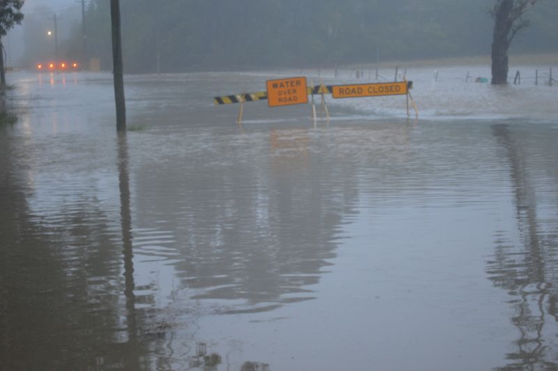
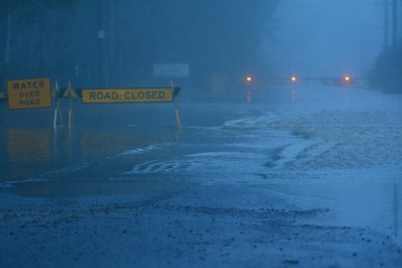
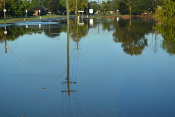
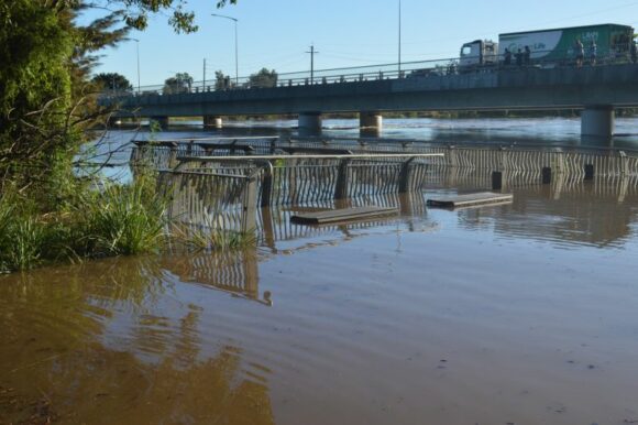
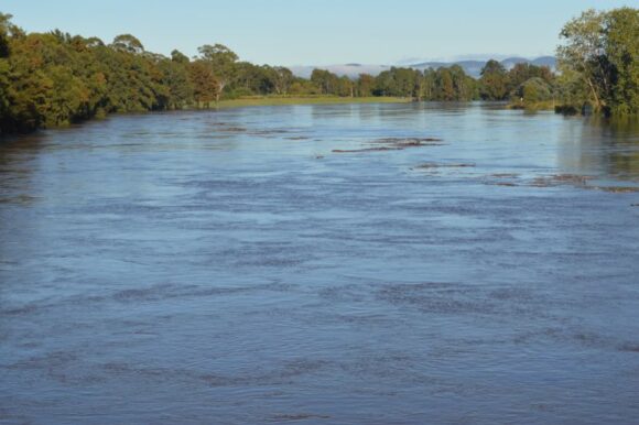
I went out at daybreak to take photos of the aftermath of this event around Windsor. Several low lying areas were visited including those around Pitt Town, Windsor and nearby areas. During the period between 7 am and 10 am Saturday morning:
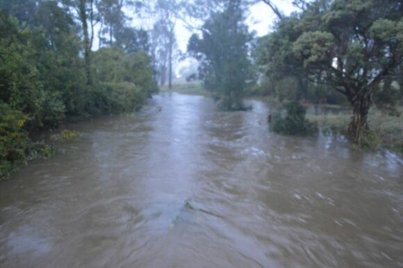
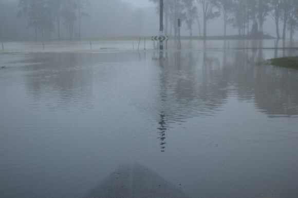
- Windsor Road was closed whilst I was at Windsor due to rising flood waters reaching the road carriageway.
- Windsor Bridge was open but rising floodwaters were within 2.5 metres of reaching the bridge concrete decking span. SES and authorities were on standby monitoring this.
- Television reporters with cameras were on site at Windsor Bridge filming the situation.
- Many smaller roads had or were in the process of been closed.
Inland New South Wales
Not as dramatic, the event pushed inland as well with rainfall reaching almost 100 mm at some locations. It is worth noting this as usually such events remain coastal. In this case, there have been some some significant rainfall totals across the inland including but not limited to Tamworth, Inverell and Dubbo as follows:
Tamworth
- 9 am Friday morning - 30.8 mm.
- 9 am Saturday morning - 66.8 mm.
Total 97.6 mm across the 2 day period.
Inverell
- 9 am Friday morning - 44.6 mm.
- 9 am Saturday morning - 55.6 mm.
Total 100.2 mm across the 2 day period.
Dubbo
- 9 am Friday morning - 37.2 mm.
- 9 am Saturday morning - 32.4 mm.
Total 69.6 mm across the 2 day period.
The system has moved south into northeast and northern Victoria. However, such high rainfall did not occur with only light falls occurring with maximum totals being 17 mm at Albury and surrounding regions to 9 am Saturday.
Melbourne 2 April 2024
Just prior to this event, the cold front that crossed through Victoria Monday night and into Tuesday (Monday 1 and Tuesday 2 April) brought some significant rainfall totals around Melbourne producing widespread 50 to 90 mm falls across the city and adjacent regions. It is rare to see Melbourne receive such rainfall in any given year.
The highest total was 92 mm at Toorourong followed by:
- Ferny Creek - 83 mm.
- Wallaby Creek - 81 mm.
- Monbulk - 79 mm.
- Avalon Station - 78 mm.
- Kinglake - 76 mm.
- Viewbank - 70 mm.
- Coldstream - 66 mm.
- Melbourne (City) - 53 mm.
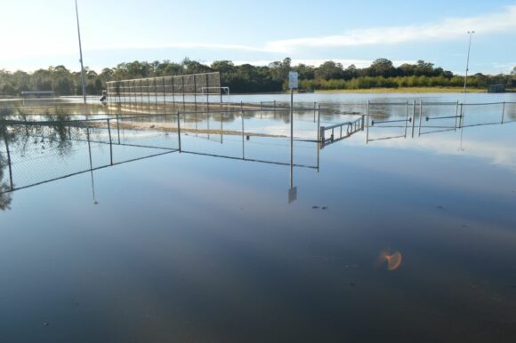
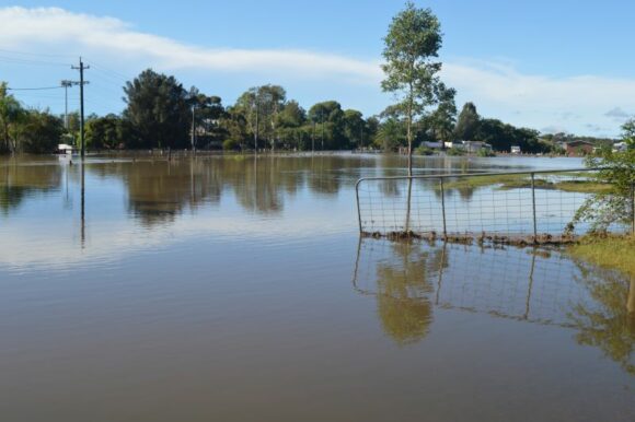
All photos supporting the post were taken between 7 am and 10 am Saturday morning 6 April 2024 across northwest Sydney. All these are showing various flooding situations arising from the event.
