Overnight Saturday and early Sunday morning as expected, the named storm “Tropical Cyclone Megan” formed and was officially declared a tropical cyclone.
The storm has moved further away from Groot Elylandt but not before dropping an impressive 431 mm of rainfall at the airport (Figure to 9 am Sunday morning) with cumulative 2 day totals topping 680.4 mm. If the 23.2 mm is included to 9 am Monday, then the 3 day rainfall tally stands at 703.6 mm.
This is an incredible amount of rainfall from a developing tropical cyclone and certainly an event that would cause major riverine flooding across the region.
Of interest, the weather station does in fact provide clues of its intensification as overnight Saturday / Sunday morning, peak wind gusts reached 85 to 87 km/h. With the core to the southeast at that time, it is likely that higher wind gusts would have occurred further to the south and east.
The region lacks a thorough weather station network and thus accurate rainfall and peak wind gusts are not possible. The region is isolated and thus it will be difficult to obtain a true picture of what has occurred at landfall.
There is a rain gauge at Centre Island on the Pellow Islands which has provided a solid account of rainfall at that location including:
- 75 mm to 9 am Sunday morning.
- 224 mm to 9 am Monday morning.
- 238 mm to 5 pm Monday afternoon.
Total to 5 pm Monday afternoon is 537 mm.
At nearby Borroloola:
- 114 mm to 9 am Monday morning.
- 111.6 mm to 5 pm Monday afternoon.
Total to 5 pm Monday afternoon is 225.6 mm.
It is clear that the storm is producing torrential and flooding rains.
There are peak wind gusts to 78 km/h at Borroloola but landfall has occurred to the east.

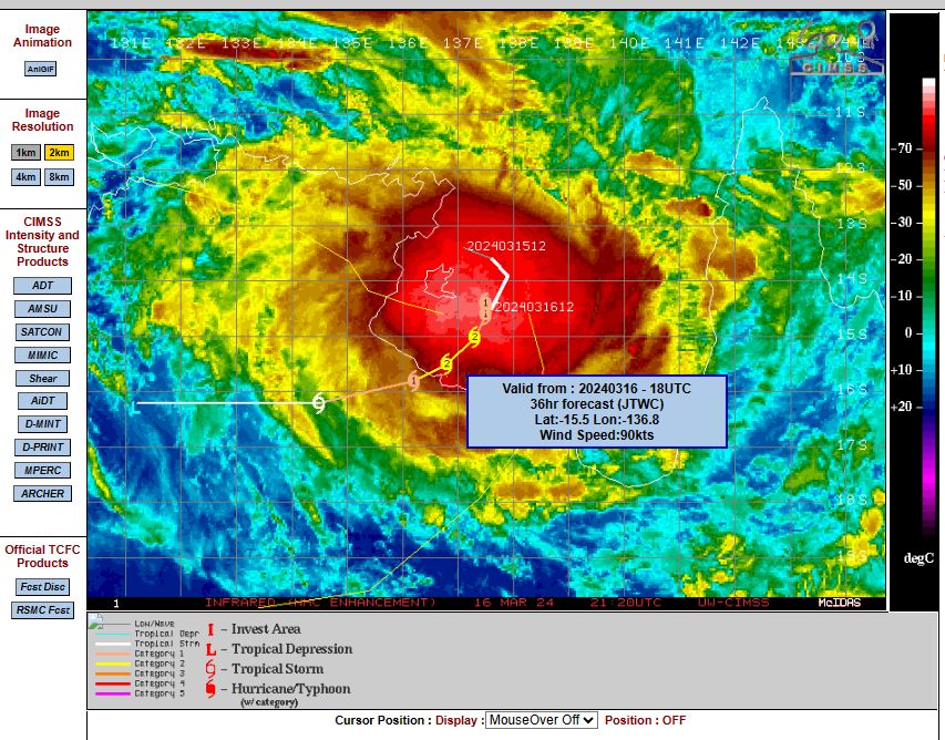
It is interesting to note that the CIMSS model as shown in the feature image above upgraded this storm to a Category 2 system on the Saffir Simpson Scale Sunday morning when compared to Saturday with forecast peak wind gusts to 90 knots or 167 km/h. This was further upgraded to peak wind gusts of 95 knots (176 km/h) Sunday afternoon prior to landfall.
This shows that that despite its short life span, this is one storm that has formed within an ideal environment.
Its life span is now cut short due to the proximity of land close by and with landfall occurring Monday, gradual weakening is now occurring.