
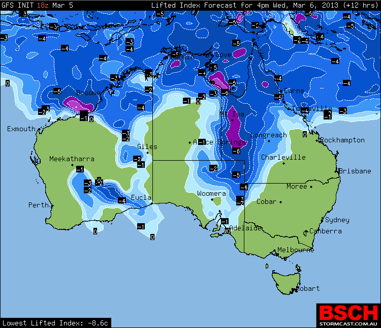
 The trough that has affected much of eastern Australia has progressed to western Queensland. Rain and storms can be expected int his region with day time heating although most likely moderate totals are anticipated.
Meanwhile, the Queensland map shows the development of a strong monsoonal low pressure system off far north Queensland. Models are expecting the low to deepen over the next few days and this time of the year is the most optimum for tropical cyclone development so this will be monitored closely if ideal conditions are in place for further intensification into a tropical cyclone.
I guess there were already isolated falls of 200mm – this from Weatherzone”
Outback downpour lifts grazier’s spirits
10:43 EDT A grazier in central-west Queensland says he has recorded more than 200 millimetres of rain overnight at Aramac, north of Longreach.
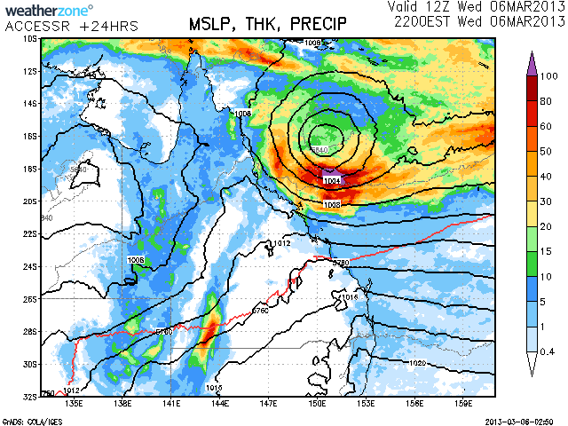
The expected low that should deepen in a couple of days!
Looks like a heads up that a tropical cyclone may form and possibly move towards the coast of Queensland near Rockhampton at this stage. A tropical cyclone watch and warning will be issued if this occurs for the relevant areas.
Posted is the wind map showing the wind direction and strengths in the Coral Sea (courtesy of the Bureau of Meteorology).
Here’s some information posted on the EWN QLD Alerts page this morning showing the variation in models with regards to the possible track of a tropical cyclone.
So Michael, how does one resolve possible tracks ie in your experience which solution comes out best – are there any patterns?