
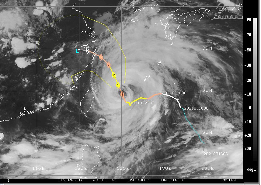
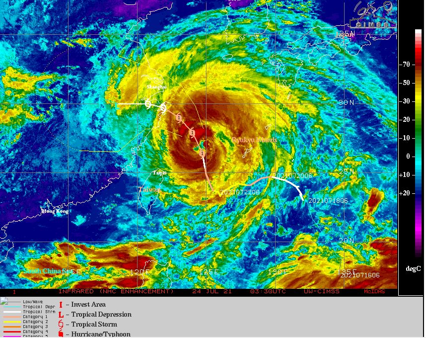
A sluggish and slow moving typhoon is currently slowly moving towards the city of Shanghai however landfall is expected to the south of the city. The storm has struggled to maintain any significant strength throughout its life span but it has changed course over recent days. While it has reached a Category 2 system on the Saffir Simpson scale, it has weakened somewhat to a Category 1 System with peak wind gusts ranging between 65 and 70 knots (Between 120 and 130 km/h) at the core.

It is not a strong storm in terms of wind intensities but given its speed, it does have potential to unleash significant rainfall and flooding once it approaches land. This storm is expected to weaken further to a tropical depression at landfall below the threshold of a typhoon.
China has recently experienced two major flood events with one such event along the southern coast near Yangjiang (Southern Guandong Provence) caused by a weak typhoon named Cempaka and another such event in Zhengzhou in China’s central Henan province.
Both events have caused significant losses and flooding including fatalities. The latest storm has the potential to add to the flooding events that have already occurred.
Typhoon In - Fa presently has a well defined eye and is passing over waters of approximately 28 to 29C but will encounter a slightly more unfavourable environment just prior to landfall.
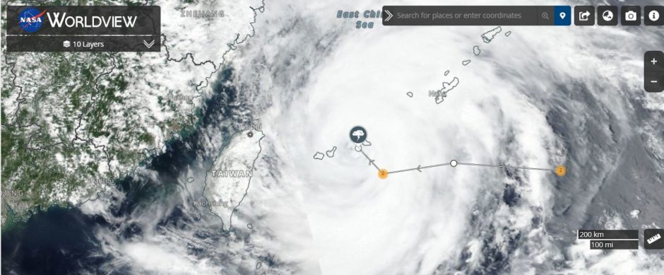
The main impact would be flooding at landfall. A population density plot for Eastern China has been generated using NASA Worldview. Given the forecast track shown on CIMSS, it does show that this storm has potential to unleash a significant flood event for eastern China close to Shanghai.

This is a highly populated region of China and as such, this storm has potential to be another significant event and the third such event for China in recent weeks.