
The north - west Pacific Ocean has to this time this season been relatively benign in terms of intense storms and typhoons.
There have been tropical depressions / tropical storms and a small number of weak typhoons (No stronger than Category 1 systems) but none of these have been major events. A few have made landfall producing heavy rain and flooding in affected regions such as what has occurred recently in coastal China near Shanghai but generally none have reached the higher categories on the Saffir Simpson Scale.
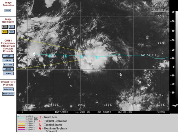
There is now a threat in the form of “Tropical Depression 16”. The storm is currently not named but a pack of thunderstorms in the western Pacific Ocean east of the Philippines is beginning to rotate around a small low pressure cell and gathering strength.
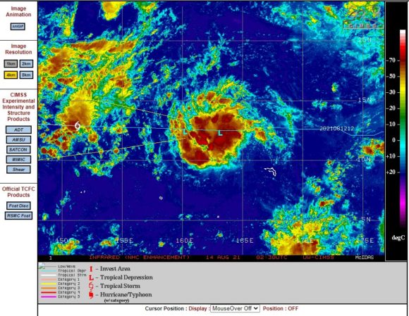
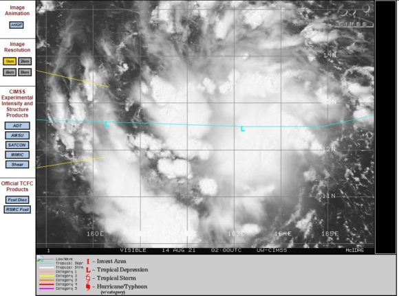
A close up view of the system from satellite imagery is clearly showing convection and cumulonimbus cloud towers and intense storms surrounding the low pressure cell.
This storm will approach the Philippines and Taiwan waters in coming days and strengthen into a typhoon. The storm appears to be different to many others that have formed and died in recent weeks across the north west Pacific Ocean.
The storm is about to track over oceanic waters that have been heated to 30C or more and conditions are favourable to support a significant storm / typhoon given location. This is one storm to watch given its shape and dynamics.
IN particular, CIMSS is forecasting the development of a typhoon in coming days at least to Category 1 status within 5 days with wind gusts to 70 knots (130 km/h) at the centre although forecasts do not currently exceed 5 days. Within this time, the storm will become a threat to the north east coast of the Philippines and or Taiwan depending on its future track.
This storm has potential to be the strongest storm so far this season and will be watched in coming days to see what occurs.