

Typhoon Goni (Ineng according to PAGASA) is giving northern Luzon (Philippines) a glancing blow. The storm appears to have come closer to Northern Luzon Island than originally anticipated. While the eye of the storm remains out to sea, much of the southern portion of the storm is passing across northern Luzon Island producing potentially flooding rains.
The storm is currently moving over the Balintang Channel and is presently located at 19.3 degrees north and 122.4 degrees east.
Winds at the centre are calculated at approximately 170 km/h with higher wind gusts to 205 km/h according to PAGASA.
PAGASA is forecasting a slow movement of 7 km/h towards the north west.
The storm has become more of a threat to northern Luzon Island and it is possible that the storm may come to within 60 km of Basco Batanes.
Due to heavy rain, a flood warning is now issued for the Cagayan Valley and wind alerts are issued for coastal northern Luzon Island.
The CIMSS Model attached (Acquired 21 August 2015) has suggested that the storm would move towards Taiwan and pass to the east of Taiwan but a closer view of that shows the eye of the storm further west than forecast.
It is not clear whether the storm will follow the course as suggested. The storm is moving very slowly at the present time and it is clear that the storm has slowed.
It will be interesting to see whether the storm does change course and take a more northerly path. If not, then a new forecast would be required.
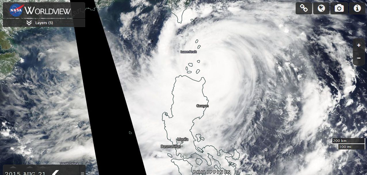
The MODIS (Worldview) acquired from NASA dated 21 August 2015 is showing the storm affecting a significant portion of northern Luzon Island north of Manilla. However the visible eye remains out to sea. Given the slow movement of the storm, it is likely that flooding will be an issue for areas of northern Luzon Island.
This storm has made a dramatic 90 degree turn towards the north north east over the past few hours. The storm is still impacting northern Luzon Island but moving slowly towards the north north east as a weakened Category 1 typhoon. While heavy rain is still impacting northern Luzon Island, it will now be interesting to see what impact the storm will have along the eastern coastline of Taiwan. Already some outer rain bands and cloud is impacting south east Taiwan. Hence during Saturday, the storms progress towards the west north west ceased. The storm stalled for a period then commenced its movement in a north north east direction which will take it parallel to the east coast of Taiwan and further away from Luzon Island.
It is also interesting to note that the strength of the storm weakened during this phase and the storm now only sustains wind speeds of 80 knots (Approximately 148 km/h) with higher gusts to 100 knots (Approximately 185 km/h) at the core.