In a previous post, it was identified that a new tropical storm had developed and was likely to develop into a typhoon within days.
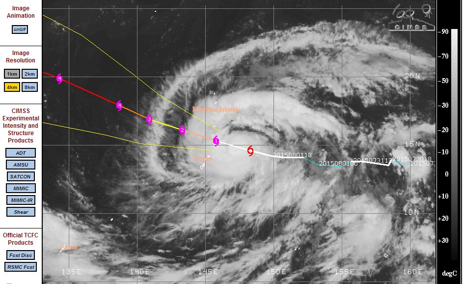
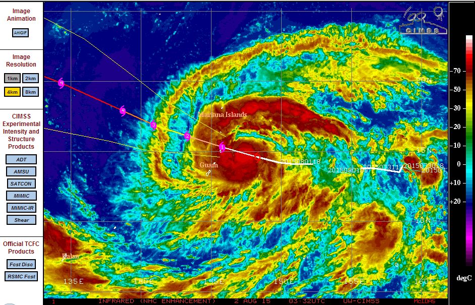
During Sunday, this storm has intensified rapidly and given that winds have reached 60 knots at the centre, this storm has effectively reached the thresh hold of a typhoon. It is now encroaching the Mariana Islands and Guam. The plot acquired from CIMSS suggests the core passing over or near the Mariana Islands.
The storm has well developed outer rain bands and a strong area of convection close to the core. The storm has now taken on a shape characteristic of a typhoon.
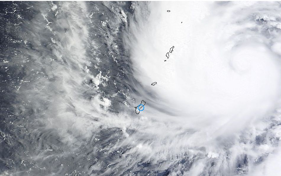
The attached image acquired from NASA 2 August (MODIS) also shows the storm in great detail including the nearby islands super imposed to show their size relative to the storm. Substantial convection (Cumulonimbus cloud towers) are a feature across the storm. A formal eye has not formed but should soon.
Forecast models do suggest a powerful storm (Category 4) in coming days as it takes a north west path towards Taiwan and or China. At the present time, the storm does not threaten a population centre but this could change as the storm continues its north west path across open waters.
Further to the above, this storm continues to intensify. NOAA has issued a typhoon warning for winds of 70 miles per hour (116 km/h) in coming hours for Rota, Tinian, Saipan, Talamagan, Agrihan and the North Mariana Islands.
At 2 pm Sunday afternoon, the core of the typhoon was located 160 km east south east of Saipan and moving west at 12 miles or 20 km/h per hour.
NOAA models suggests powerful winds at the centre reaching 140 miles per hour by Tuesday (230 km/h) and 145 mile per hour winds by Wednesday (240 km/h).