
Update: Two tropical cyclones were in Queensland and Northern Territory waters simultaneously.
Not a very common occurrence with not one but two strong tropical cyclones simultaneously nearby! Warnings are in effect for Tropical cyclone Lam in the Gulf of Carpentaria and Tropical Cyckone Marcia heading for southeast Queensland. Based on population and trajectory, Tropical Cyclone Marcia is expected to dump phenomenal rainfall amounts over mostly a two day period with falls of 500mm not out of the question! The region has lacked a real wet season with only a couple of episodes proving some heavy rainfall during the season in parts of Queensland.
Tropical Cyclone Marcia
This tropical cyclone is still well off the coast of Mackay but a weather station situated some 10 to 15 km from the eye wall is recording some powerful wind gusts as follows:-
Weather Station Creal Reef (Station Number 200736) Latitude 20.53 S and 150.36 E
It is an isolated remote outpost 1.7 metres above sea level. It is possible that this station could go offline but for the time being it records wind data for the 19/2/2015 as follows:-
2.40 pm – Peak wind gust reach 100 km/h.
4 pm – Average wind gusts reach 100 km/h.
At 5.30 pm, a peak wind gust of 167 km/h is recorded from the SSW. The station is within the eye wall very close to the eye.
I cannot get a rainfall figure for this station or maybe a rain gauge is not attached to the recording equipment.
Tropical Cyclone Lam
This tropical cyclone is currently tracking barely off the top end of the Northern Territory and I have found up to date weather data for the closest weather station to the eye wall.
Ngayawili (Elcho Island) Station Number 014517 at Latitude 12 S and Longitude 135.57 East.
Height above sea level is 8.1 metres.
For the 19/2/2015 wind gusts are:-
2.30 pm – First wind gusts reach 100 km/h and such gusts continue to 5.30 pm when reviewing the data set.
4.12 pm – Peak wind gust reach 137 km/h with average wind speeds of 83 km/h.
At 5.30 pm – Wind gusts ease back to 117 km/h from the SE quarter.
This weather station is recording rainfall data. Up to 69.8 mm fell here to 9 am 19/2/2015. Up until 5.30 pm, the station had recorded 72 mm. The highest at the time of writing.
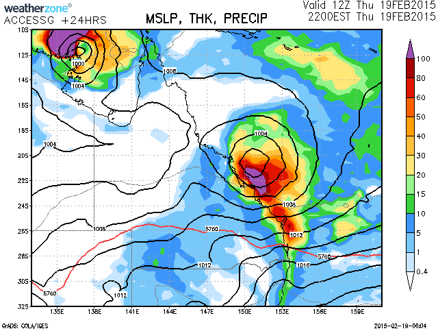
I attach a radar image of the Queensland Tropical Cyclone. It is still well of the coast and as a result, rainfall figures are not high at the time of writing but that will change. I have heard reports that Marcia may intensify into a Category 4 Tropical Cyclone prior to crossing the coast.
I attach a radar image of the tropical cyclone off the Northern Territory Coast. This cyclone is much clearer at the present time as it is closer to radars. Its shape is interesting as it takes the shape of a galaxy with spiral rain bands clearly visible.
I have noted a squall line on its north west quadrant being a narrow band of heavy rain at the time of the image. This was moving north influenced by strong southerly winds on its western flanks.
The two tropical cyclones are different in stature for the Queensland system has a defined eye wall as shown on the satellite photo (5 pm) but the system off the Northern Territory Coast does not have a visible eye wall as shown in the images for comparison.
Dense cloud (Most likely Cumulonimbus clouds) surround the eye wall of the Queensland system.
The centre of the storm system off the Northern Territory Coast appears to be a single circular dense cloud formation. However, there is also convective activity across the north west quadrant of the system where the squall line is located and that is clearly visible on the image.
The latest data set from for wind at Creal Reef Weather Station to 7 pm.
6.07 pm – Average wind speed is 146 km/h with a peak wind gust of 189 km/h (SW direction).
6.09 pm – Peak wind gust of 189 km/h.
6.14 pm – Peak wind gust of 189 km/h.
Following this, wind gusts begin to taper back to 182 km/h then slightly lower.
At 7 pm, a wind gust of 172 km/h occurs (south west direction).
They are the highest wind gusts that I have seen verified from a weather station during a tropical cyclone in Australian Waters. The wind vane has survived these winds. With the eye wall to the south east of this weather station, this does suggest that the system is taking a more southerly route.
The lowest pressure reading is 977.4 Hectopascals at 6.49 pm.
I have investigated some weather stations across the northern coastline of the Northern Territory to verify some wind gusts. However, the problem here is that the area is remote and the network is more patchy and large areas do not have recording stations.
It is hard to obtain verifiable peak wind gusts from this storm as it has made landfall over an area not covered by a weather station.
Notwithstanding this, The following is provided from the closest weather stations to the storm:-
Maningrida Airport – Station Number 014405 – Latitude 12.06 S and Longitude 134.23 E (Height 28.1 Metres ABS)
At 9 am 20/2/2015 – 105.4 mm of rain is recorded and a peak wind gust of 63 km/h is recorded. This area mainly experienced heavy rain with the eye wall well to the east.
Bulman Observation Station – Station Number ID014627 – Latitude 13.67 S and Longitude 134.34E (Height 103.4 Metres ABS).
This station recorded 105.8 mm of rain with a peak wind gust to 57 km/h at 11.03 am from the SSE quarter. This station is well inland and hence the storm would have weakened. This station also records a further 91 mm after 9 am to 8 pm giving a combined tally of 196.8 mm.
Due to the lack of observation stations in the area where the storm struck, it is best that this rainfall plot be provided. It provides some idea what occurred in terms of rainfall.
Cape Wessel Observation Station – Station Number ID 200786 – Latitude 11.5 S and Longitude 136.76 E (Height 18 Metres ABS)
The Cape Wessel observation Station will need to be relied on regarding verifiable wind gusts as this station was best placed with regards to the position of the storm core. This is a remote station in the northern Wessel Islands. This remote station has recorded the strongest wind gusts as follows:-
9.42 pm – wind gust to 106 km/h.
9.57 pm – wind gust to 113 km/h.
10 pm – wind gust to 113 km/h.
10.25 pm – wind gust to 128 km/h.
10.30 pm – wind gust to 150 km/h.
10.58 pm – wind gust to 126 km/h.
11 pm – wind gust to 124 km/h.
11.30 pm – wind gust to 117 km/h.
12 midnight – wind gust to 117 km/h.
12.30 am – wind gust to 130 km/h.
1 am – wind gust to 128 km/h.
Up to this point, wind direction is from the NNE which indicates the storm core to the west north west.
1.50 am – wind gust of 150 km/h with average wind speeds of 106 km/h recorded.
1.56 am – A maximum wind gust of 161 km/h is recorded with average wind gusts of 130 km/h.
2 am – A maximum wind gust of 161 km/h is recorded with average wind gusts of 122 km/h.
2.03 am – The last 161 km/h wind gust is recorded but average wind gusts ease to 100 km/h.
2.18 am – Wind gust of 132 km/h but average winds drop to 72 km/h.
Wind direction is now from the north.
The last 100 km/h wind gust occurs at 5 am (102 km/h) and winds ease thereafter.
This suggests the eye or core was close but to the west.
However, this station only records 58.2 mm of rain up until 9 am 20/2/2015.
There are no other stations recording such winds.
The map of Arnhem land rainfall statistics shows some high totals for a 24 hour period – widespread region experiencing 150mm! But like Tropical Cyclone Marcia, the rainfall totals were not as high as one would have thought. Check the great summary out Harley has produced including radar for Tropical Cyclone Lam!
I have updated the article to correct the fact that Tropical Cyclone Lam had formed in Northern Territory waters.