
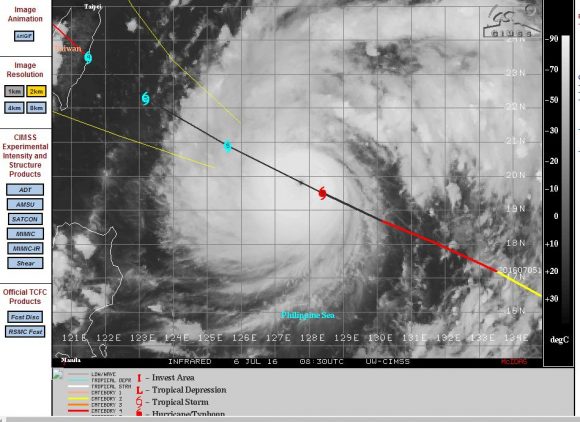
The drought of typhoons across the north west Pacific Ocean has finally been broken. The first significant storm of the 2016 season has developed south east of the Philippines and is travelling north west at a rapid pace. At the time of writing, the storm was located 645 nautical miles south east of Taiwan.
The storm has rapidly developed over oceanic waters of 31C or greater and is now known as “Super typhoon Nepartak”. It is travelling at 18 knots north west towards Taiwan and if it maintains its current track, it would strike the country’s east coast late Thursday or early into Friday.
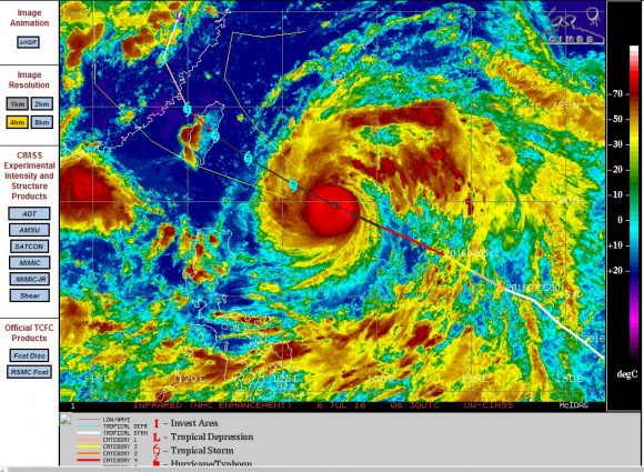
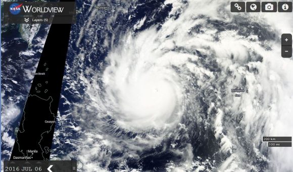
Super Typhoon Nepartak has a small eye and models show the storm sustaining winds near the core of 150 knots (approximately 278 km/h) with gusts to at least 170 knots (Approximately 315 km/h).
Within 24 hours, models suggest a storm with winds of 150 knots (Approximately 278 km/h) but with wind gusts approaching 180 knots (Approximately 330 km/h) close to the core.
This is a powerful storm but fortunately it is over open ocean. The CIMSS model suggests the storm sustaining Category 5 status right before it reaches the east coast of Taiwan. Fortunately much of the population of Taiwan live on the west coast with a mountain range offering some degree of buffer against the worst impacts of such a storm moving in from the Pacific Ocean.
The plots below show the storm in detail including a forecast model. Strong convection is occurring close to the core. This is one storm to be watched over coming days especially if it does strike the east coast of Taiwan. At this strength, there is potential for significant damage.
CREDITS
1 – CIMSS Forecast plot of Super Typhoon Nepartak acquired 6/7/2016.
2 – CIRA for satellite imagery acquired 6/7/2016.
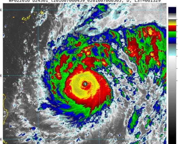
3 – NASA (Worldview with overlays) acquired 6/7/2016.
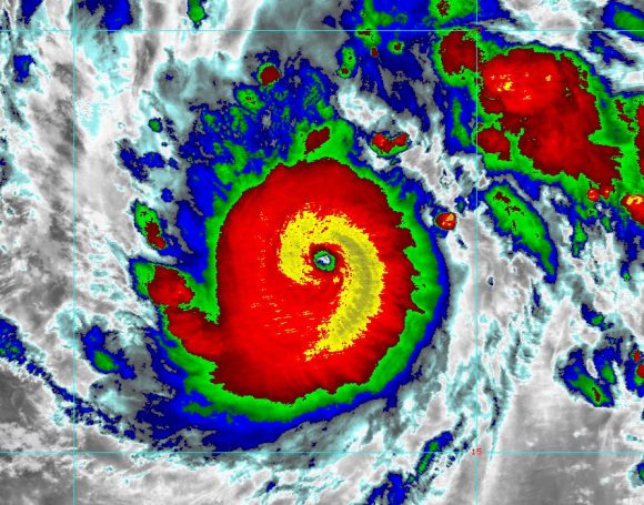
Super Typhoon Nepartak is bearing down on Taiwan and expected to make landfall within a few hours. According to the Central Weather Bureau, the super typhoon has winds of 55 metres per second near to the the core with higher gusts of 68 metres per second.
It is still a super typhoon so close to Taiwan.
News reports suggest that 30,000 personnel have been mobilised to deal with a potential catastrophe including flooding, landslides and wind damage.
Forecasts of extremely heavy rain are being made for south east and eastern Taiwan and evacuations are occurring.
The radar image of the super typhoon from the Central Weather Bureau is attached showing how close the storm is to Taiwan. The storm is currently over 200 km wide.
Should landfall occur, the storm will rapidly lose strength.
The eye of the storm is relatively small but visible in the image.