As identified in a previous post, a significant weather event is expected to unfold across inland New South Wales, eastern South Australia and most of Victoria in coming days.
Many of the regions affected by the recent burst of storms will again be affected by this event that may create additional issues as the cleanup progresses.
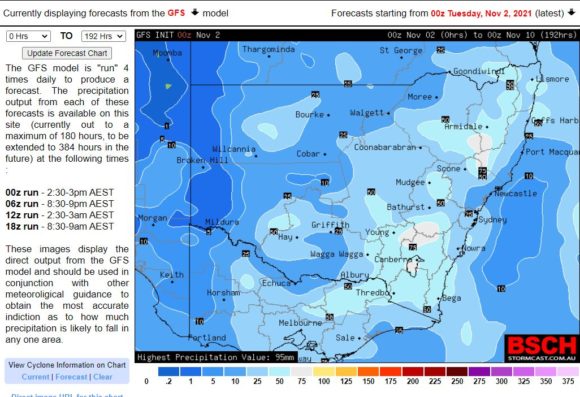
A band of rain is expected to Cross southern Australia during Wednesday and into Thursday however, it is noted that various models are showing that event as having less impact to coastal locations along the New South Wales coastline.
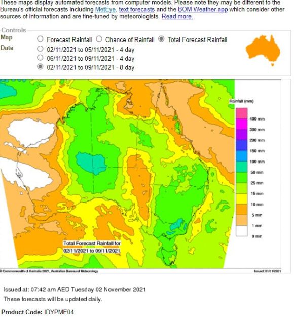
The heaviest rain as seen on the weekly "Water and the Land" plot which is an accumulative 7 day plot for the period 2 to the 9 November is showing the highest rainfall occurring across most of the inland regions of New South Wales with elevated rainfall along the western slopes of the Great Dividing Range. Lighter accumulative totals are shown for coastal New South Wales.
A similar forecast was made for a recent event and rainfall totals that fell were lighter than expected thus it will be interesting to see if this event eventuates as to what is being shown on the various plots.
It is also noted that a separate event is forecast for the same period for parts of the arid interior being north west South Australia, eastern central Western Australia and south west Northern Territory.
Should this eventuate, it would be widespread in area and duration occurring over several days. Some of this rain is expected to fall from thunderstorms especially across western New South Wales. This event should be interesting as it unfolds and will be monitored over coming days.
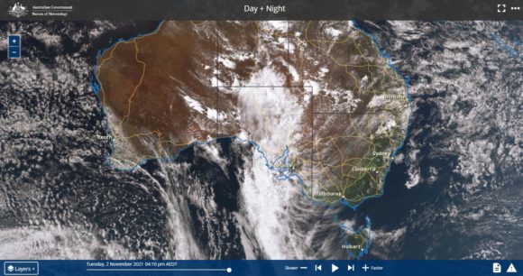
The Himawari satellite photo is showing the cloud mass that is expected to cross southern Australia during Wednesday with the first rain band. That cloud is still over South Australia at the time although it will move east overnight and enter Victoria and Western New South Wales before daybreak Wednesday morning.