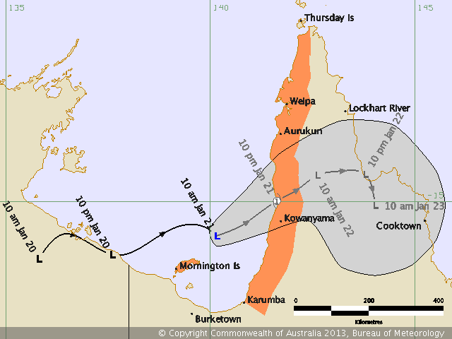
A tropical low in the Gulf has been threatening to develop into tropical cyclone the past few days, though appears to have the best potential right now (Monday afternoon and evening). It's likely to be short-lived with a forecast track likely to see it cross the Peninsula.
Widespread heavy rainfalls will be the main event from this unless the low moves into the Coral Sea. Parts of North QLD are likely to see some flooding over coming days.
Good to see some useful rain from this system for the region. What are the long term predictions once the low crosses the Peninsula Michael Bath?
Hi Michael, I see the GFS model has this system redeveloping next week as it heads off the coast near Townsville. I'm seriously tempted to chase!
It seems there is also a tropical cyclone watch for the NW coast as well?
Not expecting any strong TC activity but the rainfalls are likely to extreme along the northern half of the QLD coast. The monsoon trough is active in the area and likely to remain so for several days.
A TC is also likely across the Pilbara Coast of WA though very close to the coastline so unlikely to become severe either.