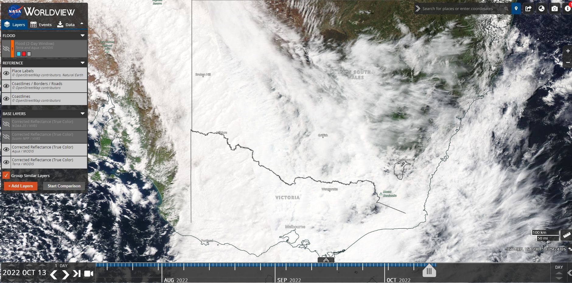
The NASA EOSDIS Worldview image of southern Australia for Thursday 13 October 2022 is showing extensive cloud across the whole of Victoria and most of south and western New South Wales. Much of this is thick nimbostratus cloud.
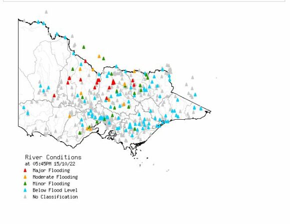
A significant rain event has impacted the areas underneath the cloud mass for a period of 2 to 3 days which has resulted in almost every major river north of the Great Dividing Range of Victoria being in flood ranging from minor to major.
Flooding impacts
Significant and major flooding at the time of writing exists at Wangaratta in North East Victoria, areas around Shepparton (Northern Country), areas north of Bendigo, Seymour, Kerang and Echuca.
Eventually the waters of the Campaspe, Goulburn, Kiewa, Loddon and Ovens Rivers will empty out into the Murray River which in turn will create substantial flooding along much of its length.
Some of the rainfall was substantial enough to break various records including the falls that fell at Swan Hill.
Rainfall figures
The weather station at Bendigo recorded 65.6 mm of rain to 9 am Thursday morning which was followed by 51.4 mm to 9 am Friday morning (The 2 day total was 117 mm).
The weather station at Swan Hill (Mallee region North West Victoria) recorded 71 mm to 9 am Thursday morning plus another 14 mm to 9 am Friday morning.
The weather station at Shepparton recorded 76 mm for the 2 day period to 9 am Friday morning.
The above mentioned figures pale into insignificance when compared to the following locations for the 3 day period to 9 am Friday morning:
- Strathbogie North - 221.6 mm.
- Charnwood - 209.4 mm.
- Mt Buffalo Chalet - 160.4 mm.
- Syemour - 155.2 mm.
The locations are within the north east areas of the state.
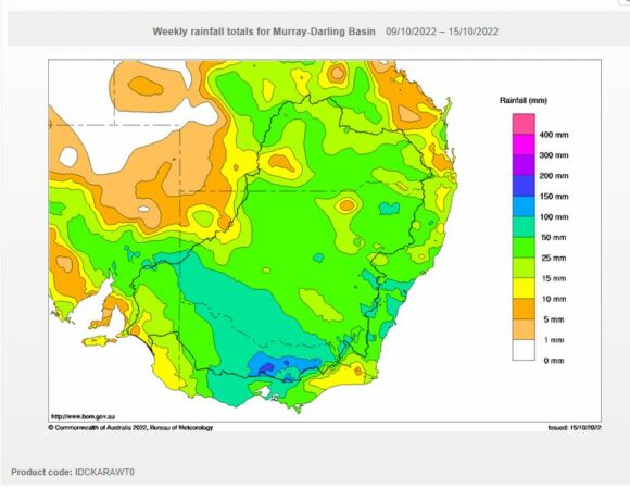
For the week ending to 9 am 14 October much of northern Victoria had received between 50 and 100 mm of rain but there were areas north of Melbourne that received 100 to 150 mm including isolated pockets that topped 200 mm.
As a result of this event, there are some interesting rainfall figures emerging across the state of Victoria for this month as follows:
- Swan Hill has recorded 120.6 mm for the first 2 weeks of October. This is significant because Swan Hill usually has a semi arid climate and such heavy rain is rare for this location. Usually October is relatively dry for this region.
- Bendigo - Has recorded 164 mm of rain for the period 1 to the 14 October 2022.
Albury Airport
While only 50 mm fell from this event to 9 am Friday morning, this was enough to push the monthly rainfall tally to 100 mm for the period 1 to the 14 October. This event has resulted in the months of August, September and October now recording 100 mm of rain or more which is exceptional and a rare occurrence.
The result of this sustained rainfall is a major flood event.
New South Wales
In New South Wales, there is also substantial flooding occurring along many inland rivers at the same time and there is still concern for areas west of Forbes.
As such, there is a flood crises impacting two states at the same time especially across the inland.
Tasmania
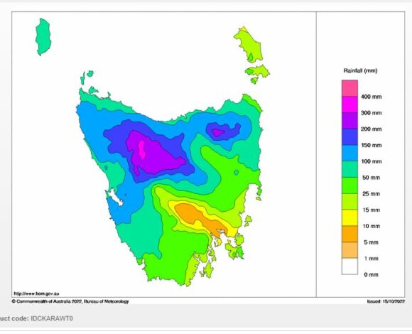
This event also impacted Tasmania and cumulative rainfall totals topped 200 to 300 mm across the mountainous areas of the north west inland. In Tasmania there is major flooding along rivers just to the south west of Launceston.
During Friday, the weather system that caused the flood crises cleared the state allowing for some clear weather.
Future rain event
Of concern is yet another weather system forecast for mid to late in the week for eastern Australia and again forecasts are being made for 25 to 50 mm again across much of the flooded regions with higher totals exceeding 50 mm for much of the western slopes and ranges. Longer range, there appears to be a second event following this but at the present time, it is still too early to ascertain what is likely to occur.
What is noted is that a number of the weather events have started out as cut off lows across the inland which have interacted with tropical moisture as they have tracked eastwards.
The next weather event appears to follow the same sequence to the previous event.
