http://www.extremestorms.com.au/september-2022-a-very-wet-month-with-inland-floods-for-new-south-wales/
Warragamba Dam
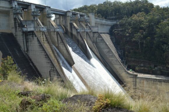
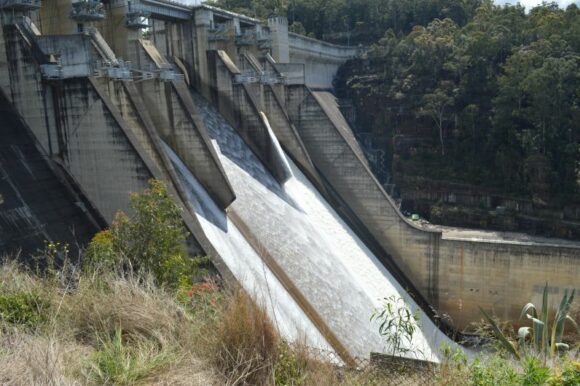
On Sunday, 2 October 2022, I visited Warragamba Dam and was able to walk put onto the dam wall. This was a unique experience because at that time, significant water releases were being made from the dam in anticipation of more rainfall.
The photos attached shows strong water releases being made. Such scenes are being repeated right around the state of New South Wales due to the amount of rainfall that has fallen during August, September and now into early October.
During the first week of October, another significant rain event crossed the state which has compounded the current issue of flooding along many inland rivers.
Observatory Hill Sydney
Prior to this event, Sydney’s Observatory Hill’s Rainfall stood at:
- 1950 - 2,194 mm.
- 1860 - 2,110.5 mm.
- September 30 2022 - 2,100.8 mm (Third wettest year).
- 1890 - 2,071.1 mm.
- 1963 - 2,035.6 mm.
Following heavy rainfall including an intense fall of 91 mm on Wednesday afternoon (5/10/22) from rainfall that had a train echo affect along the coastline for many hours, the record finally fell between 1 pm and 1.30 pm. Heavy showers passed over the same area for hours until the system weakened late afternoon. By this time the new rainfall record had been set for the Observatory Hill weather station. The above now stands at:
- As at 9 am October 9 2022 - 2,303.2 (Wettest year recorded).
- 1950 - 2,194 mm.
- 1860 - 2,110.5 mm.
- 1890 - 2,071.1 mm.
- 1963 - 2,035.6 mm.
This has occurred following 203 mm falling between October 1 and October 9 2022.
Current rainfall event
The current rainfall event has been significant as most areas of the state has again received widespread rainfall of between 40 and 60 mm with some areas receiving much more. Some standout rainfall figures include:
To 9am Thursday morning
- Robertson - 104 mm.
- Macquarie Pass - 96 mm.
- Campbelltown - 56 mm.
- Camden - 51 mm.
To 9am Friday morning
- Mascot (Airport) - 97 mm.
- Observatory Hill and Cronulla South - 91 mm.
All located within Sydney.
To 9 am Saturday morning
The heaviest falls fell within an area centred on Dubbo to Coonabarabran including:
- Coonabarabran - 62 mm.
- Barina - 58 mm.
- Dubbo - 53.2 mm.
- Keeva - 52 mm.
There are very few areas that have missed out on this system.
This event has shown how wet 2022 has been and this is now becoming an exceptional year for rainfall for many areas.
Saturday afternoon event
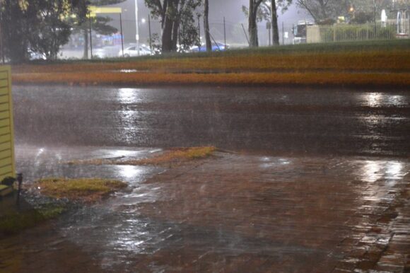
Following a brief sunny period during the morning, thick cloud increased and by 1 pm, more rainfall began to encroach upon Sydney from the north west. Rainfall was at first light. At this time, there was a noticeable wind change to the south south east and thicker nimbostratus cloud then built. Rainfall slowly increased from light to moderate.
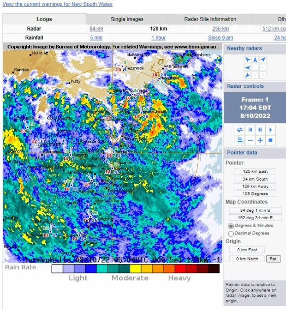
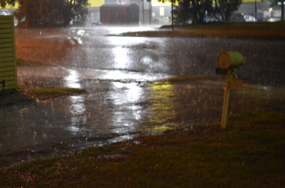
The period between 5 pm and 10 pm was marked by bursts of moderate to heavy rain which began to ease after 10 pm. Some of the rainfall across Sydney was considerable including:
- Camden - 89.6 mm.
- Bringelly - 72 mm.
All weather station within south west Sydney recorded greater than 50 mm from the event.
- Observatory Hill received 50.2 mm from this event.
Most weather stations in Sydney’s west recorded 40 to 50 mm. Heavier falls fell elsewhere including:
- Windale No 2 (Southern Newcastle) - 103 mm.
- Ulludulla - 110 mm.
- Vincentia - 124 mm.
- Lake Conjola - 126 mm.
Being the heaviest totals.
Many coastal locations between Newcastle and Batemans Bay recorded at least 50 to 60 mm from this event.
Once again, there has been enough rainfall to cause minor flooding along the Hawkesbury River with the Hawkesbury River at North Richmond recording minor flooding and the Colo River experiencing minor to moderate flooding. The flooding is not expected to be as severe as the most recent events.
Minor flooding is also beginning to occur at Windsor (5.57 metres at the time of writing and rising). The minor flood level is set at 5.8 metres but with the rain easing, such flooding should not worsen.
There has also been enough rain across parts of the Central West of New South Wales to exacerbate flooding as well such as what has occurred at Dubbo with moderate flooding of the Macquarie River.
This event has to been exceptional for October due to the longevity, the amount of rainfall that has fallen and with Sydney Observatory Hill breaking its 72 year rainfall record. Of final note, this weather station as at 9 am Sunday morning has now recorded 109 mm more rain than what fell during the whole of 1950 and there are still 2.5 months left of 2022.
Another rain event looming
Of interest, weather models identify another rain event for midweek (Wednesday and Thursday) across the inland of the state including most of Victoria with widespread 25 to 50 mm totals being suggested at this stage.
