A sustained weather event has brought days of showers, storms and flooding rains to large areas of Eastern Australia across a period of 7 days. This event stalled over Eastern Australia which has resulted in significant rainfalls occurring across many regions.
Heavier rainfall totals have occurred from slow moving thunderstorms and very few regions have missed out.
Some exceptional rainfall totals have been recorded and some of the standout totals are described below.
Ivanhoe - South West New South Wales - Wednesday 19 October
Slow moving thunderstorms across the Ivanhoe region of New South Wales dropped 68.8 mm of rainfall Wednesday evening and into early Thursday morning. Such rainfall has resulted in renewed flooding which certainly did not assist the current flood situation across western areas of the state.
North West Slopes and plans - New South Wales - Friday 21 October
Thursday afternoon, heavy rainfall impacted regions around Tamworth and Gunnedah. For the 24 hours to 9 am Friday morning, rainfall topped 100 mm in some areas including:
- Terry Hie Hie - 123 mm.
- Upper Horton - 120 mm.
- Moree - 108 mm.
- Barraba - 99 mm.
- Gunnedah Airport - 65.8 mm.
Moderate and major flooding occurred at Moree resulting in large scale evacuations.


The above mentioned totals were topped by a fall of 146 mm at Brogers No 2 south west of Wollongong.
New South Wales and the ACT - To 9 am Saturday 22 October
Moderate and heavy rainfall impacted Canberra with parts of the city receiving 64 mm to 9 am.
Areas just to the south and west of Coffs Harbour including the Bellinger Valley received 50 to 87 mm of rain for the 24 hour period.
Victoria - To 9 am Saturday 22 October
Areas to the north west of Geelong received 50 to 87 mm including a fall of 87 mm at She Oaks.
Exceptional rainfalls Queensland - To 9 am Saturday 22 October
Exceptional rainfall totals approaching 300 mm has fallen within an area north of the Sunshine Coast to Bundaberg. The heaviest totals include:
- Coopers Corner - 291 mm.
- Tin Can Bay - 288 mm.
- Rainbow Beach - 264 mm.
- Branyan (Woongarra) - 208 mm.
- Tiaro Alert - 170 mm.
Generally, most coastal areas north of Brisbane were impacted by this event.


Heavy falls New South Wales South Coast - To 9 am Sunday 23 October
Some areas such as the New South Wales South Coast and Southern Tablelands again have received significant rainfall totals including:
- Jerrawangala - 66 mm.
- Nowra - 48.6 mm.
- Ulludulla - 41.8 mm.
Thunderstorms also impacted Batemans Bay during the same period.
An isolated fall of 78 mm fell at Mudgee (Eastern side of the Central West of New South Wales).
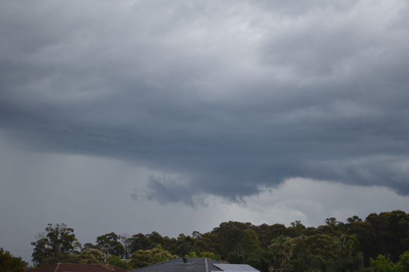
Western Sydney Saturday afternoon
As shown in my photos, an intense rainstorm passed over parts of Western Sydney Saturday afternoon. This cell was isolated and was generally the only rain to impact the Sydney region during Saturday.
Other than this and a few light showers, Western Sydney generally escaped the worst of the weather for the period 19 to the 22 October.


Heavy rain and floods to 9 am - Monday 24 October
Heavy rain set in Sunday afternoon and into Monday morning along parts of the New South Wales North Coast especially around the Lismore region where flooding once again occurred. Falls ranged from 120 to 233 mm including:
- Alstonville - 233 mm.
- Doon Doon (Mc Cabes Road) - 196 mm.
- Terrania Creek - 160 mm.
- Mullimbimby - 145 mm.
- Lismore - 128 mm.
Other regions
Moderate and heavy rainfall impacted north west Victoria once again where falls of between 25 and 40 mm occurred across parts of the Mallee region.
A region centred on Griffith was also impacted by moderate and heavy rainfall where falls topped 74 mm at Coleambally and 72 mm at Griffith.
During the same period an isolated fall of 65 mm fell at Rossmore (South Creek) south west of Sydney.
Heavy rainfall New South Wales South Coast - Tuesday 25 October 2022
More substantial rain impacted the New South Wales South Coast from Nowra to the Victorian border where isolated falls topped 100 mm including:
- Mt Darragh - 162 mm.
- Moruya - 113 mm.
Many other localities along the same area of coastline recorded 50 to 95 mm for the same period.
Sydney Observatory Hill rainfall
During early October, Sydney Observatory Hill broke its all time rainfall record of 2,194 mm. Since that time, the weather station has recorded the wettest October in 165 years and as at 9 am Tuesday 25 October, the city had topped 293 mm of rain for the month with still 6 days to go and an incredible 2,393.8 mm so far for the year. This is effectively 200 mm more than the record set in 1950.
This is showing that rainfall for 2022 is truly incredible and an aberration of long term records.
Western Sydney Storm Tuesday afternoon
A fast moving thunderstorm cell tracked across large areas of Western Sydney during the afternoon of the 25 producing 24 mm at Badgerys Creek and falls of 10 to 20 mm within nearby areas.
Generally, during Wednesday, much drier weather conditions prevailed except for shower activity across southern New South Wales and much of Victoria where continued rainfall was much lighter when compared to the past seven days.
Future weather event for Saturday and Sunday 29 and 30 October 2022
While the event has generally concluded, weather models show another interesting weather event for Saturday and Sunday across southern areas of Australia which is expected to provide more rainfall to flooded regions of the south and east.