
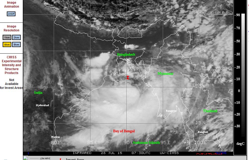
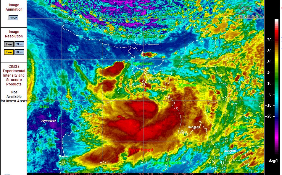
As shown on the satellite images acquired from CIMSS 28/7/2015, a very active monsoon low has developed within the northern part of the Bay of Bengal over the past few days. The low pressure cell is barely moving at the present time. Significant convective activity is occurring just off the coast of Bangladesh, India and Myanmar. Satellite images are showing major thunderstorm and rain activity within this system much of it over open waters.
It is suggested that this low will eventually move onto the Indian land mass resulting in a renewed burst of the monsoon.
Weather forecasters in India are anticipating a major rain event for Bangladesh and parts of India that borders the delta region of the country including Kolkata (Former Calcutta).
Weather forecasts for Kolkata for the next three days anticipates heavy rain including a forecast for drenching rain on Thursday with flooding anticipated and maximum daytime temperatures anywhere between 88F and 83F (28C to 31C). The forecasts even warn residents to be on alert for flooding during heavy rain events.
While not a tropical cyclone, the monsoon outbreak is threatening a flood event for parts of India especially around Kolkata and much of Bangladesh. This event is certainly one to watch for storms and flooding across the Indian Subcontinent.
The monsoon event has the potential to be a significant weather system and even a costly event for parts of India and Bangladesh. Today, the tropical low has deepened and CIMSS has named the low “Tropical Depression Two”.
It is clear that the system is going to impact a substantial portion of the Bay of Bengal including the city of Kolkata.
The India Meteorological Department identifies the low being near Khepupara (Bangladesh). Heavy to very heavy rain is being forecast for the Ganges West Bengal region including Kolkata along with squally winds of 45 to 55 km/h. Such a forecast also extends to Odisha coast for the next 72 hours.
Already significant rainfall has occurred in the region including 240 mm at Purihansa and 130 mm at Tusuma (Ganges West Bengal State).
There has also been 200 mm at Jamspedpur.
Rainfall is being measured in centimetres and not mm so figures would not be exact.
In Odisha State, Tiring is reported to have had 230 mm from this event (28/7/15) and Balikuda is reported to have had 190 mm. Many centres in this state have had between 70 mm and 230 mm for the 28/7/15.
In adjoining Bangladesh, there is flooding from recent rains and this event will only compound the flood situation.
The Bangladesh Meteorological Department identifies that Chittagong received 256 mm of rain on the 25/7/15 followed by 299 mm on the 26/7/15 and 210 mm on the 27/7/15 (This adds to 765 mm in 3 days). This event will compound the flooding and damage that is occurring throughout.
A heavy rain warning is in effect for Khulna, Barisal and Chittagong State Bangladesh.
The attached satellite photo acquired from MODIS (NASA 29/7/15) is showing the monsoon cloud mass in the upper Bay of Bengal. Areas around Kolkata is affected by this and heavy rain. The country borders have been super imposed onto the image to show more closely the region affected.
The depression has barely moved in the past 24 hours but it is expected that the system will track north and west and affect a greater region bringing storms, heavy rains and more flooding.