
As outlined by two recent posts, a significant rain event is expected to unfold across eastern Australia affecting three states.
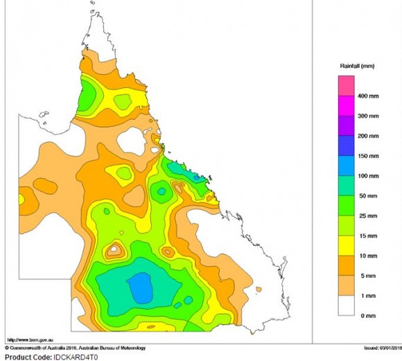
During the 2 January, a region heavily affected by drought across inland Queensland has received a significant rain event with rainfall totals reaching as high as 126 mm. This is significant due to the drought that has been plaguing the region.
The rainfall is shown on the attached plot from the Bureau of Meteorology “Water and the land”. The falls have affected towns or regions near Quilpie, Charleville and Blackall. Further heavy rain could potentially cause some flooding. The heaviest falls to 9 am 3 January 2016 include:-
Boothulla - 126 mm.
Wansey Downs - 92 mm.
Trinidad - 87 mm.
Anywhere within this region has received upwards of 50 mm or more. There have been further falls during the 3 January reaching as much as 50 mm within the same region.
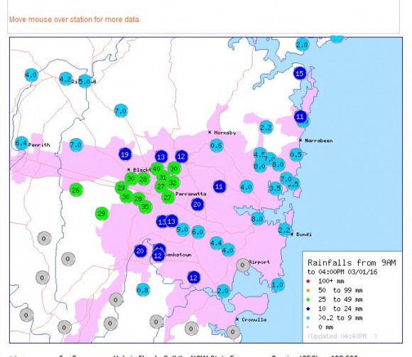
Sydney
A slow moving rain cell including isolated thunder across Western Sydney has produced as much as 40 mm after 3 pm. The intense cell has produced 27 to 40 mm of rain within an area bounded by Baulkham Hills, Blacktown and Parramatta as shown on the rainfall plot to 4 pm 3/1/2016.
North East Victoria
In portions of north east Victoria, isolated thunderstorms produced as much as 20 mm of rain at Wangaratta and during the afternoon of the 3/1/16, an area of the region is enjoying further rainfall.
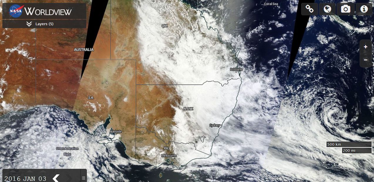
This generally shows a large weather system affecting areas of three states which will continue for some time. The satellite photo of eastern Australia from NASA Worldview taken 3/1/2016 is attached. Any location within eastern Australia underneath the cloud as shown is likely to receive further rainfall. Further rainfall is expected during Monday and Tuesday from the cloud mass that has developed over eastern Australia.