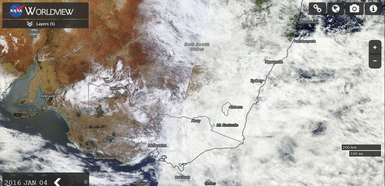
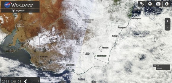
A large cloud mass originating initially from the tropics of Northern Territory has continued its movement south and east and now covers much of eastern Australia including the coastline. This is shown on the satellite image from NASA (Worldview) and dated 4 January 2016.
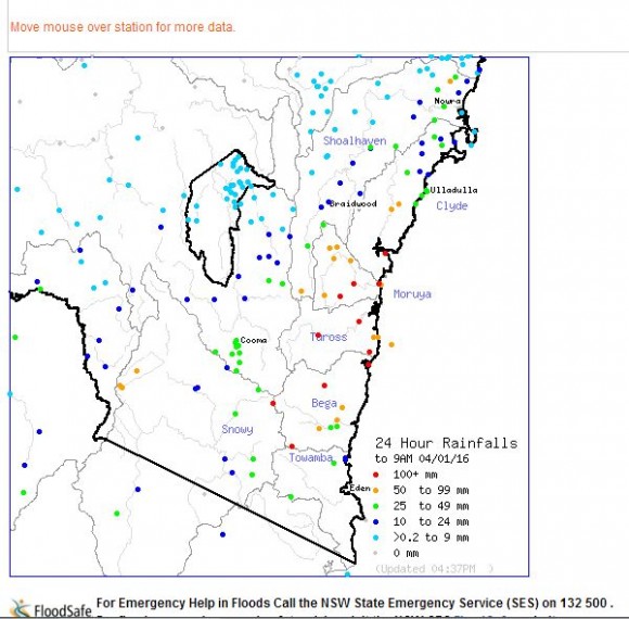
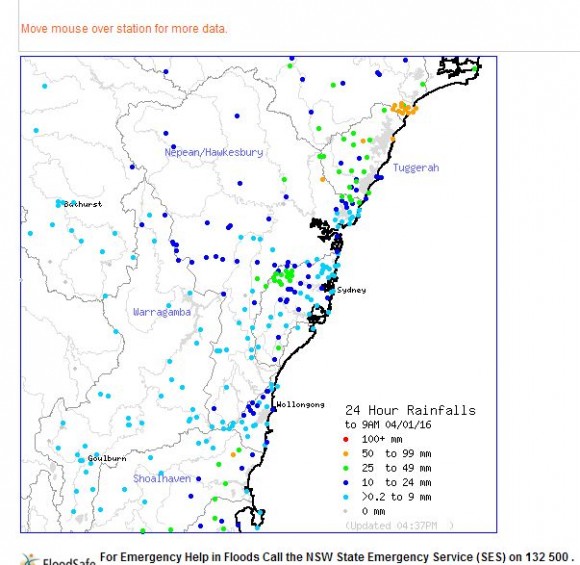
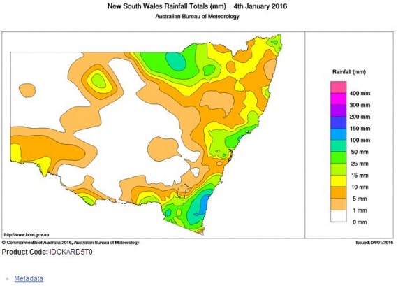
The cloud mass is responsible for producing some sizeable rainfall totals across portions of New South Wales, Queensland and Victoria for the past 24 hours. Up until 9 am 4 January 2016, the following rainfall totals are evident.
NEW SOUTH WALES.
The south coast around Batemans Bay and Moruya has received a soaking as follows:-
Brogo Dam - 164 mm.
Central Tilba - 146 mm.
Moruya - 131 mm.
Moruya Airport - 125 mm.
Eurobodalla - 121 mm.
Brogo Dam and Mt Darragh - 118 mm.
Batemans Bay - 117 mm.
Snowy Mountains
A big fall of 81 mm occurred at Perisha Valley while 70 mm fell at the Thredbo Weather Station.
Central Coast and Newcastle
Mangrove Mountain - 78 mm.
Newcastle 34 to 70 mm including 69 mm in the city centre.
Lake Macquarie - 56 mm.
QUEENSLAND
Further big falls occurred across the interior of the state which will ease the drought situation further. Falls near Charleville have reached as much as 63 mm with 63 mm being recorded at Warida.
VICTORIA
Isolated big falls occurred especially from passing thunderstorms. A very isolated fall of 110 mm occurred at Goulburn Weir (Central Victoria). Other large totals include:-
Graytown - 79 mm.
Campaspe Weir - 50 mm.
Mangalore - 40.8 mm.
Hunters Hill - 39.8 mm.
Mildura - 25.8 mm. It is rare to see such a fall here during summer.
This shows the extent of the rain baring system. The various plots from the Bureau of Meteorology “Water and the Land” showing the falls are provided below.