The strongest cold outbreak of this Autumn is forecast to pass over south east Australia Monday and Tuesday 6 and 7 April 2015. According to weather models and forecasts, this system is expected to drag a band of showers across New South Wales Easter Monday and even a few thunderstorms with it. More interestingly the air behind this front is rather cold for April. Places like Canberra are forecast to reach 15C for Tuesday and Albury is forecast to reach 14C which is more akin to winter.
The ski resort at Falls Creek (Mt Mc Kay) is forecast to reach 3C in southerly winds Tuesday while nearby Mt Hotham is forecast to reach 1C. There is snow being forecast on higher elevations. It appears the air will be cold enough and with some moisture available, snow could fall on Mt Hotham, Mt Feathertop, Mt Bogong and nearby higher peaks. The cold air should spill into New South Wales where snow could fall on the higher elevations of the Snowy Mountains.
Scattered showers and small hail is common over Victoria during these outbreaks with southern Victoria receiving most of the rain under cold and even squally south west winds. Here in New South Wales, scattered showers usually develops on the south west slopes and Central West Slopes usually west of the Great Dividing Range with the coast usually dry due to a rain shadow effect.
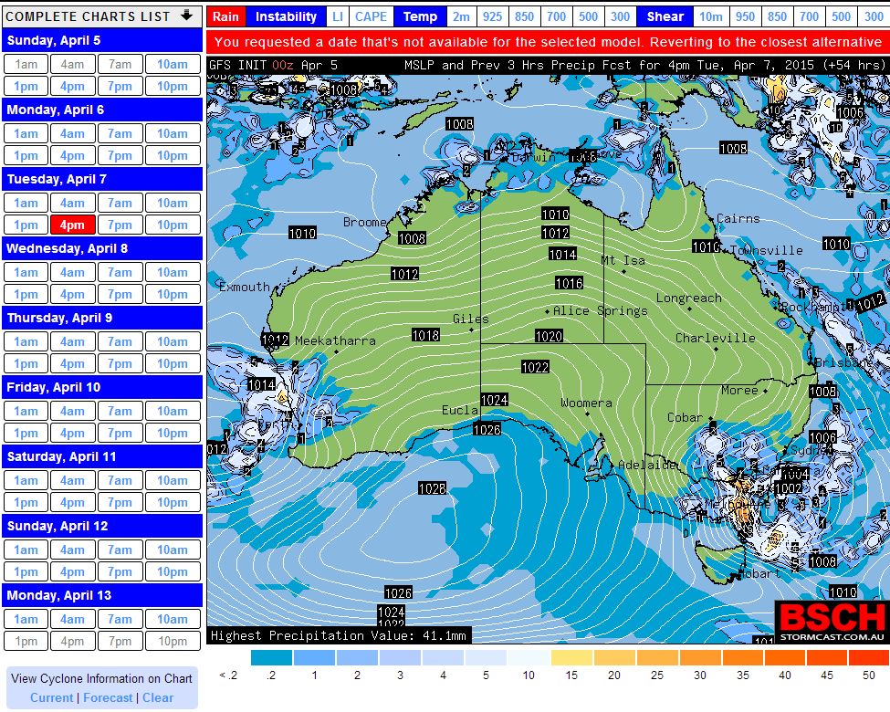
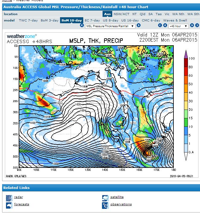
I have attached two weather plots for Tuesday showing the possible position of the weather system likely to cause this outbreak.
Rain event followed by snow in the Southern Alps and what do people think for the Oberon Plateau?
Rain event followed by snow in the Southern Alps and what do people think for the Oberon Plateau?
Should be some storms today!
Should be some storms today!
A dynamic wintry outbreak has occurred across south east Australia as indicated by the weather models.
During the afternoon of the 6/4/2015, thunderstorms did occur with one passing over Western Sydney. This is described under separate reports with photos provided. There were thunderstorms north of Sydney with storms impacting the Hunter Valley, Newcastle and north west slopes and plains and I have seen news reports and photos suggesting hail to 2 to 2.5 cm from the stronger storm cells.
Most rainfall across Sydney was less than 10 mm although an isolated fall of 18 mm did fall at Cronulla South Bowling Club being by far the highest figure for the whole city.
During the 7/4/2015 the cold wintry outbreak has spread across South East Australia bringing colder than normal temperatures, wind, rain and further storm activity. Some of the more interesting weather features from this event are described below:-
WIND
The weather station at Mt Hotham has recorded a wind gust of 104 km/h this evening with the temperature falling to 0.4C. Given that the rain gauge is recording light precipitation, it could be snowing on the summit this evening.
The weather station at nearby Falls Creek (Actually Mt Mc Kay) slightly lower in elevation has recorded a wind gust this evening to 85 km/h with the temperature falling to 1.1C. It could be snowing higher up.
At Bathurst, a peak wind gust of 74 km/h occurred at 1.40 pm and again at 1.45 pm from the north west being the same time that a sharp temperature drop is recorded.
RAINFALL
Useful rain fell at Wangaratta and Rutherglen in North East Victoria with 15.4 mm respectively falling for the 24 hours to 9 am 7/4/2015. This is a useful rain event considering how dry it has been over recent weeks for the entire region.
Much heavier rain has occurred across parts of south eastern Victoria. Up until 9 am 7/4/2015 Bullumwaal had received 67 mm and Reeves Knob had received 56 mm being the highest figures.
For the period 9 am to 7 pm 7/4/2015, Basin Creek had received 75 mm, Bullumwaal and Mt Nowa Nowa had received 64 mm, Mount Elizabeth had received 62 mm and Bairnsdale Airport had received 54 mm being the highest figures.
Bullumwall has so far received 131 mm from this event.
TEMPERATURES
The maximum temperature for Wagga Wagga reached 13.7C at 12 Noon (Well below average).
An interesting temperature range occurred at Orange this afternoon. At 12.30 pm, the temperature was 9.3C. At 1.30 pm, a temperature of 2.9C was recorded. When reviewing the weather station, it appears that it was not raining at the time. I have read a report of snow flakes falling somewhere in the region but the report is not specific where this may have occurred.
At Oberon it reached 14.4C at 11.30 am but by 2.54 pm, the temperature had fallen to 4.8C. There is no suggestion of snowfall in town.
At Bathurst the temperature at 1.30 pm was 12.2C but fell sharply to 4.7C at 1.45 pm and 4.4C at 1.55pm. The temperature rose back to 9.7C shortly after.
This shows that the system is unleashing various weather phenomena at various locations. It is a dynamic system but usually such events do not last long. Conditions are expected to settle throughout Wednesday and Thursday.
Following my last post, this weather system generated some extensive wild weather across south east Australia although conditions eased during Wednesday.
Some further weather conditions observed for the 24 hours to 9 am 8/4/2015.
WIND
The weather station at Mt Hotham recorded a maximum wind gust of 126 km/h at 5.24 and 5.30 pm with 124 km/h gusts from the south / south east at 6 pm and 6.02 pm.
Nearby Falls Creek (Mt Mc Kay) had a maximum wind gust of 96 km/h at 11.24 pm and 11.30 pm.
SNOW
A snow shower was observed at Shooters Hill 20 km south of Oberon at an elevation of 1,354 metres during Tuesday afternoon.
Looking at the snow cams of the Snowy Mountains, snow did fall on the higher elevations. I attach images of the first snow event of the season from Perisher Valley (Source – Perisher Valley Snow Cams 8/4/2015).
It appears snow flurries occurred at Mt Hotham and Mt Buller and possibly Mt Baw Baw but I could not see any evidence of snow on the Mt Buffalo Snow Cam (Dingo Dell). It is not clear whether snow fell at Falls Creek as there was none on the ground near the snow cams when I looked.
Generally, the air was cold enough and snow did fall at least on the higher elevations of South East Australia.
RAIN (24 hours to 9 am 8/4/2015 – highest totals only)
The Canberra region, the Monaro region south of Canberra, far south coast of New South Wales and eastern Victoria taking in Gippsland scored the brunt of the rain. In particular:-
1 – Canberra region
The city received from 53 to 84 mm depending on location with lighter falls further north.
2 – South Coast
Wellsby – 98 mm.
Mount Darragh – 72 mm.
Merimbula – 62 mm.
3 – Monaro region of New South Wales
Nimmitabel – 78 mm.
Bombala AWS – 75 mm.
Cooma – 70 mm.
Berridale – 68 mm.
Bombala – 60 mm.
4 – Eastern Victoria and Gippsland
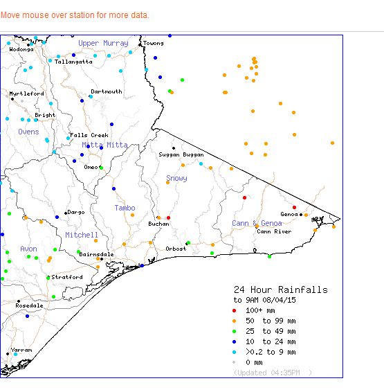
Basin Creek – 123 mm.
The Gorge – 107 mm.
Combienbar – 102 mm.
Mt Elizabeth – 98 mm.
Buchan Field – 85 mm.
Gelantipy – 73 mm.
Generally any location in the southern foothills of the Great Dividing Range did well from this event and uplift created by the ranges would have enhanced the rainfall creating rain shadows on the northern side of the range.
Light falls did penetrate into north east Victoria and adjacent borders of New South Wales but falls were indeed light.
The whole two day event shows that the transition from summer towards winter is well underway. Conditions are now settling down as the system moves offshore.
I attach the rainfall plot for Eastern Victoria to conclude the post and overall storey specific to this event.