
During the period 29 to 31 January, a small Category 1 Tropical Cyclone formed off the coast of the Pilbara region of North West Western Australia. This was a short lived storm because it developed so close to the coastline and its ability to intensify would have been limited.
The storm formed over waters of 29C before moving south east.
This was the first tropical cyclone to form and cross the Australian coastline during the summer of 2015 / 2016. The storm transitioned into a tropical cyclone at latitude 18.7 degrees south and 118.8 degrees east and tracked south east crossing the coast east of Port Headland.
The storm had little impact on Port Headland and only brought 11.2 mm of rain at the local weather station.
While warnings were issued for flooding and gales from the storm, a significant disaster was avoided. The Pilbara is sparsely settled with few towns. If anything, the storm brought beneficial rains including 97 mm at Nullagine, 82 mm at Bonney Downs and 74 mm to Tarina to 9 am 1 February 2016.
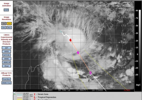
The CIMSS weather model suggested a Category 1 Tropical Cyclone to cross the coast with peak wind speed to 65 knots or 120 km/h with possible higher speeds to 70 knots or 130 km/h.
A weather station at Rowley Shoals well north of Port Headland at latitude 17.52 degrees south and 118.95 degrees east which is close to where the storm formed recorded a peak wind gust to 133 km/h at 9.24 am and again at 9.30 am on the morning of the 30/1/2016 from the west which is consistent with the CIMSS Model. This implies the core of the storm was just to the south of the weather station at the time the peak wind gusts were recorded.
This weather station also recorded 100 km/h gales between 4 am to 11 am during the morning of the 30/1/2016. The recordings appear to be the highest wind gusts obtained by a weather station from the event.
There are also peak wind gusts to 89 km/h at Bedout Island at 5.17 am 30/1/2016. Elsewhere wind speeds were lower as the storm passed through including a peak gust of just 67 km/h at Port Headland. It is acknowledged that there are few weather stations within this part of Western Australia and hence there is limited ability to verify accurate wind speeds at landfall.
Once the storm crossed the coast, the storm broke apart but has delivered beneficial rains within an area that is generally arid.
The CIMSS model for the storm is attached and while it is dated the 30 January, it is identified that the storm generally followed the path as shown.
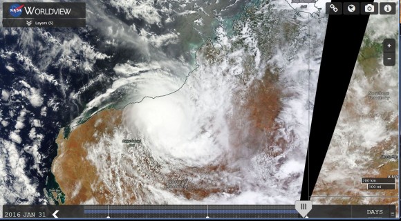
The attached satellite photo of the storm from NASA (MODIS Worldview) acquired 31/1/2016 is showing the storm shortly after landfall.
Credits
Bureau of meteorology for rainfall data dated 1/2/2016.
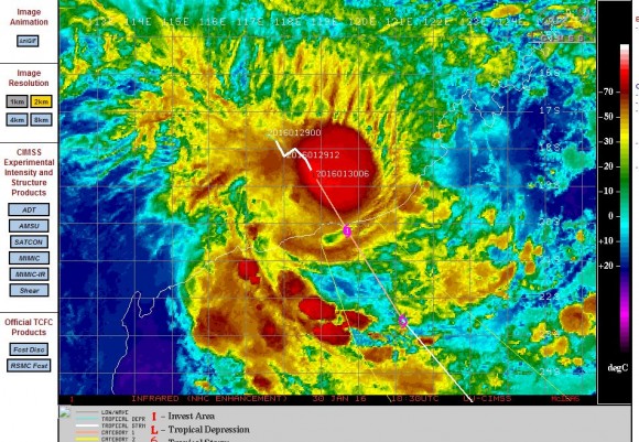
CIMSS (Satellite photo and plot) dated 30/1/2016.
NASA (MODIS Worldview) satellite image acquired 31/1/2016.