
The EOSDIS Worldview image (NASA 5/4/2021) is showing two tropical storms to the south of Indonesia as follows:-
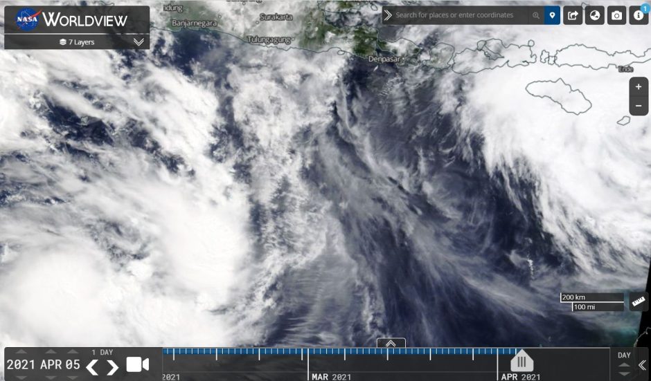
1 - At the south west corner of the satellite picture - Tropical Storm Twenty Seven which may briefly reach tropical cyclone status but given location, it does not pose any threat to any land mass or population centre. This storm should decay over open ocean.
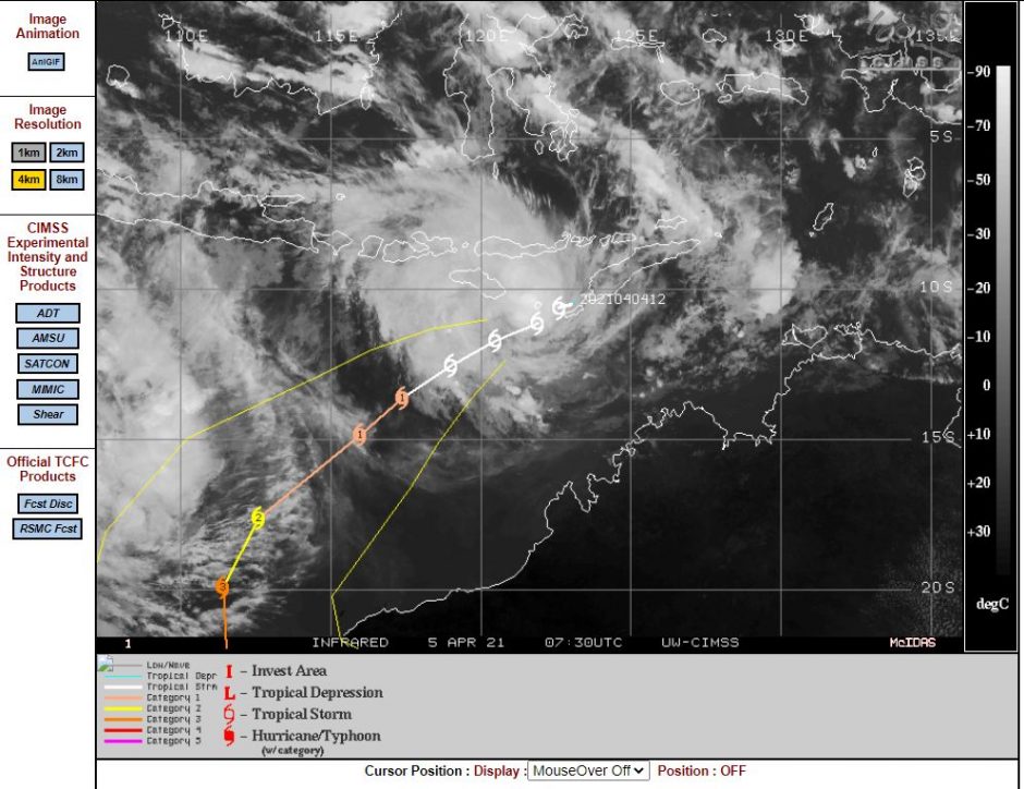
2 - Tropical Storm Seroja which is the stronger of the two storms and situated at the north east corner of the picture. This storm is south west of East Timor and weather models clearly show this storm developing into a significant tropical cyclone over coming days. The CIMSS model of the 5/4/2021 suggests that this storm may reach Category Three on the Saffir Simpson Scale.
Tropical Storm Seroja is expected to track to the south west but remaining off the coast of Western Australia. After 96 hours, the storm is forecast to track more to the south. This storm is within an environment where ocean temperatures are within the range of 30C to 31C which would favour a strong storm of Category three strength or greater.
CIMSS models suggest a storm with maximum winds at the core reaching 105 knots or 195 km/h within 96 hours. The Model as shown would suggest a threat to the north west coast of Western Australia within the next 96 hours as the storm tracks more to the south.
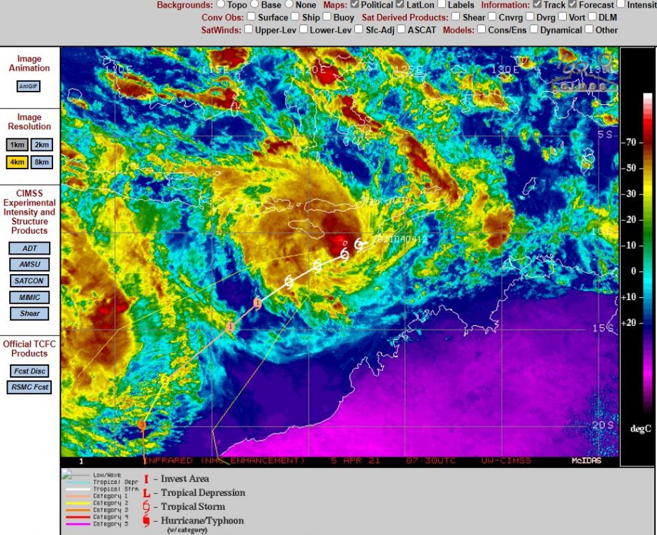
Over the next four days, the storm will impact shipping lanes and flights between Australia and Indonesia but not impact any population centre.
The storm will be watched to ascertain what occurs over coming days especially at it approaches the north west coast of Western Australia.