


Less than 10 days after Tropical Cyclone Chapala made landfall over coastal Yemen as a Category 1 storm, another tropical cyclone has formed over the Arabian Sea within the same region.
This is unusual because tropical cyclones have less chances of forming over this area due to the effects of dry air and deserts prevailing across the Arabian Peninsula and parts of Eastern Africa.
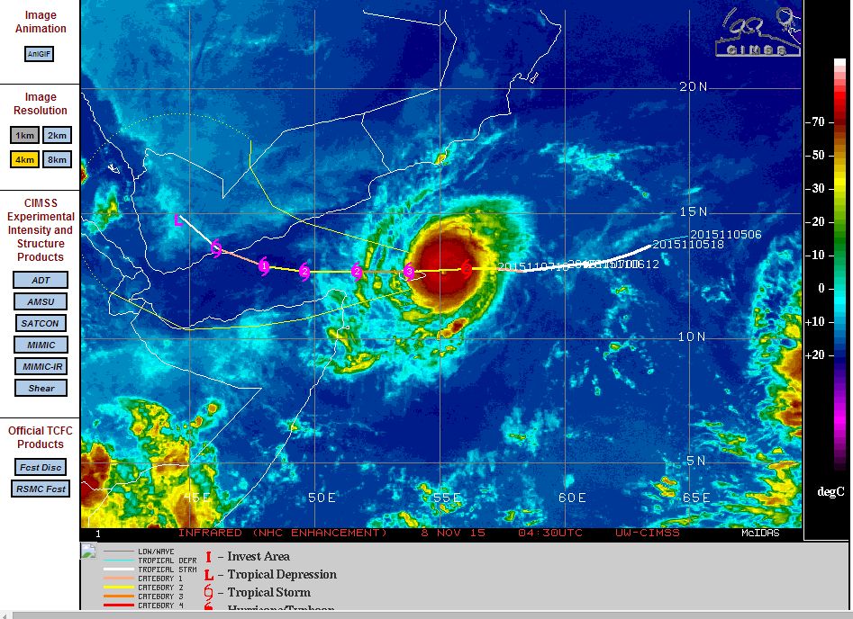
The latest storm is named Tropical Cyclone Megh and should track towards the Gulf of Aden. The storm is a little further south than the track taken by Tropical Cyclone Chapala.
The storm is currently at Category 2 on the Saffir Simpson Scale with winds of approximately 90 knots (Approximately 167 km/h). According to the CIMSS forecast model, the storm could reach Category 3 on the Saffic Simpson Scale with peak winds of 105 knots (Approximately 194 km/h). However, should it reach Category 3 then it would only be brief. Dry air is expected to impact the intensity of the storm and the storm is expected to weaken. By the time it makes landfall, the named storm should have weakened to a tropical storm.
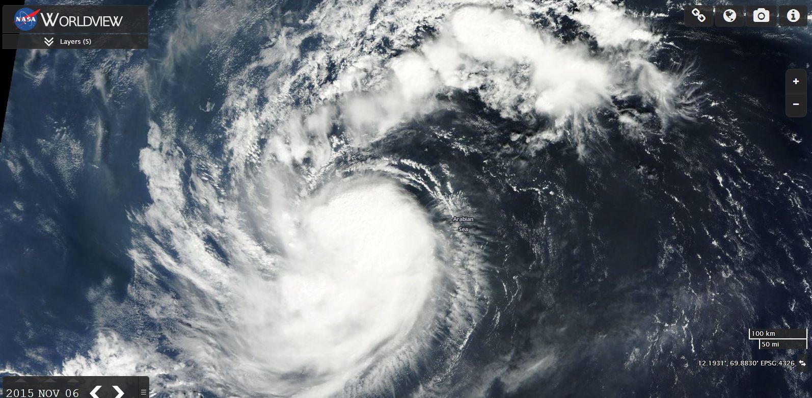
It’s lifespan as a tropical cyclone is expected to be short and a feature of the storm over recent hours is that it is relatively small. Sea surface temperatures are only 27 to 29 degrees across this part of the world and it is hard to see the storm intensifying much further.
At the time the satellite photo was taken on November 6, (Worldview image from NASA) the storm was struggling to form and had no eye. Convection was apparent and there were separate thunderstorms well to the north east of the storm. Since that time, the storm has developed into a small tropical cyclone featuring a small but clearly defined eye.
It was only two days ago that computer models were not sure if the storm would transition into a tropical cyclone greater than Category 1 in strength. That has now occurred and now the storm approaches Yemen.
Tropical Cyclone Chapala
Tropical Cyclone Chapala did cross the coast of Yemen but it did weaken beforehand. Peak wind gusts topped 127 knots or 235 km/h at peak intensity and it reached a Category 4 storm on the Saffir Simpson Scale. Due to the effects of civil unrest and non functioning weather stations, it is difficult to obtain data from the region. It appears it crossed the coast as a Category 1 storm with wind gusts of 90 knots (Approximately 167 km/h) and sustained wind speeds of 75 knots (Approximately 139 km/h).
The storm did produced damaging winds and flooding rain across Socotra Island.
Rainfall can only be estimated with precipitation amounts being approximately 250 mm. According to one estimate, the storm may have brought 1 to 3 years worth of rain to a region that receives such low rainfall and where desert like conditions prevail.
CREDITS
1 – Accuweather (Estimated rainfall from Chapala).
2 – CIMSS (Models of the storm acquired 6 and 8 November 2015).
3 – NASA Worldview (Satellite photo of the storm) dated 6 November 2015.