

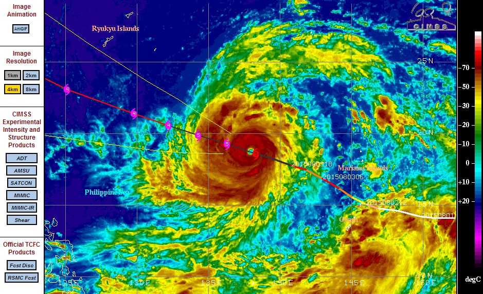
Typhoon Soudelor has intensified into a powerful Category 5 storm with NOAA calling this a “Super Typhoon”. As shown in the CIMSS model (Acquired 4 August 2015), it is clear that this storm has reached Category 5 status.
This storm has formed and developed within an ideal environment. According to NOAA, this storm has an eye with a diameter of approximately 15 nautical miles. According to modelling, this storm has sustained winds reaching 155 knots (1 knot = 1.85 km/h). When converted, that is approximately 286 km/h. Based on satellite data and modelling, it appears that this storm could have peak wind gusts of 190 knots. When converted, this would imply wind gusts reaching 351 km/h.
There are no weather stations currently in its path to verify satellite data or available data.
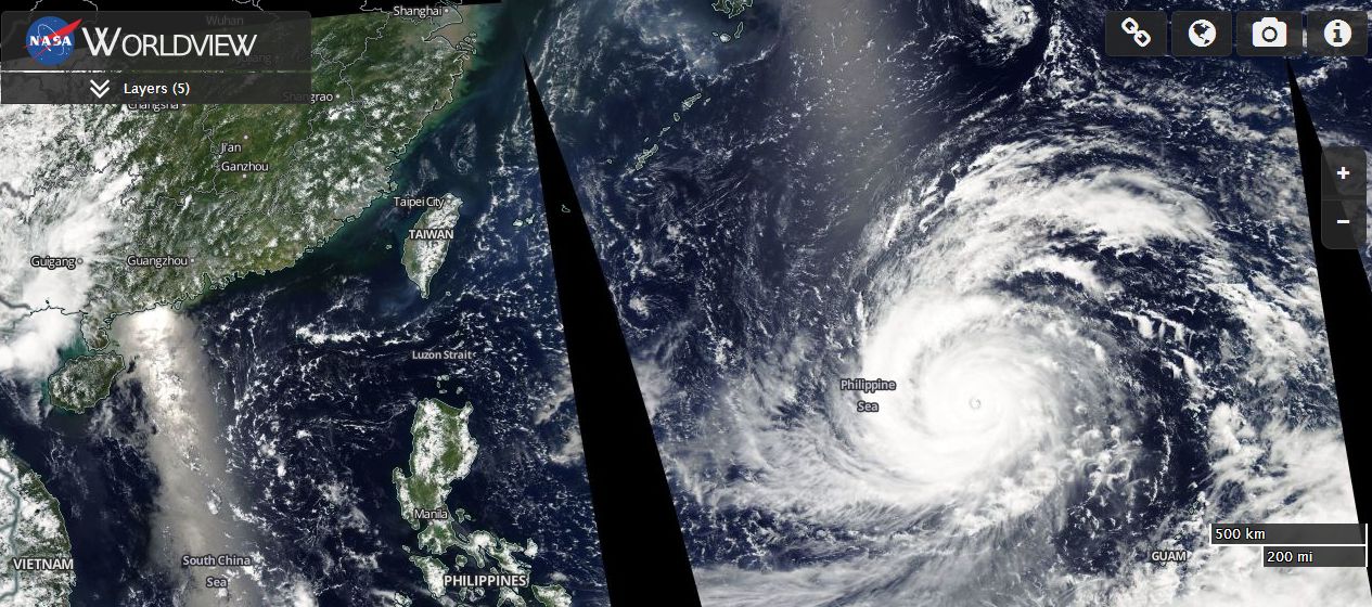
A well developed eye is visible on the satellite photos. As shown in the satellite photo (MODIS – Worldview acquired from NASA 4 August) with overlays, the eye is visible. Surrounding the eye are bands of cumulonimbus clouds marking thunderstorms with heavy rain. The storm takes the shape of a spiral.
Using MODIS “Worldview” (NASA 4 August 2015) with overlays, the storm is now passing over the Philippine Sea in a west north west direction and under its present trajectory, it will approach Taiwan and may even clip the northern coast of Taiwan then make landfall in Eastern China.
The CIMSS model suggests some weakening back to a Category 4 storm in coming days. It has become clear that this storm has exceeded initial forecasts in terms of strength and it will be interesting to see how this storm ends its life span in coming days.
Intense eye!