
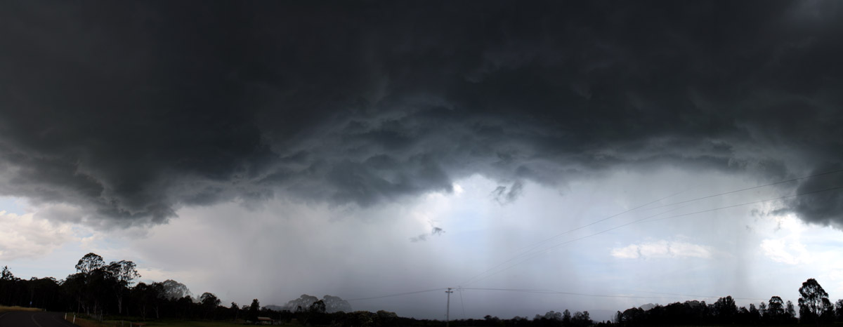
I was contemplating a mini chase today – more local given the marginal instability. When the first radar scan showed a cell near Colo Heights, I made the move immediately. Reports from Nick Moir and also radar showed the storm intensifying with updrafts rising further.
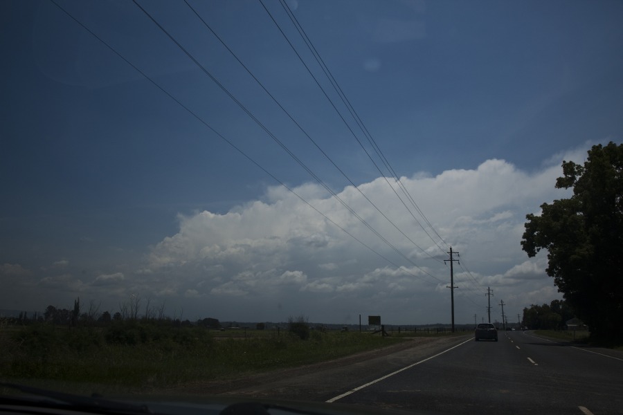
There was a slight chance of intercepting the cell on the Putty Road. However, I was only able to get a few hailstones (perhaps diameters of about 2cm) from the back end of the storm which now had escaped into the wilderness. The best I could do is observe the storm through the few breaks in the jungle up the Putty Road. Timelapse was also captued of the storm. After this point, the storm went into a slow decline perhaps undercut by the boundary responsible for its development.
After this storm, I had some thoughts of chasing the mid-north coast cells but alas, I would not have made it based on the typical time scales required to travel.
All in all, a nice cell to watch!
Regards,
Jimmy Deguara
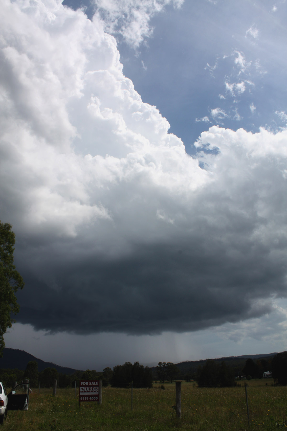
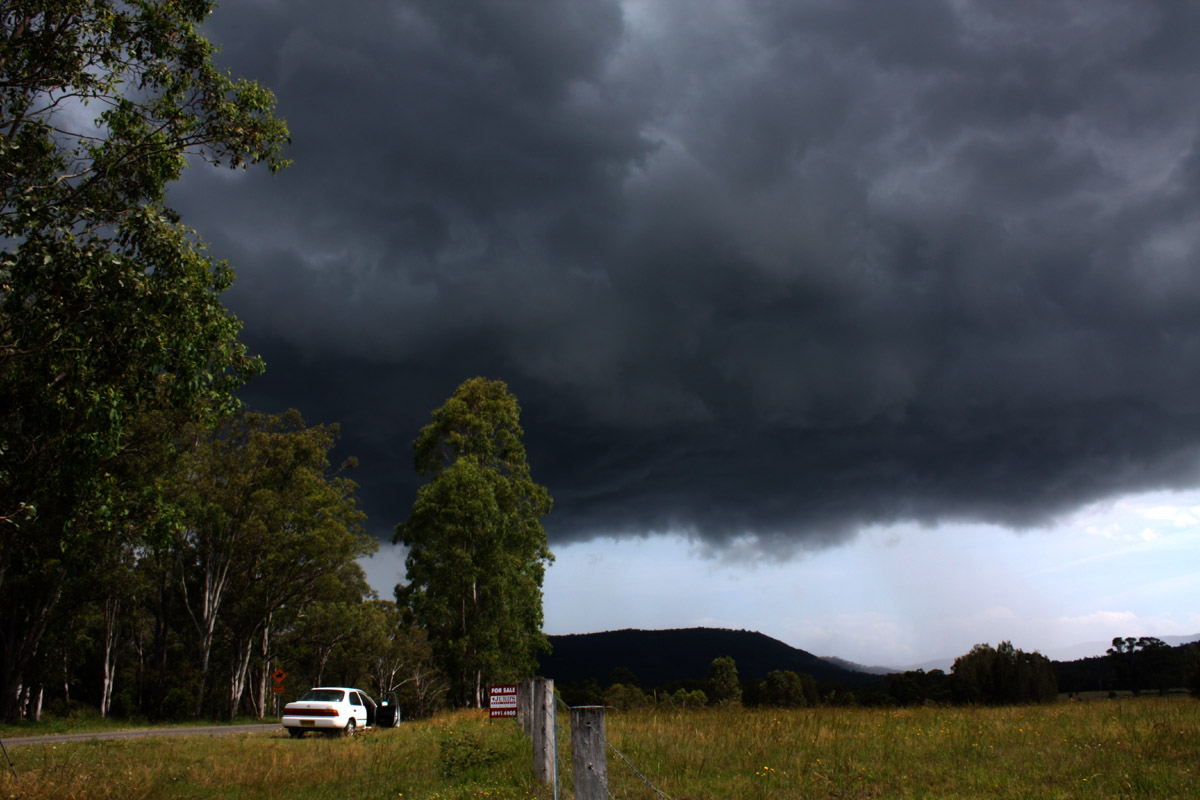
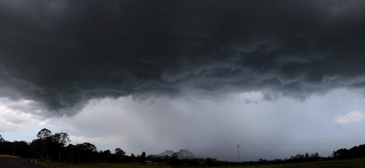
Got onto this cell too. Am going away early tomorrow so don’t have time to edit so will just check up a stitched unedited shot. The cell had a massive rain free base and rotation in the updraft. Will put more photos up when I get back. 2cm hail in the core and strong winds maybe pushing 90km/h.

Home at last. Finally got the pics sorted out! Was an interesting cell, rather LP in nature. Decent rotation in the updraft for the duration I saw it, none in the base. Would have loved to have chased the MNC on this day, GFS was greatly underestimating CAPE values and there was amazing shear. Any reports of that Smiths Lake right mover, or the massive storm near Kempsey? Both had large black cores and were undoubtedly supercells, would have packed some hail. One of the best MNC outbreaks I have seen anyway following storms! Here are the pics in my chase from Ellalong – Quorrobolong area.
Hi,
Nice one Ben. Great positioning. Do you have timelapse showing the rotation? I could not detect any obvious rotation except for the occasional updraft turning.
Here is the timelapse video from this event
Regards,
Jimmy Deguara
Hi Ben,
Not sure if you checked the models after the Mid North Coast event but the re-anlysed models showed a totally different picture for the region near Taree. A jet maximum passing over the area was one significant change. A deep atmosphere allowed for tall thunderstorms to develop and coupled with a strong shear environment made this a far more ideal region to chase.
Defintely some decent hail and extremely heavy rain over the region.
Regards,
Jimmy Deguara
Hi Jimmy,
I didn’t look at the reanalysed models no. But the region did take my interest the night before. LIs were only progged at -3, and CAPE values low, but the shear was quite amazing on the run I saw anyway with some good turning with a deep NE’ly flow progged, and shear about 50kts at 500 and a rather strong jet. Models predicted a good 20 or so mm in the region too. That alone caused me to head out but had to settle for Cessnock as I had work at 7. I was not confident on the day, just wary of the potential and kind of hoping. Chasing in high shear environments in low CAPE environments can be risky, as I’ve noticed cells get sheared apart. However it worked out on this day as the usual clutter on the MNC didn’t happen as much and there were 3 well defined supercells.. Someone I knew chased the MNC this day anyway and said it was covered in scud, as is often the case on big days on the MNC (certainly was when I last chased it and got the large hail), which would have made it frustrating. I just find it confusing as to why there is not even any public reports as to those two storms.. I can only imagine the structure on them and hail size!
Re: timelapse I shall have to get onto it and get it uploaded. Though looking back at it I timelapsed the base more than the updraft!
Any pictures or video from the event from this guy? Also, although the region probably experienced large hailstones, it may alsoo have been impacted by very heavy rainfall.
Regards,
Jimmy Deguara