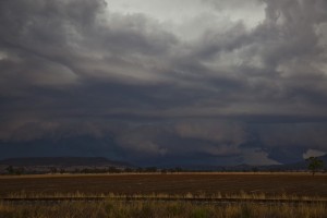

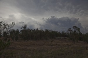
Was in the Tamworth region and getting some thing done when I noted the first towers developing on the hills near Tamworth. I had not checked the models - well I had not had a chance but from the previous day's model data had not planned on chasing. So I took a few pictures locally of exploding towers and went back to task.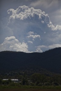
On checking the models and local radar and having completed my tasks, it was inevitable, I was going for a local chase - to near Manilla, then near Gunnedah - not so local in the end!
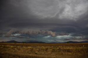
I passed quite a few storms becoming outflow dominant and setting up boundaries to my south. 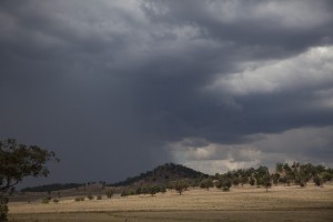 Finally to the south of Gunnedah, I stuck to the major storm that was emerging from the haze to the west. I set up tripod when I hear this voice "Jimmy!" I turn around and Ben has just arrived from Sydney! We enjoyed a spectacular high contrast storm with shelf cloud. It became reasonably lightning active but alas, outflow dominance ruled the day once more!
I had to head off home and Ben remained for the next day's action. I noted that was on track for a black radar cored storm to my east but alas, it weakened before I could get to see any features. Friends of mine suggested it had marble sized hail!
What an unexpected chase!

Great and interesting to have met up near this storm Ben McBurney!
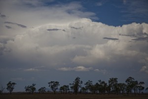
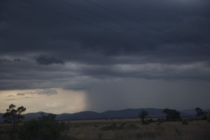
Yes not a bad day this one. Some strong outflow in this storm to 90km/h which made photographing difficult at times. I headed north after this storm after the Narrabri line that fired up after you headed south Jimmy.. but a truck smash at Boggabri cut off the road and erased any hopes of catching it. Was some decent amounts of leaf litter behind the storm though. Was good catching up Jimmy!
Gustfront weakening but good contrast
Daytime CG I got!
Video of the event!
Posted a video of the shelf cloud!
I am glad you posted this picture. I forgot one particular clip that had the lightning!
Posted a video of the lightning I missed in the original video!
Excellent footage!!! Haha hearing our reactions. It would be great if you do a slow mo of some of these strikes – some of these were awesome!