While southern Australia is being impacted by heat and ensuring bush fires and a tropical cyclone looms deep in the Pacific Ocean north east of Queensland, another weather event could potentially unfold across eastern Australia over coming days.
Recently a monsoon low impacted the top end of Northern Territory producing substantial flooding and cutting roads. That low has tracked deeper into Northern Territory, northern South Australia and into inland south west Queensland.
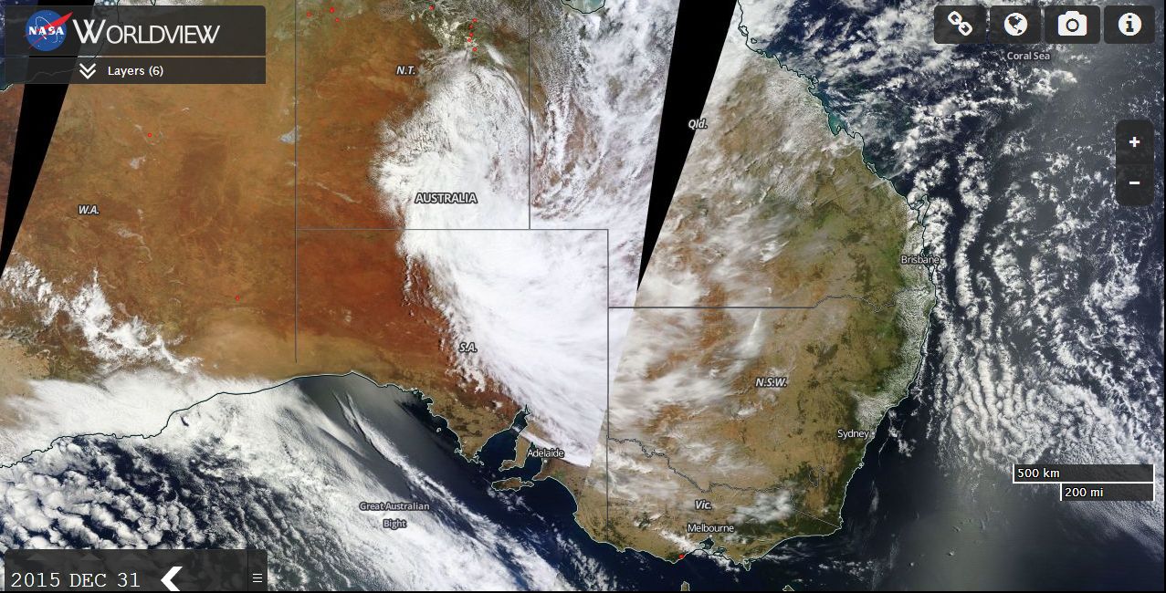
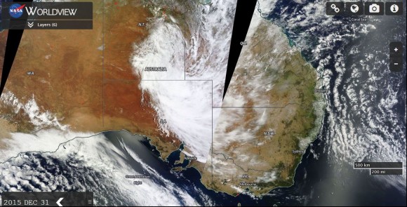
During the last day of December 2015, the cloud mass as seen in the attached satellite photo from NASA produced some light to moderate rain across desert regions of three states. Rainfall figures include 10 to 24 mm across northern South Australia and 17 mm at Maree. Birdsville had 32 mm which is a significant fall considering its location. In Northern Territory, Alice Springs enjoyed 1 to 6 mm after 9 am 31/12/15. However up until 9 am 31/12/15, the main weather station at Alice Springs recorded 49.6 mm from the cloud mass.
Furthermore, a weather station at Jervois north east of Alice Springs received 77.2 mm to 9 am 31/12/15.
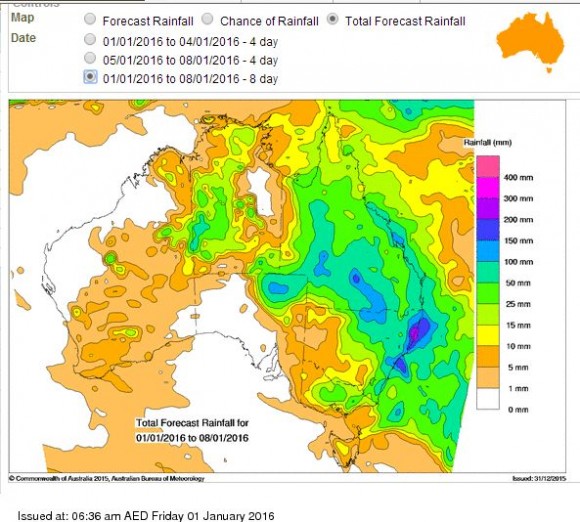
It appears that the cloud mass will continue to travel east and south east, interact with new moisture as it advances and deliver a significant rain event for some regions. The Bureau of Meteorology “Water and the Land” is suggesting a very widespread rain event for most of Queensland with some moderate to heavy falls across the inland. It is suggested that some regions in the drought affected areas would receive 100 to 150 mm.
The Bureau of Meteorology “Water and the Land” is suggesting a substantial rain event for the north east third of New South Wales and even suggests as much as 200 to 300 mm across parts of the Mid North Coast of New South Wales taking in Port Macquarie and Coffs Harbour. The model is suggesting some reasonable falls around Sydney and the Lower Hunter Valley of 100 mm to 150 mm over coming days.
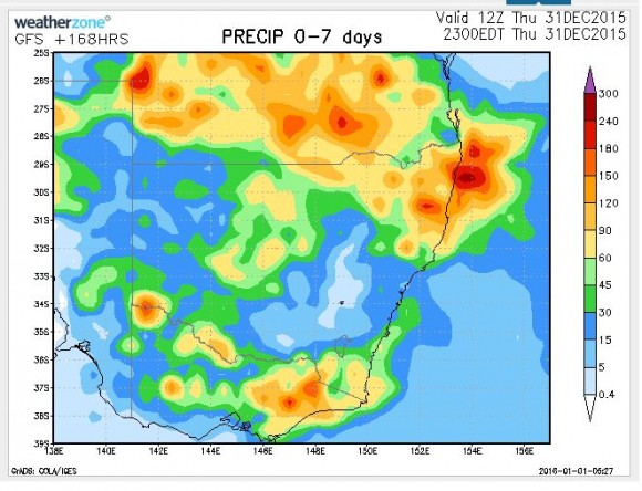
The Weatherzone model suggests much lighter falls for Sydney but heavy falls for North East New South Wales (Mid North Coast to the Queensland state border) and falls of 120 to 200 mm for inland Queensland.
The inland region of Queensland has been hit hard by drought and such a rain event as suggested would alleviate this.
It is interesting to note that both models suggest reasonable rainfall over Eastern Victoria but light falls over southern and western New South Wales.
The cloud mass that moved over the Top End of Northern Territory appears to be more significant given its movement across inland Australia. It is now poised to affect eastern Australia, especially New South Wales and Queensland in coming days.
CREDITS
1 - NASA 0Worldview) with overlays acquired 31/12/15.
2 - Bureau of Meteorology "Water and the Land”.
3 - Weatherzone (Precipitation model for New South Wales, southern Queensland and Victoria) 1 to 7 January 2016.