As the rains fall across NW NSW, Prime Minister Abbott is expected to tour NW NSW and central Queensland in response to the worsening drought! What timing!
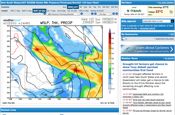
A rain band with some of the best rains in months is expected pass through central to NW NSW today of falls between 15 to 30mm of rain widespread across the region! This does affect parts of SW Queensland but lighter falls are expected further north.

However, Queensland may be getting substantial falls over the next week with models now consistently putting rains in the region by late next week!
Good news all around but it will be interesting to see how today plays out timing wise with the visit.


Let's hope that sufficient rainfall can break the drought across the worst affected region – the best rain event in quite some time!
Harley will report some rainfall statistics later.
Thank you. I have just got home. About to write something about it. Mind you, its not allot of rain for us but its better than nothing.
I am also interested in the other areas of NSW particularly the NW
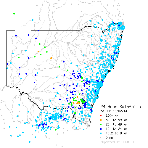
From WeatherZone "Cobar saw one of heaviest falls for the state, collecting 68mm in the 24 hours to 9am today, its heaviest rain since 2008. Some places north and west of Cobar had their best rain in more than a year, with Innesowen picking up 43mm and Louth 30mm." Says it all! Heavist rain for Cobar for 6 years!
From the ABC News on Weatherzone "A downpour while Mr Abbott was in the town was applauded by farmers, but they warned isolated rains would not provide them with enough relief to renew their businesses."
Just added a rainfall map from the Bureau of Meteorology for NSW this mornings.
Raining steadily at the moment as the front with SE winds passes over. More storms developing on the Southern Tablelands with warning of heavy rainfall.
I have added a more comprehensive discussion of rainfall under "Rain event 15 and 16 February 2014". Cobar did have a good total overnight but there seems to be a pattern in which the best totals are isolated in nature with some areas receiving worthwhile totals while other areas are missing out.
So far little rainfall has occurred across the northern inland of New South Wales including the towns of Narrabri, Moree and Inverell. This area is in bad shape. Any rain from this system later today or overnight across that region would be welcome.
On the subject of the drought not quite related to the current rain event, there is talk that 2014 could be a tough year for farming. There is talk of a possible El Nino phase returning later on this year which bring a greater chance of less rain or even drought conditions. Its still too early to guage this or to determine any strength of it, assuming it does occur. This is one to watch for 2014 but it is something that is getting some attention in the media in addition to the current drought crises.
Thanks for that Harley. Good to see the inland scoring some much need rainfall.
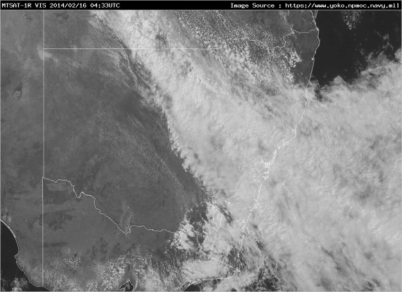
Satellite image added – nice cloud band and you can see storms developed behind the cloud band as a result of the upper trough system.