
During the 30 and 31 July, two new Pacific Ocean storms have developed. One has rapidly developed from a tropical depression into a hurricane in the space of 2 days while another storm is still a tropical storm but forecast to intensify into a typhoon within 36 to 48 hours.
It is interesting to note that both storms have developed at the same time but both will take separate courses and have different life spans and strength.
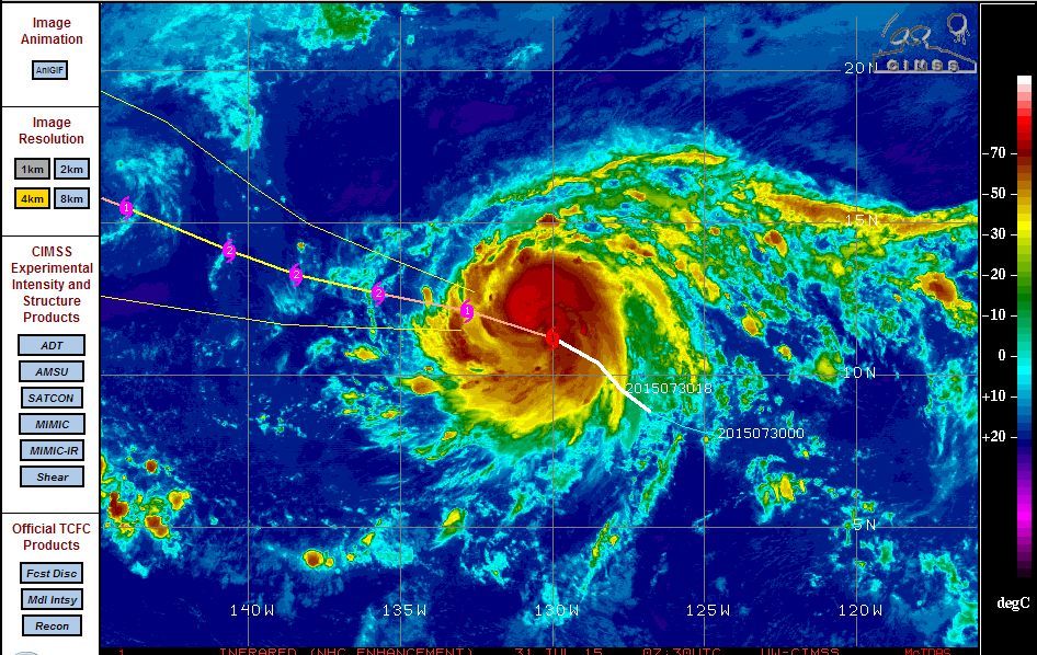
Storm Number 1 - Hurricane Guillermo.
The storm has formed in open ocean south east of Hawaii however the storm does not threaten directly the Hawaii Islands. The storm has rapidly intensified and has formed over waters of 29C. The storm as at 31 July 2015 is currently located 11.2 degrees north and 130 degrees west. It is now a Category 1 Hurricane with winds gusting at 70 knots close to its centre.
If the CIMSS Model is correct, the storm should track over open ocean, intensify into a Category Two Hurricane but weaken in 2 or 3 days time as it passes over cooler waters. It appears at this stage that the storm will have a relatively short life span and not present a significant threat to any population centre.
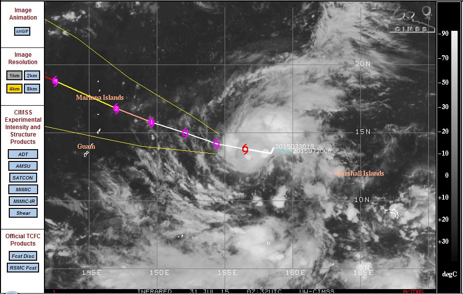
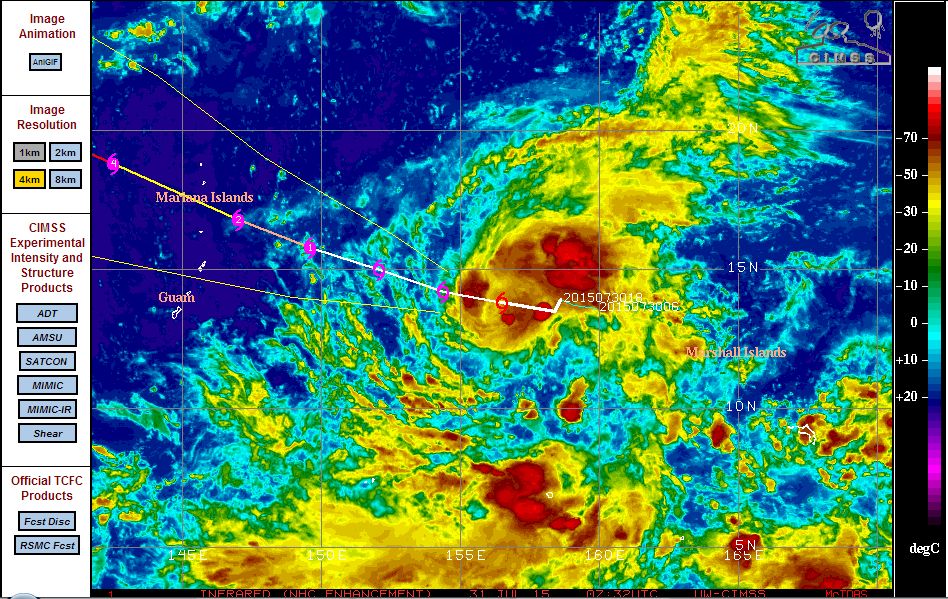
Storm Number 2 - Tropical Storm Soudelor although it is expected to intensity into a typhoon shortly.
This storm has formed approximately 4,000 km east south east of the Philippines but north west of the Marshall Islands. The CIMSS model suggests that the storm should pass north of Guam but close to the Mariana Islands in coming days.
The CIMSS model suggests a typhoon within 36 hours and a potential dynamic Category 4 Typhoon later during its life span. This storm will pass over waters greater than 31C in coming days which would support a strong typhoon. While currently over open ocean, this storm will eventually approach south east Asia.
Winds are estimated at 40 knots (Tropical storm strength) at the present time but the model is showing substantial intensification in coming days.
The models attached for both storms are acquired on the 31 July 2015 from CIMSS.
Harley, passing over 31C sea surface temperatures should surely get the typhoon to intensify!