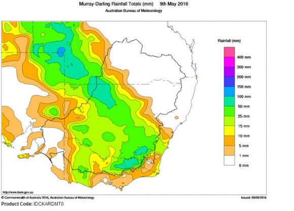
The cloud mass is now clearing out to sea but it has delivered some strong rainfall totals for Australia's food bowl - The Murray Darling Basin.
The same system has also delivered strong rainfall in areas south west of Alice Springs that has not seen much rain for up to 5 years.
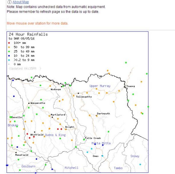
Across the ranges of North East Victoria, falls have exceeded 100 mm although this is limited in area and there were significant rain shadows further south and east.
The highest totals for the 24 hours to 9 am 9/5/2016 are:
VICTORIA
Mt Buffalo Chalet 175 mm (This is the chalet at Bents Lookout).
Harris Lane 123 mm (At the foot of Mt Buffalo).
Handcock 119 mm.
Whitlands 111 mm.
Cheshunt 109 mm.
The area includes Mt Buffalo, Mt Hotham and Mt Feathertop region and the small farms that dot their bases. Smaller totals include:-
Barkleys Camp 97 mm.
Eurobin 96 mm.
Charnwood 94 mm.
Hunters Hill (981 metres in elevation) 80 mm.
Bright - The only significant town within the area had 76 mm.
In surrounding areas, falls of 40 to 55 mm occurred including Corryong 52 mm and Albury Airport 46 mm.
NEW SOUTH WALES
In the far north west of the state, Hungerford and Wanaaring had 79 mm and Louth had 63 mm.
In the south east, the western areas of the Snowy Mountains received falls of 50 to 99 mm including 84 mm at Long Plain. A fall of 76 mm occurred at Burrinjuck Dam.
QUEENSLAND
South West Queensland also received this event although some storm activity occurred along the Northern territory / Queensland state border as evening approached. The highest falls include:-
Ballera Gas Field 97 mm.
The Monument 92 mm.
Nappa Merrie 84 mm.
The falls have come as the El Nino wanes and there is the possibility of a La Nina event late 2016. Should this eventuate, then it would suggest a greater chance of more back up rainfall as the year progresses.
During Monday, a cold front passing through Victoria has brought some storm activity, brief pulses of heavy rainfall and strong winds including gales at elevation.
At Melbourne Airport, a peak wind gust to 78 km/h was recorded at 9.18 am and in Melbourne City, 6 mm of rain fell between 11.16 am and 11.30 am as a cold front passed through.
At Mt Buller, a peak wind gust of 117 km/h was recorded at 11.41 am and wind gust to 106 km/h was recorded at 1.03 pm.
The rainfall plot for the Murray Darling Basin is provided to 9 am 9 May 2016. The rainfall plot for North East Victoria is also provided for the same period showing rainfall across that region.
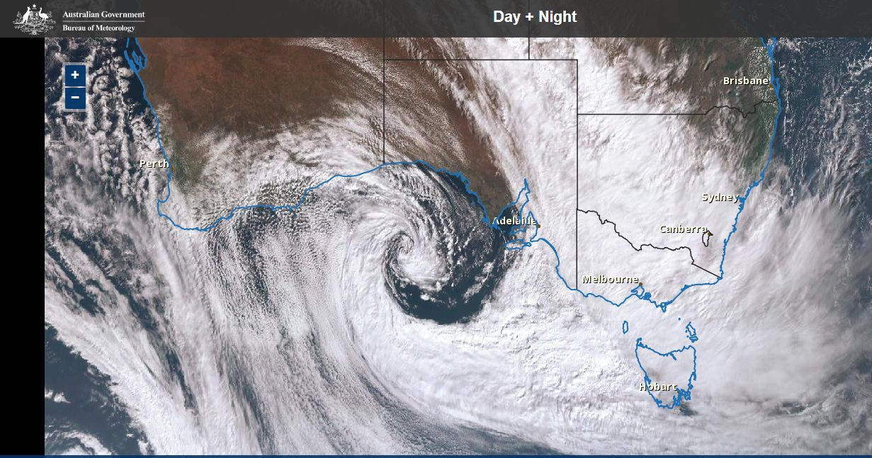
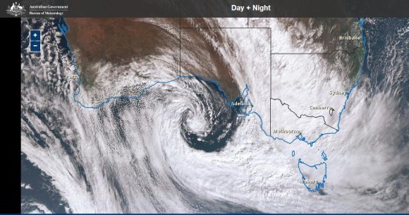
An impressive satellite photo of Australia is provided showing the cloud mass and the deep low pressure cell south of South Australia taken late Sunday 8 May. An array of weather is occurring across much of southern Australia within the large weather system seen. Conditions will now moderate as a new high pressure cell starts to dominate later in the week.
CREDITS
Bureau of Meteorology rainfall data and satellite photo 8 and 9 May 2016.
Rainfall 9 am 10 May 2016
Throughout May 9 and into May 10 2016, further heavy rainfall was concentrated within small pockets of North East Victoria and southern New South Wales. This has resulted in rises to rivers but for the most part, flooding was avoided and where flooding occurred, it was relatively minor.
Furthermore, snowfall was recorded at Mt Hotham, Falls Creek and Mt Buller ski resorts (Victoria) and Perisher Valley and surrounds (New South Wales) with snow settling on the ground.
There were also solid rainfall totals for a large portion of the Adelaide Hills where 50 to 88 mm fell while 11 to 30 mm fell across Adelaide City.
The best falls for the 24 hours to 9 am 10/5/2016 are:-
VICTORIA
Falls Creek 125 mm.
Mt Hotham 114 mm.
Mt Buffalo 94 mm.
High Ridge 69 mm.
Mt Buller 61 mm.
The nearby ranges received 25 to 49 mm. A feature of this is that the large falls are localised and confined to the ranges.
NEW SOUTH WALES
Thredbo 101 mm.
Geehi Airstrip 78 mm.
Perisha 74 mm.
The nearby western slopes received 26 to 49 mm.
Other than isolated showers and lighter falls, the weather system responsible for this has cleared. However it is identified that a greening of southern parts of the Murray Darling Basin has commenced which is a clear sign this system has produced worthwhile rainfall.