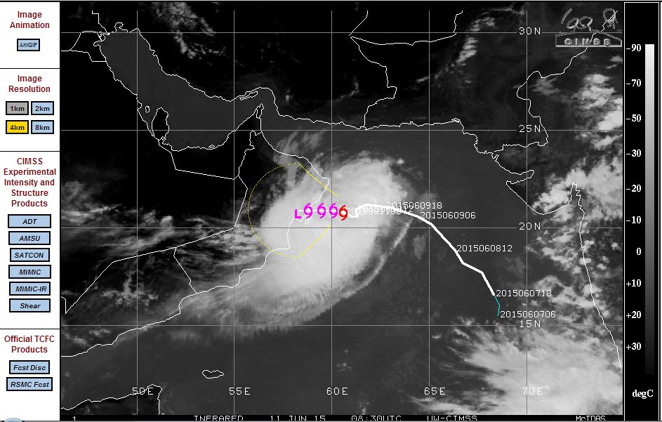
The satellite photo shows the weak tropical Cyclone Ashoba commencing landfall in Oman but south of the capital Muscat. The coastline where landfall is occurring is largely desert with no significant population centres affected or likely to be affected.
This storm is expected to bring heavy rain at least to the coastal regions of the country but with dry air being entrained into the storm, it is expected that the storm will weaken fast.
This storm has been fuelled by ocean waters that are at least 28C to 30C which has enabled the storm to sustain itself in an area where tropical cyclones or tropical storms are relatively rare. In other words, it is unusual to have such a storm in this part of the world.
Wind speeds have been dropping (Now at 40 knots) as landfall commences but at one stage, the storm was showing strong convective thunderstorm cells on its south west flanks and with winds estimated to be 92 km/h with peak gusts estimated to be 120 km/h.
As landfall commences, the central pressure of the storm is 985 millibars. The storm will weaken fast as it spreads rain along the coastline which will effectively end its life span.
The satellite photo (CIMSS dated 11 June 2015) is attached showing the storm spilling onto the coast of Oman.