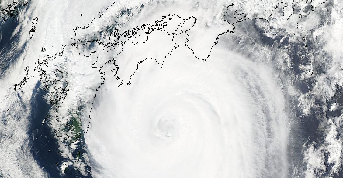
The attached satellite image of Typhoon Nankga acquired from NASA 18 July 2015 is the image of the Typhoon on the 16 July 2015 as it made its final approach towards southern Japan.
The photo is the typhoon as a Category 1 storm but with a visible eye. According to Accuweather data and research (19 July 2015), this storm was significant for the following reasons:-
1 - It travelled more than 4,000 km since it was born and survived for 12 days.
2 - It reached a Category 4 storm at peak intensity with peak winds estimated at 250 km/h at the core.
3 - It reached Japan as a Category 1 storm with winds varying between 119 km/h and 153 km/h.
It made landfall near Murato City on Shikoku Island at 11 pm with sustained winds of 130 km/h.
The storm brought heavy rains in the order of 125 to 250 mm over Shikoku Prefecture with isolated falls of 500 mm over rugged mountainous regions.
A weather station at a town called Kamikitayama (Nara Prefecture) south of Osaka appears to have recorded an amazing 745.5 mm of rain as the storm passed over.
The storm has now weakened to a low pressure cell and no longer an intense storm.