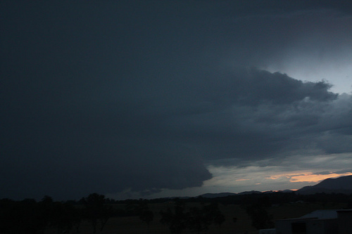
Who would have thought April would produce something like this? The setup on the 8th April was quite amazing with an upper trough moving in from the W -14c @500mb, LFTX values around -5 to -6, 35-40 tks @ 700mb, and 50kts 500mb. There was also ample moisture up to 750mb, with a large dry slot in the uppers thereafter. Perfect conditions for supercells. I targetted the Hunter valley, aiming to sit somewhere on the convergence of the NE and NW winds where I believed the drier storms from the W would perk up and become more active. Not exactly what happened, but I got onto a storm coming in from out near Dunedoo near Singleton. Unfortunately the storm was 10km N of Singleton, and with the road towards Lostock Dam having terrible views, I sat just east of town on the Gresford road. An originally interesting base quickly turned into a wall cloud and exhibited supercellur structure for an hour or so, before becoming outflow dominant on nightfall as it tracked east towards Gresford.


I aimed to get ahead of it and tried out the Gresford road, which actually wasn't too bad. Unfortunately I hit a pothole coming off a tight corner, and blew my front left tyre, spinning off and ending up in a paddock. Very scary. Some lovely people assisted me by helping with the tyre and towing me out, and I somehow managed to get ahead of the storm which was not definitely outflow. Some amazing crawlers and CG's were to be on show, but towards Gresford there were too many trees. The corepunch yielded some strong winds 80-90kmh, and some brief 1-2cm hail. The lightshow after the line had passed was also spectacular.
When I arrived home I heard reports of a tornado in Asquith, my suburb. I had seen no damage and was pessimistic. So after hearing from my friend Steve whos house was in the middle of it, I had a looked around, quite amazing! Most of the damage was in the Mills Park area. I would say it is definitely a tornado, in the F1-F2 range. Huge gum trees down, through peoples rooves, jacarandas uprooted, some trees have been half eaten up. It is amazing how the damage stopped so suddenly. I spoke to 2 residents in the path. They said the winds lasted no more than 30 seconds and it sounded like a freight train. The damage also does not look linear, there is no one direction that it tracked. One resident, who had a trees in his yard uprooted and thrown through the neighbours house roof, said he was watching TV, and all of a sudden the wind picked up, the TV reception flickered and it got ridiculously windy for about 30 seconds, and then went dead calm thereafter. And he stepped outside and saw the chaos. Simply amazing anyway, I will try and get photos of the damage in the morning if it is still around.
Doppler radar at around 7:30pm is very interesting http://www.theweatherchaser.com/radar-loop/IDR71I-sydney-terrey-hills/2012-04-08-08/2012-04-08-13 just north of Hornsby
Hi Ben,
Yes there seems to be a pendant of sorts for a brief period but me thinks inconsistent on doppler – nothing spectacular. I was in Pennant Hills in minor hail when this storm was passing through. I saw no interesting structure personally but I guess hard to see in terms of trees. I would also be interested in noting whether the storms were elevated? I will be interested in seeing the photographs. Was it a case of a cell merger? Boundary interaction? Were the cells travelling extremely fast hence the brief moment of activity?
Incidently, I was planning to go through to the area you were but decided against it knowing the storm was headed for the area you suggested and evening was almost in progress. I am glad you showed me what was there. It ewas the cell I wanted to target being on the southern end of Lake Macquarie.
See : 64km Radar Loop for Sydney (Terrey Hills), 08:00 08/04/2012 to 13:00 08/04/2012 UTC
Glad you were ok after that driving experience Ben ! Some very intense rainfall was reported by Don White as the cells passed over the northern suburbs with a 9mm in 1 minute measured.
The afternoon sounding for Sydney was nice as you described. Been very few looking like that this past season.
North Turramurra was also quite damaged. Maybe even moreso than Asquith. Huge eucalyptus trees down across rooves, many uprooted that are massive. Tiles have been stripped off houses, damage is about 500m wide again. One of my friends houses was in the middle of it so I shall be asking their opinion when I can get hold of them.
Now what is REALLY cool is that I went to Golden Jubilee oval. Most of the oval is fine but I went for a bit of a walk into the bush and the damage starts there with a few trees uprooted. When you get to the cliff edge with a view across the valley there is a CLEAR damage path of where it tracked.. it carved its way right through the valley flattening everything in its path. Simply incredible.
I have photos but I am off to Wisemans Ferry now, so will put them up when I get back.
Interesting re: you saw nothing Jimmy. Doppler showed it started just around the Asquith area. I would have loved to have been here to have possibly seen it, but I guess rain would have ruined any chance of photos. Damage and reports do seem consistent with a tornado though.
Sorry I never picked up on the couplet until now! Yes there is something there on doppler for sure.
By the way, with double de merit on I was not looking at radar and definitely not doppler as the radar echos in the area looked crap!
Michael, we observed 43.0mm of rain from this event which is up there for Schofields!
Regards,
Jimmy Deguara
Actually, Ben I saw a vague hook at the same storm at the time you specified but it looked so messy. Now that you match them up, which is what I was suggesting with Paul Graham earlier this evening, it does match up!
Any pictures there Ben?
Regards,
Jimmy Deguara
Hi Jimmy, yes the hook does indeed look very messy. I don’t know what you’d call the storm.. if it was supercellular or not, but regardless it produced some very powerful winds/tornado 150km/h+ looking at damage.
I have yet to go through photos etc as I have been away. I will do them later today. However some decent photos including one of the giant 15m gum tree being uprooted in N Turramurra on the local papers website at http://north-shore-times.whereilive.com.au/photos/gallery/easter-storm-damages-north-turramurra/
After work tonight I also drove around in accordance to the doppler images and I tried to get an idea of the damage path. I noticed further damage on Mona Vale road near Forest way, and also up in St Ives chase on the edge of the NP, confined to only one street on its edge. So I have constructed a damage path + estimated fujita ratings in accordance to damage I observed (and as a result, estimated wind speeds). Certainly winds could have been ~150km/h looking at damage, with similar sized trees down to the ones I observed at Belford in January 2010 (when my car got trashed), when it was estimated by damage there by SES of similar wind speeds.
Hi Ben,
Thanks for the map and for the estimate in damage. Well done! Hopefully you have noted in your images orientation of tree felling and debris.
Was it supercellular? We require more information from the Bureau on this issue and I will ask Michael Logan at the AMOS meeting tonight at Turrumurra tonight. If it was a tornado, it could have been a gustnado style. One could suggest book end vortex but I don’t see evidence on that within the mess on radar.
Based on the pictures from that link in your last post, it is not consistent with a tornado as evidence on its own. Hopefully your images can provide better evidence. I would have liked to know the orientation/direction of the roof tiles being sheared off. Inflow jets in the Dunoon tornado 2007 sheared off roof tiles. There was also a lot more mess on the ground. Interestingly the small trees are still standing. Was this ‘tornado’ shearing the tops of the trees? Or was this a sudden change in momentum forcing larger trees to be toppled.
I await your images Ben.
Regards,
Jimmy Deguara
Michael Logan did talk at some length about the probable tornado and that evidence did point towards a tornado based on the couplet which is what has been covered here. He did say that the couplet was more intense at the scan angle level above the ground and further down it was not as intense. The path mirrors what Ben has plotted here.
Regards,
Jimmy Deguara
Hi Jimmy,
Very interesting in terms of what Michael said. Going by the couplet, and the damage path I plotted the track was about 9km, which is quite long for tornado tracks in Australia. Quite remarkable. The lack of debris is interesting to note, although the streets of Asquith right after the event before cleanup had a lot of debris. In some of my images I ventured into the National Park where the SES had obviously not been yet to try and get an idea of the damage and at times it was quite severe. In the North Turramurra area at least, the damage was actually quite linear in the residential areas more symbolic of straight line winds, bit more varied once you got to the National Park. However, the image of the track through the National Park suggests more tornado.
About 75 images of the damage etc on my flickr account showing most of the photos I took of the damage mostly focused on North Turramurra http://www.flickr.com/photos/28009095@N05/
Ben,
Do you by any chance have a more wider view of the track in the forest. I see felling of trees towards the photographer right along the National Park picture. There is only a few pictures that remotely come close to considering tornado damage – all others point to straight line winds at this point. We need you to label each of them where they were taken along the path and the orientation of the images. This is important.
With tornado damage, I like to see some sort of inflow jet roof tile damage, sheeting iron wrapped around power lines ie debris all over the place, garbage bins all over the place even with F0 to F1 damage.
Regards,
Jimmy Deguara
Jimmy,
In my flickr, there is a wider view of the one posted here. That’s as wide as I have got. My brother had a look too and reckoned there was a better view. I intend on going back and redoing photos in the National Park, I don’t think the residential areas give a complete idea of the type of damage. Apparently the NP between North Turra and St ives is obliterated, so I will venture there. In terms of photos.. that’s pretty difficult as I didn’t really take complete note of every trees direction. But in the residential areas of N Turramurra, a lot of trees were down from W/E or NW/SE direction suggesting straightline. However, in Asquith, and through the NP trees were down in no clear direction. There are trees down randomly over the North Shore too suggesting the possibility of outflow winds of 70-80k/h in the main part of the storm, but the ‘intensive’ damage path is very narrow as shown in the photos over the NP.
The valley between North Turramurra and St ives was quite an amazing venture. Went for a brief bushbash on dusk, and with brief views through the trees. It is quite amazing, entire gum trees have been completely stripped of their branches and leaves, leaving only seemingly dead trees. All in such a thin path. I shall go and get photos tomorrow!
Hi Ben McBurney,
I guess it is inconclusive. Why is it that it often is difficult to prove tornadic damage here? I guess weaker tornadic events can be difficult and without evidence of a sighting, it makes it more difficult again. The sounded like a freight train comment is important to note – did they suggest that? Usually with such damage of a tornado, a narrow path of intense damage takes off parts of roves etc.
Hi Jimmy, I believe this has been confirmed by the BoM. I recall reading a quote suggesting the damage survey and doppler radar (clearly showing strong rotation) suggest a F1 Tornado touched down in Asquith and continued E for a number of km. I can't seem to find that quote anymore though. They do have it marked as a TOR in the Severe Storms Archive on the BoM website.
23993 Tornado 1200 2012-04-08 09:45:00 ASQUITH RAILWAY STATION NSW -33.6901 151.1096.
Massive pine tree uprooted, evidence in post analysis points to rotation in the cell.
As well as this from the NST 10 days after the event (and debate/questions on the original article from a few weather enthusiasts and readers).
http://north-shore-times.whereilive.com.au/news/story/north-turramurra-storm-damage-quite-likely-to-have-been-tornado-radar-shows/
Hi Jimmy, I believe this has been confirmed by the BoM. I recall reading a quote suggesting the damage survey and doppler radar (clearly showing strong rotation) suggest a F1 Tornado touched down in Asquith and continued E for a number of km. I can’t seem to find that quote anymore though. They do have it marked as a TOR in the Severe Storms Archive on the BoM website.
23993 Tornado 1200 2012-04-08 09:45:00 ASQUITH RAILWAY STATION NSW -33.6901 151.1096.
Massive pine tree uprooted, evidence in post analysis points to rotation in the cell.
As well as this from the NST 10 days after the event (and debate/questions on the original article from a few weather enthusiasts and readers).
http://north-shore-times.whereilive.com.au/news/story/north-turramurra-storm-damage-quite-likely-to-have-been-tornado-radar-shows/
Yeah I am convinced that this was a tornado. I really do suggest you come up to these parts if you have time Jimmy, there is still a path of damage that is clearly noticeable. The bushland is still completely obliterated. I also did a few walks at the wildflower gardens in St Ives in the deep forest there in the valley. They had shut the walking track here but I went down anyway and the damage there showed no indication of straight line winds with a clear damage path about 100m wide. Gum trees were twisted in the canopy. It was rather spectacular. I do have photos somewhere will have to dig them up. Also in further investigation the tornado seems to touched down for brief periods and then retreated somewhat and touch down again. Just looking, between Asquith and Golden Jubilee, the valley does not show any damage. Once it hit the ridge again it seems to have touched down and that's when it went through North Turramurra.
Yeah I am convinced that this was a tornado. I really do suggest you come up to these parts if you have time Jimmy, there is still a path of damage that is clearly noticeable. The bushland is still completely obliterated. I also did a few walks at the wildflower gardens in St Ives in the deep forest there in the valley. They had shut the walking track here but I went down anyway and the damage there showed no indication of straight line winds with a clear damage path about 100m wide. Gum trees were twisted in the canopy. It was rather spectacular. I do have photos somewhere will have to dig them up. Also in further investigation the tornado seems to touched down for brief periods and then retreated somewhat and touch down again. Just looking, between Asquith and Golden Jubilee, the valley does not show any damage. Once it hit the ridge again it seems to have touched down and that’s when it went through North Turramurra.
Sounds like a tornado! At least the evidence points towards it.
Sounds like a tornado! At least the evidence points towards it.
Here is the video of the tornado from that night – note that I did not see the tornado and went through the affected area about 10 minutes or so prior to the event!