The past seven days across Australia can only be described as a week where numerous significant and severe weather events have occurred. It is identified that extreme events have occurred across all mainland Australian states at some point.
Events range from thunderstorms, flooding, a weak tropical cyclone event and even heat across areas not being impacted by storm events.
The number of events are too numerous to describe and thus, it is appropriate that a summary be undertaken which demonstrates what has been occurring.
Weak tropical cyclone Tiffany - (NE Queensland and Northern Territory)
The storm which formed off the North East Queensland coast appears to have at least briefly reached Category one under the Saffir Simpson Scale (Being a storm that at least have winds of greater than 65 knots (120 km/h) at the core). The media also suggested possible peak wind gusts to 130 km/h.
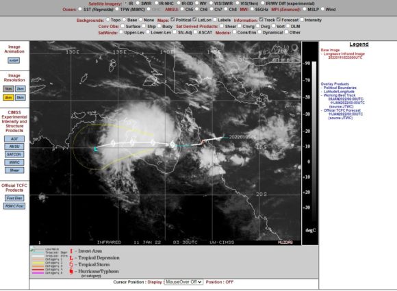
However, the strongest verified winds identified from a weather station were 63 km/h at Cape Flattery. Given that CIMSS modelling have indicated that winds did reach at least 120 km/h however briefly, it does support the view that this storm did reach tropical cyclone status.
This storm brought heavy coastal rainfall but it was limited in extent and not widespread. Up until 9 am 10/1/2022, the heaviest falls were 122 mm at Black Mt and 105 mm at Coen.
After landfall, the storm weakened but sustained moderate to heavy rainfall across small areas including 144 mm at Innisfail Wharf and 129 mm at Tung Oil Alert (For the 24 hours to 9 am 11/1/2022). The storm brought heavier rain inland including 229 mm at Holroyd (Located South east of Weipa) and 212 mm at Cragie TM (Also for the 24 hours to 9 am 11/1/2022).

The storm crossed over into the Gulf of Carpentaria then tracked west and crossed the coast of Northern Territory. The storm did not regain tropical cyclone status but remained a tropical storm.
The same system brought heavy rain to isolated areas of the Top End of Northern Territory such as 155 mm to Maranbey Hill and 138 mm to Beswick Bridge. The storm eventually spread rain right across the Top End of the Northern Territory including the Katherine region.
Generally isolated accumulative falls reached up to 150 mm to 200 mm which would have contributed to typical seasonal flooding of low lying areas.
Heat (NW Western Australia)
While northern Australia was being impacted by a tropical storm and sometimes significant rainfall, on Thursday 13/1/2022, three remote towns across the Pilbara recorded a maximum temperature that exceeded 50C. These were:-
- Onslow - 50.7C at Onslow Airport.
- Mardie and Roebourne 50.5C.
These have been verified as being accurate. The 50.7C recorded at Onslow equals the 50.7C recorded at Oodnadatta in South Australia on January 2 1960 and of course the highest maximum temperature recorded that is accurate for Australia.
A closer look at what happened at Roebourne reveals a remarkable temperature increase for the morning period with the following occurring:-
- 31.9C at 1 am.
- 38.9C at 7 am.
- 40.5C at 7.30 am.
- 49.1C at 12 midday.
At nearby Marble Bar, the minimum overnight temperature for the day was 35C with a maximum of just over 47C.
Flooding (Maryborough Queensland)
The regional city of Maryborough was grappling with major flooding along the Mary River following rainfall totals that reached more than 600 mm within its upper catchment. Rainfall peaked at 674 mm to 9 am 8/1/2022 at a rural locality called Marodian and localized heavy falls of 500 to 600 mm fells in central areas of the catchment. It was this rainfall that contributed to the major flood event along this river and at Maryborough. This will require a major cleanup as the floods subside.
Storms (SE Australia)
Many localities were impacted by storm events some of which were significant in nature. These include:-
Lithgow - A major afternoon thunderstorm on Wednesday afternoon dropped more than 70 mm of rain around Lithgow in a short period of time resulting in significant flooding and flash flooding.
Southern New South Wales - A major thunderstorm overnight has impacted Albury / Wodonga mainly between 11 pm and 12 midnight that dropped a rare downpour exceeding 65 mm in 1 hour (Total - 69.2 mm - To 9 am 15/1/2022). This is the second such storm event in the space of 9 days. When including the storm of Wednesday morning that dropped 20 mm of rain, the airport has recorded an incredible 213 mm of rain this month which is more remarkable given that the average January rainfall here is just 39.3 mm. This is five times the monthly average rainfall.
Damage from this is certain. Rainfall was even heavier at nearby Hume Dam Wall weather station being 73 mm.
Such heavy storms have also impacted the Upper Murray Region including 58 mm at Hunter Hill.
Snowy Mountains - Major storms overnight 15/1/2022 have dropped as much as 89 mm at Tooma Dam and Thredbo and surrounding areas.
SE Canberra - A small region south East of Canberra has also been impacted by significant thunderstorm events with the highest total being 71 mm at Googong Dam (To 9 am 15/1/2022).
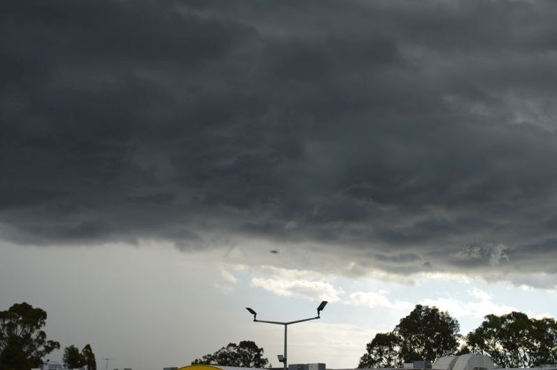
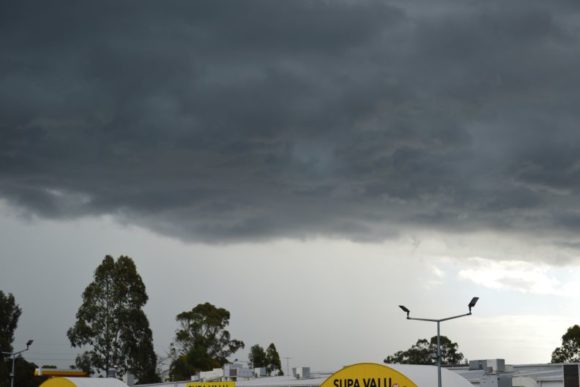
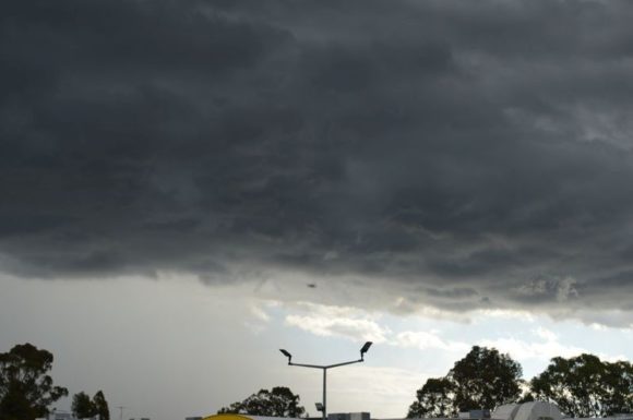
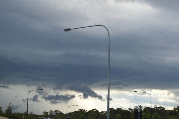
The images seen in the attached photos of recent storms over Sydney have also been repeated at Goulburn, Griffith, Wagga Wagga, Dubbo, Forbes, Parkes and few areas have missed out. (Images taken 8/1/2022).
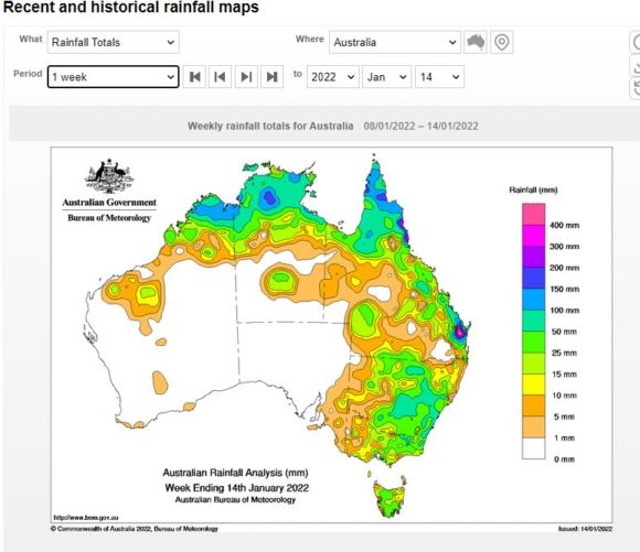
As shown in the weekly rainfall plot for Australia and focusing on New South Wales, the only areas to have missed the most recent storm events is the coastal strip along the New South Wales North Coast and the far west of the state (Plot prepared on the Water and the Land site - BOM 15/1/2022).
Further rain event (New South Wales and Victoria)
Notwithstanding what has occurred across the first 15 days of the month, weather models are indicating another rainfall event across the south east emanating from the tropics and evidence points to further rainfall, further potential flood events and further storm activity in coming days. This event is expected between Tuesday and Friday 18 to 22 January 2022.