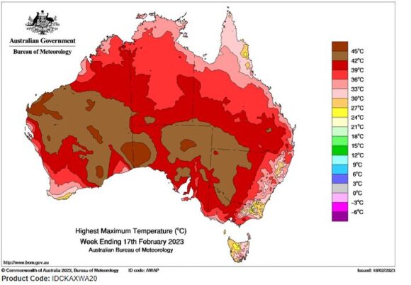
The period between February 11 to February 18 is best described as being another variable period with significant hot weather impacting some regions while strong thunderstorms and heavy rain impacted other regions.
Maximum daytime temperatures have soared to levels not seen in 1 to 2 years for several regions with maximum temperatures reaching 40C in some cases.
In Western Sydney, the hottest day this summer occurred on the Saturday 11 February 2023 where temperatures soared above 37C at the following locations:
- Penrith - 38.6C.
- Richmond - 37.7C
- Horsley Park - 37C.
It is also identified that the number of 30C days that have occurred so this summer where I live in Doonside (Part of Blacktown) between the 1 December 2022 to the 18 February 2023 has exceeded the total number that occurred between the 1 October 2021 and the 31 March 2022 (6 months). During that period, there were barely 25 days where it reached 30C or higher including 20 such days during the summer period.
The total number this summer has so far reached 26 days. This follows a spring where no 30C days were recorded.
Evidence is emerging that the La Nina weather pattern is weakening and conditions are returning more towards normal which includes a greater number of 30C days.
During the week, a strong burst of heat impacted parts of the western inland regions of New South Wales including:
Saturday 11 February 2023
- Gunnedah - 38C.
- Parkes - 38.5C.
- Hay- 39.7C.
- Brewarrina - 41.3C.
- Cobar - 41.2C.
- Tibooburra - 42.4C
- Bourke - 43.6C.
The worst of the heat occurred well inland towards western regions of the state.
This has since been followed up with an even stronger burst of heat on the 16 February as follows:
Thursday 16 February 2023
- Cobar - 38.1C.
- Bourke and Ivanhoe - 39C.
- Hay - 39.6C.
- Menindee - 40C.
- Tibooburra - 40.5C
The interesting part of this is that for the first time in 2 years, this level of heat swept south into western Victoria even reaching Melbourne for 1 day. Thus on Friday 17 February, the following maximum temperatures were recorded across Victoria (Limited more to Western Victoria).
- Melbourne City and Geelong - 39.6C (Prior to the late cool change).
- Shepparton - 40C.
- Yarrawonga - 40.2C.
- Castlemaine - 40.3C.
- Hopetoun Airport - 40.5C.
- Kyabram and Tullamarine Airport (Melbourne) - 41.3C.
- Swan Hill - 41.7C.
- Mildura - 42C.
Maximum temperatures at Mildura and Swan Hill also reached 39.2C on the Wednesday.
Sydney’s Rain event Tuesday 14 February 2023
During the week, a rain event occurred over much of Sydney but the western areas and the south west regions missed out or only received light totals. Heavy rainfalls occurred over parts of Sydney including 45.8 mm for Sydney City Observatory Hill.
This amount is significant for Sydney City (Observatory Hill) as this has continued a run of wet months for Sydney including 78.2 mm for December, 191.4 mm for January and so far for February - 96.8 mm (Total so far for summer 2022/23 - 366.4 mm). Compared to Penrith in Sydney’s west for the same period - 138.2 mm.
It has become drier in Sydney’s far west when compared to the coast al areas.
Saturday 18 February 2023
Maximum temperatures topped 36C and 37C in Sydney’s west again including:
- Badgerys Creek - 37.9C.
- Penrith - 37.5C.
- Richmond - 37.3C.
- Horsley Park - 36.9C.
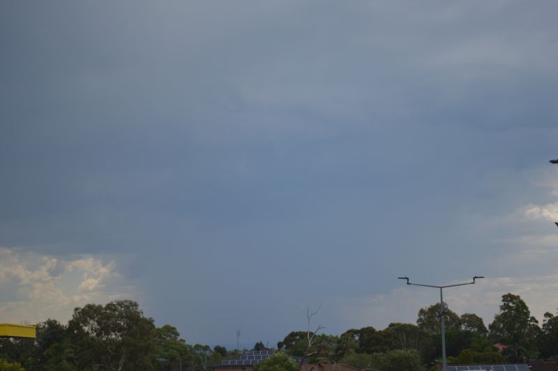
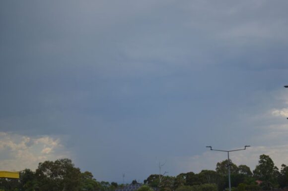
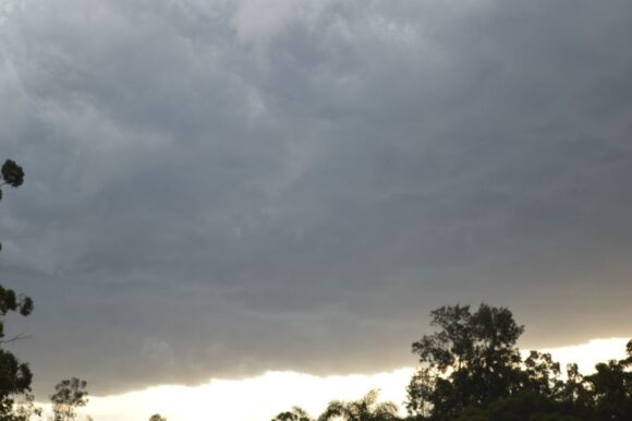
As shown in the attached photos, a small isolated cluster of thunderstorms cells developed mid to late afternoon across outer Western Sydney. As far as I could ascertain, these were high based cells. Other than the anvil clouds passing overhead and mid distant rumbles of thunder being heard, this brought nothing to Blacktown / Doonside / Mt Druitt regions.
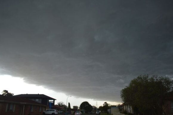
However, towards evening as shown in the photos, a much stronger system passed over producing the best shelf cloud I have seen in years. This system produced gales to 106 km/h at Moss Vale (Southern Highlands) between 5.23 pm and 5.30 pm. The same system brought wind gusts to 69 km/h at Camden Airport and 83 km/h at Holsworthy.
I was contemplating a storm chase on this after dinner but this system moved so fast that by the time I had finished, the storm system was pushing well into and through Western Sydney. I finished up taking photos at local locations due to the speed of the system.
Major thunderstorm event - SE Queensland
A major thunderstorm event impacted parts of south east Queensland on Western 15 February that brought significant but localized events to the following localities:
- Kingsthorpe - Hail to 4 to 5 cm with larger hail near Stanthorpe.
- Tangool - A peak wind gust to 90 km/h at 5.04 pm.
- Tuckombil - 173 mm of rain.
- Rosalie - 73 mm of rain in 60 minutes.
- Brisbane City - 63 mm of rain in 60 minutes.
The photos attached to the post show the late afternoon storm cell to the west and Western Sydney, Late Saturday.
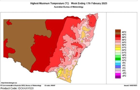
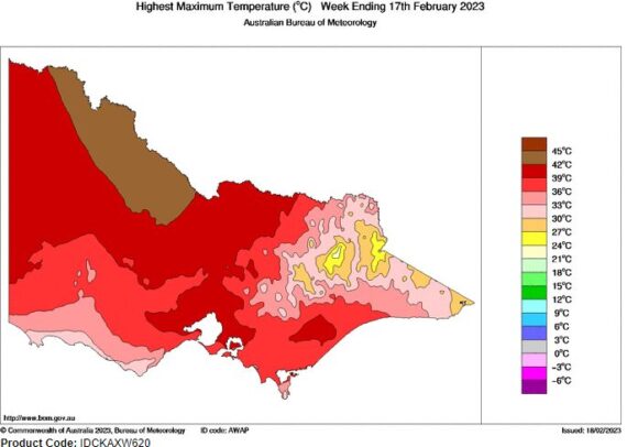
The maximum temperature plots for the week ending Saturday 18 February 2023 shows the areas where the strongest heat has occurred across Australia including a plot for New South Wales and Victoria.
