The past week has been truly remarkable across regions of Earths three major ocean basins being the:
- Atlantic Ocean - 1 significant storm event (Ongoing at the time of writing).
- Indian Ocean - 2 significant storm events.
- Pacific Ocean - 3 significant storm events.
It is rare to see so many named storms almost at the same time occurring but during the past week, this has occurred with all the named storms shown in the table below.
| Name of Ocean | Name of storm | Location and strength
Saffir Simpson Scale |
| Atlantic Ocean | Hurricane Tammy | Atlantic Ocean
Peak wind gusts - 165 km/h at core. (Category 1 and 2) |
| Pacific Ocean | Hurricane Otis | Mexico - Direct hit on Acapulco
Peak winds topped 270 km/h. (Briefly Category 5) |
| Hurricane Norma | Baja California (Mexico)
Peak winds to 215 km/h at sea but weakened to a Category 2 system at landfall. (Category 4) |
|
| Tropical Cyclone Lola | Vanuatu
Peak winds 220 - 230 km/h. (Category 4) |
|
| Indian Ocean | Tropical Cyclone Tej | Yemen
Peak winds 195 km/h to 200 km/h off Socotra Island (Category 2 / 3) |
| Tropical Cyclone Hamoon | Bangladesh / Myanmar border
Peak winds at sea 150 km/h (Category 1) |
As shown in the table:
- Two storms reached Category 4 and one reached Category 5 on the Saffir Simpson Scale with the strongest storm making landfall over a major city.
- One is ongoing at the time of writing and will decay as it encounters unsuitable oceans temperatures below 27C.
Favourable environments coupled with warm ocean temperatures exceeding 27C have allowed a high number of such storms to develop almost at the same time. Each storm is briefly discussed below.
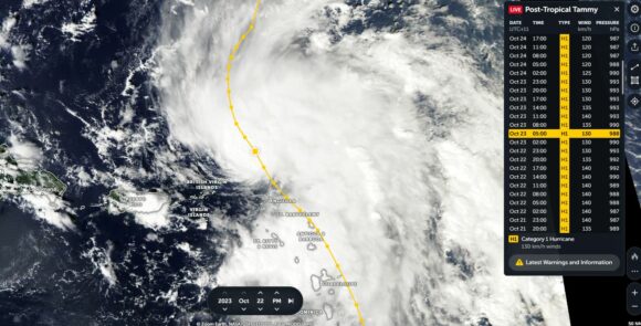
Atlantic Ocean - Hurricane Tammy - To remain over open ocean
Category 1 and 2
The storm has passed over the West Indies including close to Guadelope, Antigua and Barbuda and Anguilla. With the storm system traveling north, it is not expected to impact any further land mass. The storm will decay over the North Atlantic once it encounters colder waters further north.
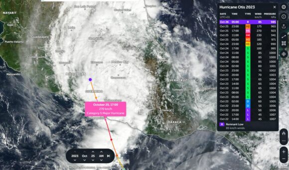
Pacific Ocean - Hurricane Otis Impacted the city of Acapulco Mexico
Briefly Category 5
This is one of two storms that has impacted Mexico over recent days. The storm has taken weather forecasters by surprise as the storm intensified rapidly to a Category 5 system just before landfall. The storm has passed directly over Acapulco which is a city of around 780,000 residents. Significant damage has occurred and at the time of writing, there are at least 27 fatalities. The storm went from a Category 3 storm to a Category 5 storm in the space of 12 hours which stunned forecasters due to speed at which it intensified. It is suggested that the intensification is amongst the fastest that forecasters have ever seen.
The peak intensity was brief because 6 hours later, its strength had fallen below Category 3 as landfall had occurred.
The cleanup from the event will take time.
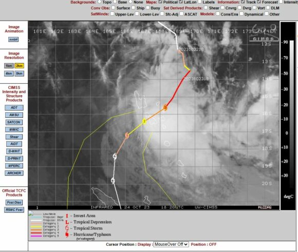
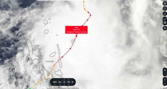
Pacific Ocean - Tropical Cyclone Lola - Vanuatu
Category 4
Category 5 under the Australian Tropical Cyclone Intensity Scale 1989 which has lower thresholds for such storms.
The storm reached peak intensity over the northern islands of Vanuatu but as it traveled southwest, its strength did weaken. The storm lost its intensity as it approached New Caledonia.
There has been significant damage and destruction to communities living on outlying islands.
Unusual but not unheard of, the storm formed early in the season and the storm could be the strongest storm this early in the season across the region.
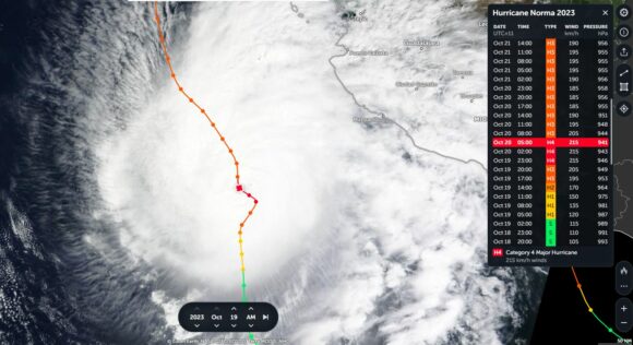
Pacific Ocean - Hurricane Norma - Baja California (Mexico)
Category 4
This was the first of two hurricanes to impact Mexico. The storm made landfall over southern Baja California and weakened rapidly.
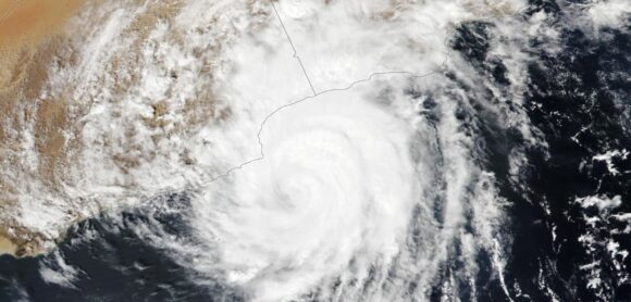
Indian Ocean - Tropical Cyclone Tej - Yemen
Category 2 or 3 (High end Category 2 / Low end Category 3)
The storm is remarkable as it made landfall across a desert region of north east Yemen and dropped around 406 mm of rain at Al Ghaydah Airport. This is roughly 8 years worth of rain within a region that receives no more than 50 mm per year.
Indian Ocean - Tropical Cyclone Hamoon -Bangladesh / Myamar border regions
This was the weakest of all the storms as it made landfall near Chattogram (Bangladesh).
All six storm events have brought their own local weather disasters, usually, wind damage, flooding and surges across low lying areas. Having six storms all at once is a rarity to see.
Images attached to the post are derived from satellites including those used for Zoom Earth / EOSDIS (NASA) with one downloaded direct from NASA (Tropical Cyclone Tej) photographed from the International Space Station (Image Expedition 70 Crew October 2023). This image is used for the top featured image.
