The north west region of the Pacific Ocean is a region where typhoons form on a regular basis each year. This region has an unimpeded and an abundant expanse of ocean and waters are often heated to greater than 30C.
Often, some of the strongest oceanic storms that form are recorded within this region.
Such storms can approach the Philippines or Taiwan as Category 4 or 5 systems and should landfall occur, the level of destruction can be significant.


Over the past week, Typhoon Mawar has shown how strong these storms can become. Typhoon Mawar, the first major storm of the season has reached “Super typhoon" strength with peak wind gusts at the core to 295 km/h or even 300 km/h as a Category 5 system.
The storm formed south east of Guam with the island taking a significant hit as the eye passed just to the north east and north of the island. In effect, the southern eye wall passed over much of Guam with the northern third of the island taking a significant hit.
Unfortunately, the weather station appears to be damaged and thus direct data from the airport weather station cannot be extracted. It is known the storm was a Category 4 system on the Saffir Simpson Scale as it made its passage through the region. It is clear there is significant damage to the island with downed trees and damaged buildings. Damage assessment is currently underway to understand what occurred.
The storm intensified to a super typhoon north west of Guam reaching peak intensity during the period May 25 to May 27 with winds close to 300 km/h at the core.
Fortunately, the storm is now encountering cooler waters which is contributing to its decline. It is fortunate that the storm is taking a more northerly path and is now expected to decay east of Taiwan across colder oceanic waters.

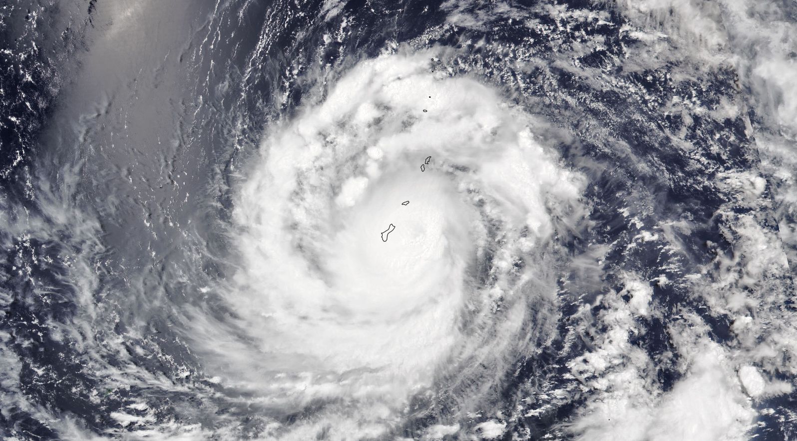
The incredible image of this storm as shown on NASAs VIIRS NOAA 20 satellite taken at 1.50 pm local time (Feature Image) on May 24 shows a storm with a visible eye. The storm is dominated by strong convection (Cumulonimbus clouds) at the core plus a region across its north west quadrant.
This storm demonstrates how strong typhoons can become across this part of the Pacific Ocean.