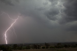
 Storms were anticipated on the 9th across most areas of the central and northern ranges. The trajectory of these storms on close analysis though but storm motions north at least for the Northern Tablelands and the eastern Hunter regions with NE tracks in the western Hunter and Central Tablelands. Storms did fire in the Wollemi and then Central Tablelands relatively early with an unstable air mass already present during the morning. Despite the strong cap, the southerly change enhanced convergence and soon, storms became widespread in the region although higher based. Steep lapse rates allowed for rapid development of cells.
 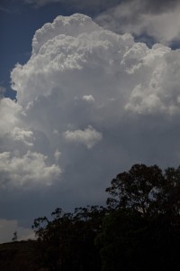 A complex of severe storm cells developed in the northern Putty Road region and this was region I intercepted hailstones to 1cm in 4 separate bursts as I zig zagged in and out of the storm complex and various cells. Both and I and Jeff Brislane noted leaf litter on the road indicative of at least 2cm hailstones. The cars parked on the side of the roads backed up these concerns.
Cell development gradually spread north and cells developed in the eastern Hunter Valley and Northern Tablelands. Some more rather explosive development occurred in the Scone and Murrurundi region but being rather high based, the storms became outflow dominant quickly.
Jeff Brislane and I met up in Jerry's Plains and chased via Muswellbrook and Scone. A nice cell rapidly developed in this region and we passed just ahead of it before it hit Murrurundi with a green tinge evident. We did not sample the core in this case trying to remain ahead of it. the outflow was rather strong and keeping ahead of it proved difficult. This storm complex then exploded to the east of the New England highway and we photographed and filmed sporadic lightning.
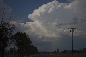
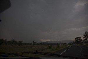
Jeff and I decided to sample this core but became entangled in the maze of roads to Nundle. Time to head out back into Tamworth in time for the storm complex moving in from the south. We did not dare to stop at the enticing big M despite our desperation for food.
The storms gradually weakened though the storms still produced a few lightning bolts. Whilst looking for a specific location for lightning shots, we decided to move out. Suddenly, we became startled by a massive bolt and instantaneous gunshot thunder that almost sent us to get toilet paper!
Jeff may wish to describe the tree he observed before we called it quits for the night. I could tell where Jeff's internal GPS was headed in Tamworth! Macdonalds went down well with two particularly starved chasers.
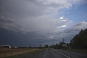
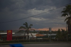

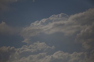
Just posted a few pictures of the storm events. Not that spectacular but a couple bolts of lightning and I guess impressive updrafts.
Took some shots in Coffs this night as well..
Another..
I don’t have much to add to Jimmy’s reports except as few photos from my perspective. The first is the storm system looking north from just after Scone.
A new base on the Murrundi cell from the other side of the pass.
The new developing storms from Garoo Rd, 40kms out from Tamworth.
Another with a daytime lightning bolt captured
Lightning from a hill overlook north Tamworth and Gunnedah.
Another lightning shot. It was a great chase, very long and a long drive home but worth it to see some really nice contrast storms along the plains. Along putty road between 11pm and 1230am I saw 1 marsupial rodent, 2 rabbits, 1 wild dog, a mob of roos, 2 wombats and 1 deer next to the road, it was like a petting zoo! ;-)
Thanks for posting those images Kane and Jeff Brislane. Jeff, you may wish to describe what you saw in terms of that tree hit by lightning! In terms of the deers, yes definitely be careful along the Putty Road at night as deers do roam that region. We once saw a bull (male deer) on the side of the road that would have easily totalled our vehicle and probably us!
I chased the area Blue Mountains to Lithgow then north to Capertee for the day. I decided to chase the western side of the Blue Mountains to see how the leading edge of the southerly change would behave.
I discovered few if any storm cells developing west of Mt Lambie with the activity being concentrated in a narrow north to south corridor close to the Blue Mountains and the effect of the advancing southerly change. Hence if I went further west than Mt Lambie say Bathurst, I would have had little thunderstorm activity.
I photographed solid updraft towers near Bilpin which built into a thunderstorm cell that moved north east away from me towards the Putty Road.
As it was, my first storm occurred just west of Mt Tomah on the Bells Line of Road. This cell while relatively small passed over me and produced a significant rain shower with small hail, no larger than pea size for several minutes. Following that, I drove to a lookout near Lithgow and watched a larger storm approach me from the south west. I photographed new storm cells and cloud towers building on the southerly change to the east and north east.
For me, it was a case of keeping abreast of the southerly change and I found myself crossing over it several times during my chase and experiencing different temperature gradients and wind changes from northerly to southerly, then back to northerly.
I then went down into Lithgow, then south towards Hartley and watched a substantial storm approach along the crest of the Blue Mountains (Blackheath). That eventually went into decline but a new storm cell began building over the top of me and consolidated rapidly. I followed that back into Lithgow but that too traversed north east. That developed into a new thunderstorm cell but I could only photograph it as it moved away.
I alerted Jimmy to this cell as he would have been in better position than me to intercept this storm.
I drove towards Portland where I intercepted another storm which was high based but it did produce a few cloud to ground lightning strikes and short but heavy bursts of rain.
I drove north towards Capertee just ahead of the southerly change. By the time I reached Capertee Canyon overlook, I was amazed to see the storm that I alerted Jimmy to 50 minutes previously appeared to have gone into decline. I am no sure what happened but all I saw was a large rain shower with low cloud below it.
Despite the high cloud and weak shower cells, a small storm to my west started to consolidate slowly and close in on me. I drove to Capertee Village and let it pass over. That was high based but I never expected a 20 minute deluge from it. I was stunned to see so much rain fall with very large raindrops. While no hail fell, there was enough rain to cause water to temporarily flow over the road surfaces and to cause road edges and verges to overfill with water. This was a significant downpour. I tried to film lightning but the strikes occurred in the wrong direction to where I was pointing my camera.
Following that, two more weaker storms formed then decayed around Capertee. At 4.30 pm, the impact of the southerly change was beginning to be felt and with all remaining storm activity in the area waning, I made my way home.
I saw new thunderstorm towers build well to the north east of me. I took a handful of photos of these but as I had to work Monday, the new cells were well beyond my driving range for the day.
I need to work on my photos and will post a selection once I prepare them. Despite my limitations for the day, I still managed a number of storm cells along the leading edge of that southerly change.
Please note:- If anyone is storm chasing along the Castlereagh Highway near Cullen Bullen (Just south of the township), there are some road works to cross and possible lane closures as new road surfaces are built. If chasing on a weekday, these may cause short delays. Please be aware of these in the short term. Thank you.
Today me and Steve from Canberra targeted Singleton. The early morning models indicated a good cap, however the southerly forced this,and we were left with early storms, which seemed to clutter our chase area. Of course our plan to avoid this was to work our way NW of the first storms, however our limit for the day was Scone as I had to work the next day. The first convection was crisp and vigourous, with some very impressive towers, however it was all very high based.
Our first and only decent storm developed southwest of us. We drove closer but were unable to find a view. 15kms south of Singlton,we found oursleves under a dark and rippled RFB, high based of course, but it looked to have the potential to wack down a nasty microburst… With anvil rain spreading past us, and no views, we quickly legged it towards Singlton again. By now, the base had really lowered and even had a slight circular appearance to it… The storm was looking good, but had become outflow dominant really quickly.. We enjoyed some nice consolidated shelf structure before the storm collaped into a structurelss heavy rain curtain.Just east of Town we enjoyed a ferocious spelll of intense lightning from the back end of the rain curtain ,it was very lightning active for a short time there! with dozens of cgs, though alot eluded the video camera…
Unfortunately we didn’t get too much from here, enjoying a few more cgs from the Muswellbrook stuff, and some back end strucure as well from the no mans cells NE of Muswellbrook.
Below is a 40second video from the Singleton storm. Hopefully it works,,,,
Heres a link in case the video doesen’t work
I also forgot 1 fox gnawing on roadkill in the middle of the road
What time did you guys get to the target area? You would have had to beat the Sydney traffic!
Very detailed report Harley. I can only learn from your thorough coverages of your storm perspective! That heavy deluge sounds like a significant event – would someone like to post the radar imagery for the day as Harley did ask for it on the chase day but I was chasing at the time.
Michael, it looks as though you guys also got the severe complex of cells from the front that I went through from the other side.
Fantastic reports guys! Although these were generally high based events, the updrafts were rather impressive which reflected the steep lapsd rates aloft.
Michael Bath, you got some nice lower base features feel free to post them on here when you get a chance.
Following a great ASWA BBQ lunch at Beaudesert (9th Dec), most of the attendees headed up to the eastern Darling Downs or Northern Tablelands for some storms. Jason Paterson and I watched a few cells spread up from NSW into the evening. It was a LONG drive home (arrival 1.50am for me) but the storms were enjoyable with some decent lightning. The best of it occurred after the rain hit of course. These photos taken at Wheatvale and Ellangowan, QLD Darling Downs.
Hi Michael, great that you guys got onto the storms. great lightning and seems to be nice structure.
However, I must say I am not much of a fan for use of fish eye lens but that’s just me. I wished you had a separate video without it and show that.
My first photo shows a developing storm cell from of Billpin. This was moving north east away from me as it built into a storm cell.
My second photo shows a small storm cell and base. This passed over me which brought small pea size hail. I am west of Mt Tomah and Mt Bell and I am looking west or south west.
My third photo is taken near Lithgow showing storm cells building on the southerly change. I am looking east and north east.
The next photo shows a small interesting storm cell (with little rain) south of Lithgow. This did not last long and I left the area shortly after. I am near Hartley looking south / south west.
I intercepted a high base storm near Portland. This produced a few cloud to ground lightning strikes and short bursts of heavy rainfall as I drove under it. I am looking west or south west for this photo.
The last photo shows the Capertee storm building. At first it did not look significant but as it consolidated, it produced a much heavier localised rain event than I had initially expected. I am looking west. I drove into Capertee township shortly after to view the storm and to enjoy an unexpected downpour.
Hey Jimmy. Thats fair enough,I agree with you. The fish eye is only a temporary. Last month my 5d mk 2 stopped working (salt water penetration) ,and i’m saving hard for a new one. In recent seasons I have used the MK11 for the majority of my videos, and I plan to do so again as soon as possible… It would’ve worked a treat last Sunday…
I think we got to Cessnock at Midday.. The traffic was quite heavy,and alot of drivers were doing stupid things… Might leave earlier next time, however it was an unusual situation as I was at my brothers in Canberra for the weekend and couldn’t get away that early….
Sorry not having a dig at you – just reflecting my point on view on fish eye lens. I used to have one and I guess it also stuffed up my only brief tornado in 2003! So there is another reason why – it not only distorted the image but also made the brief narrow tornado difficult to see! And out of focus when I tried to zoom in haha!