Thunderstorms occurring during August are rare events. The month of August 2023 is unique because there have been three days during the past ten days of the month where a thunderstorm has occurred somewhere within the Sydney basin. In particular:

  • The evening of August 22.
  • The evening of August 28 which mainly affected the far western areas around Penrith to just west of Mt Druitt (Western Sydney).
  • The late afternoon of Wednesday August 30 which was widespread across the city.

The storms that occurred during the afternoon of August 30 have occurred towards the end of a warm day where maximum daytime temperatures topped 25C to 27C across much of Sydney with a maximum of 27.8C occurring at Penrith at 1.15 pm.
Thunderstorms occurring during August are rare events. The month of August 2023 is unique because there have been three days during the past ten days of the month where a thunderstorm has occurred somewhere within the Sydney basin. In particular:•	The evening of August 22.
•	The evening of August 28 which mainly affected the far western areas around Penrith to just west of Mt Druitt (Western Sydney).
•	The late afternoon of August 30 which was widespread.

The storms that occurred during the afternoon of August 30 have occurred towards the end of a warm day where maximum daytime temperatures topped 25C to 27C across much of Sydney with a maximum of 27.8C occurring at Penrith at 1.15 pm.

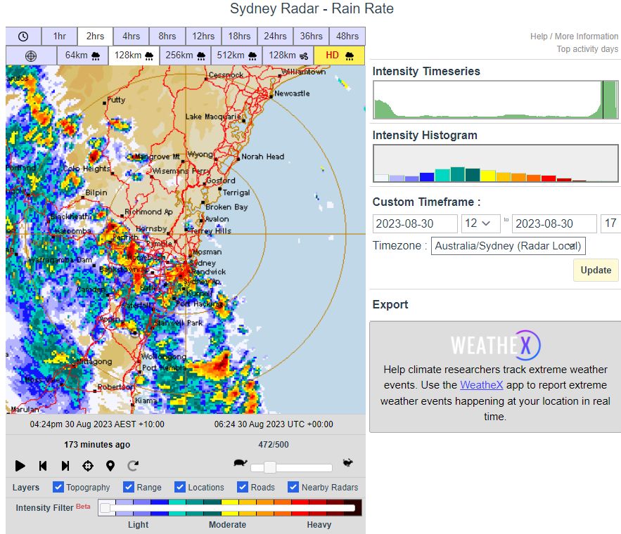
The storm system was widespread across the city especially after 3 pm with the Sydney radar at 4.24 pm showing various cells passing across the city.

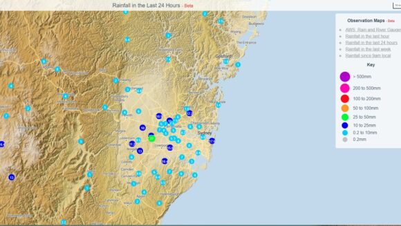
Rainfall across Sydney from the event up until approximately 7.20 pm is described as mixed ranging from as low as 3 mm around Botany Bay (SE Sydney) and Richmond (Outer North West Sydney) to 23 and 27 mm around Horsley Park in Western Sydney.
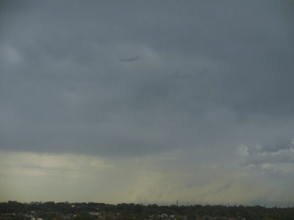
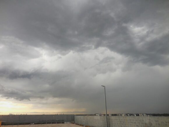
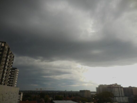
I took a number of photos after 4 pm at Auburn showing cloud structure as the system was passing over. I observed at least 2 strong cloud to ground lightning flashes plus various sheet lightning flashes but unable to catch any as the battery on the camera that I was using was fast exhausted.

The latest storm event is unique but shows that the transition from winter to spring across Eastern Australia is certainly underway.

Thunderstorms occurring during August are rare events. The month of August 2023 is unique because there have been three days during the past ten days of the month where a thunderstorm has occurred somewhere within the Sydney basin. In particular:

•	The evening of August 22.
•	The evening of August 28 which mainly affected the far western areas around Penrith to just west of Mt Druitt (Western Sydney).
•	The late afternoon of August 30 which was widespread.

The storms that occurred during the afternoon of August 30 have occurred towards the end of a warm day where maximum daytime temperatures topped 25C to 27C across much of Sydney with a maximum of 27.8C occurring at Penrith at 1.15 pm.

The storm system was widespread across the city especially after 3 pm with the Sydney radar at 4.24 pm showing various cells passing across the city.

Rainfall across Sydney from the event up until approximately 7.20 pm is described as mixed ranging from as low as 3 mm around Botany Bay (SE Sydney) and Richmond (Outer North West Sydney) to 23 and 27 mm around Horsley Park in Western Sydney.

I took a number of photos after 4 pm at Auburn showing cloud structure as the system was passing over. I observed at least 2 strong cloud to ground lightning flashes plus various sheet lightning flashes but unable to catch any as the battery on the camera that I was using was fast exhausted.

The latest storm event is unique but shows that the transition from winter to spring across Eastern Australia is certainly underway.
Sydney thunderstorms Wednesday 30 August 2023
Storm cell to the south east of Auburn moving off the coast after 4 pm.
Sydney thunderstorms Wednesday 30 August 2023
Developing storm cell and base to the north west of Auburn at approximately 4.10 pm.


The storm system was widespread across the city especially after 3 pm with the Sydney radar at 4.24 pm showing various cells passing across the city.

Rainfall across Sydney from the event up until approximately 7.20 pm is described as mixed ranging from as low as 3 mm around Botany Bay (South east Sydney) and Richmond (Outer North West Sydney) to 23 and 27 mm around Horsley Park in Western Sydney.

Sydney thunderstorms Wednesday 30 August 2023
A distant storm off the coast of Sydney with lowering looking south west from Auburn. This cell appears to be intense.


I took a number of photos after 4 pm at Auburn showing cloud structure as the system was passing over. I observed at least 2 strong cloud to ground lightning flashes plus various sheet lightning flashes within cloud but unable to catch any as the battery on the camera that I was using was fast exhausted.
Sydney thunderstorms Wednesday 30 August 2023
Sydney radar at 4.24 pm showing various storm cells passing across Sydney.
Sydney thunderstorms Wednesday 30 August 2023
Rainfall from the event to 7.20 pm across Sydney.


The latest storm event is unique but shows that the transition from winter to spring across Eastern Australia is certainly underway.

s2Member®