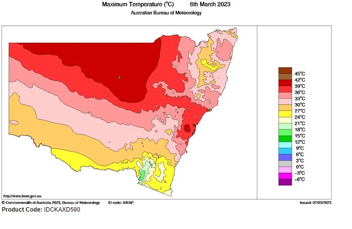
For the first time in at least 2 years, much of Sydney during Monday endured a 38C day. When compared to the rainfall that was occurring exactly months ago, this was a significant event as:
- North west winds prevailed across much of the city which prevented the coastal sea breeze taking hold across the coastal suburbs.
- The heat came ahead of a dry westerly change but that change had little impact across Sydney as Tuesday was also quite warm with 34 to 36C maximum temperatures being common across the city.
While not a heatwave, this was certainly a significant event as this occurred in early March and thus is likely to be the hottest day this spring / summer / early autumn period for 2022/23.
The maximum temperatures across Sydney were:
- Sydney Airport - 40.6C (The highest maximum temperature).
- Penrith - 40.1C.
- Holsworthy - 39.4C.
- Camden - 39C.
- Parramatta - 38.8C.
- Horsley Park - 38.6C.
- Sydney Olympic Park - 38.5C.
- Sydney Observatory Hill - 37.9C.
While there have been media reports suggesting some significant records being broken, a quick review of past weather and maximum temperature records across Western Sydney does suggest that 38C and 39C days are more common during March than many would realize.
Some samples of this in recent years include:
Western Sydney
- March 9 1983 - Prospect 38.8C (Similar temperatures would have also occurred at other locations across Western Sydney on this day).
- March 13 1998 - Penrith 40.6C, Horsley Park 40.5C and Prospect 39.5C.
- March 23 1998 - Penrith 40C and Prospect 39.4C.
- March 18 2018 - Horsley Park 39.4C and Prospect 39.1C.
- March 6 2019 - Penrith 38.4C.
- March 2 2020 - Penrith 39.5C.
It appears that at least for Penrith this was the hottest March day in at least 25 years but no record has been broken.
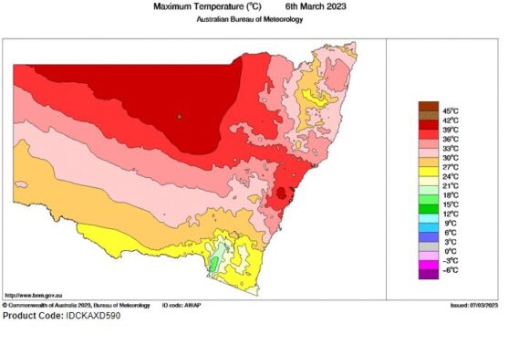
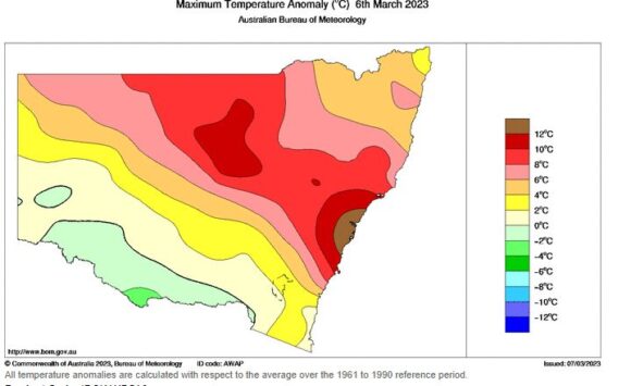
As shown in the attached plots for maximum temperatures, the heat only affected parts of the eastern coastal area of New South Wales and the northern inland of the state. Further within the area surrounding Sydney, the maximum temperature spiked at 12C above the normal averages for the city.
As seen on the satellite photo of New South Wales from NASA Worldview Images, much of New South Wales was under clear skies for the day. However, a closer look shows the beginning of a bush / grass fire and a smoke plume (Located 50 km north of Bathurst) near Hill End. That smoke plume has since enlarged with a major fire emergency occurring. The smoke plume was visible to the north of Sydney during Monday to Wednesday.
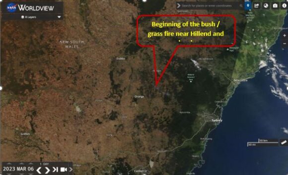
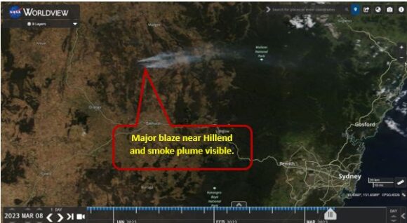
The plume and the impact of the large fire is more readily visible on the image of Wednesday 8 March 2023 with the plume traversing east south east towards the Central Coast and Newcastle of New South Wales.
This shows the continued weakening effects of La Nina and a beginning of a new phase dominated by longer periods of dry and warmer weather for the state.
