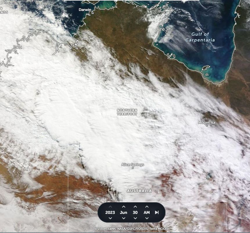
The period May to October is generally known as the dry season for much of Northern Australia encompassing much of Queensland, Northern Territory and much of Western Australia.
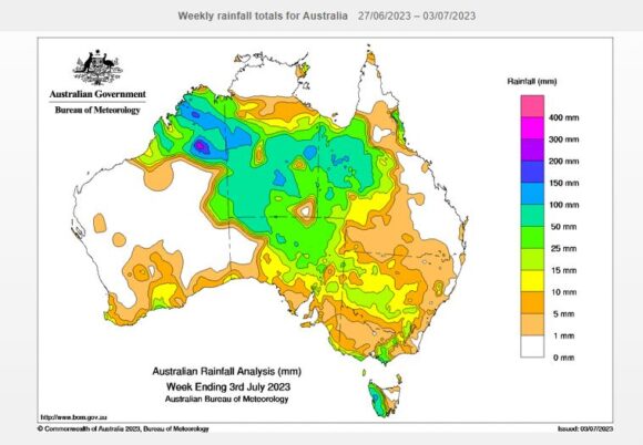
Over the past 7 days there has been some exceptional rainfall resulting from two weather systems and daily rainfall totals have topped 100 mm at isolated locations.
This event has been remarkable for its duration and scale and many arid and semi arid regions of Australia have experienced substantial rainfall.
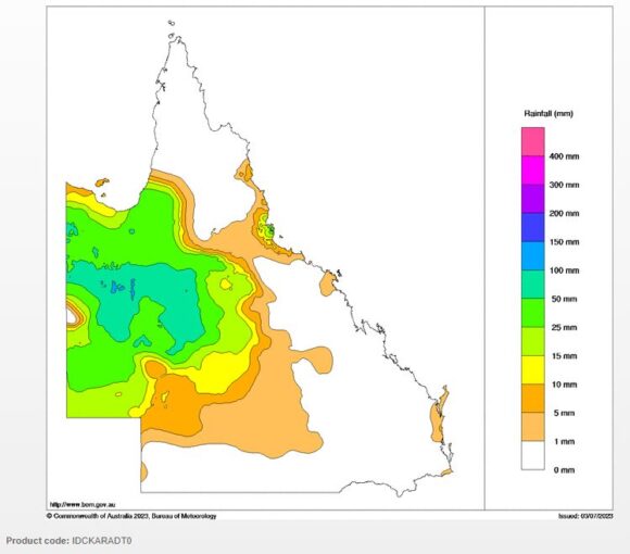
A closer review of this shows that over the past week, isolated regions of the Kimberly (Northern Western Australia) have received upwards of 150 to 200 mm and large areas of the Northern Territory south from Katherine have received between 50 and 100 mm (cumulative totals). Such rainfall have extended into north west Queensland where isolated totals have topped 100 mm.
There are instances of local flooding as a result.
While it is hard to verify many totals due to the lack of ground based weather stations and towns within affected regions, there are weather stations in affected regions that have recorded substantial falls that supports the rainfall plots as shown.
1 - Curtis Springs (Northern Territory) 19 mm on the 26 June, 35.6 mm on the 27 June and 15.2 mm on the 28 June for a cumulative total of 69.8 mm.
2 - Uluru (Northern Territory) 15 mm on the 26 June, 49.4 mm on the 27 June and 15.2 mm on the 28 June for a cumulative total of 79.6 mm.
3 - Alice Springs - Totals have been lighter with at least 30.6 mm during the whole event (Cumulative).
The event has spilled over into north west Queensland with some substantial totals occurring especially on the 2 and 3 June. For the 24 hours to 9 am Monday morning, the following totals are observed:
- May Downs - 101 mm.
- The Monument - 81.6 mm.
- Julia Creek - 79 mm.
- Mt Isa - 78.4 mm.
- Winton - 66 mm.
- Cloncurry - 64.4 mm.
- Camooweal - 38.2 mm plus 25.4 mm to 9 am 2 July 2023 (63.6 mm cumulative).
Such high totals are limited to north west outback Queensland. The cloud mass has now tracked south and east spreading light rain into New South West South and the south east. The rainfall totals that have fallen are not significant across the southeast when compared to the events of Northern Australia over recent days.
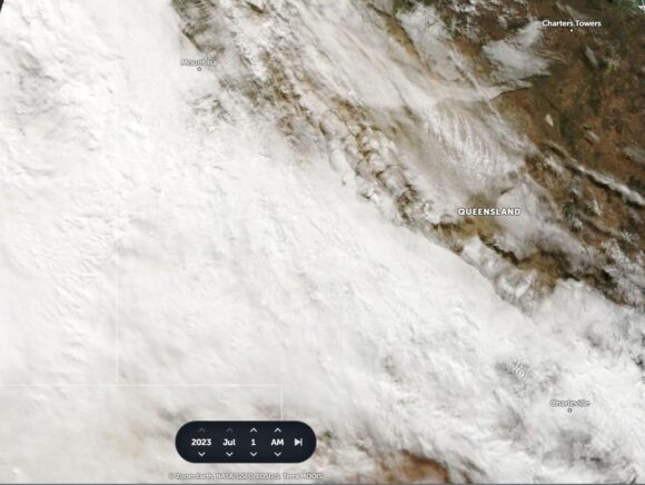
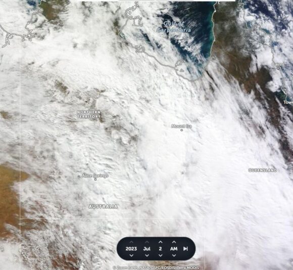
The NASA Zoom Earth Terra Modis June 30, July 1 and 2 2023 images show the cloud mass in detail. It is clear that thick nimbostratus cloud features but embedded thunderstorms can also be identified which would have increased rainfall totals in affected regions.
