While the Queensland and New South Wales rain and flood event event is still ongoing, a tropical storm / tropical cyclone made landfall near Derby during the early hours of Saturday morning.
The storm had a very short life span of 1 day following its development on Friday 28 March 2025. The storm intensified to:
- An intense tropical storm under the Saffir Simpson Scale.
- A Category 1 tropical cyclone under the Australian Tropical Cyclone Intensity Scale 1989.
The storm made landfall over a remote region of northwest Western Australia being the Buccaneer Archipelago (Koolan Island) early Saturday morning.
There is limited data available given where the landfall occurred. A single isolated weather station at Koolan Island experienced two peak wind gusts to 115 km/h at 2.23 am and 2.30 am plus 12 other peak wind gusts of between 100 and 113 km/h between 2.03 am and 4.30 am from the storm.
There are only two locations that recorded 100 mm rainfall totals to 9 am Saturday being
- Derby Airport - 153 mm.
- Meda - 102 mm.
A third location called Curtain RAFF recorded 88 mm to 9 am Saturday morning.
Other than this, there are no other known impacts from the storm at the time of writing. Given that landfall occurred over a remote region of Western Australia, the impact of the storm would be limited.
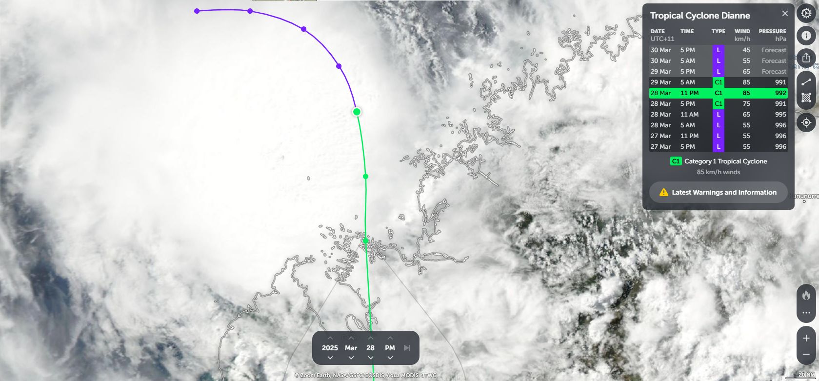
The attached feature image from Zoom Earth (NASA) shows the storm at peak intensity prior to landfall. While convection is occurring, the storm had limited time to develop. It would appear that the storm developed too close to the Western Australia coastline and did not have enough time to intensify properly despite forming over waters heated to 30C and 31C.