
A significant heatwave is unfolding across much of Western Australia that has authorities alarmed. Heat waves are common across Western Australia during the summer months and indeed there are areas of the state especially the Pilbara that are among the hottest locations on Earth during the summer months of December to February.
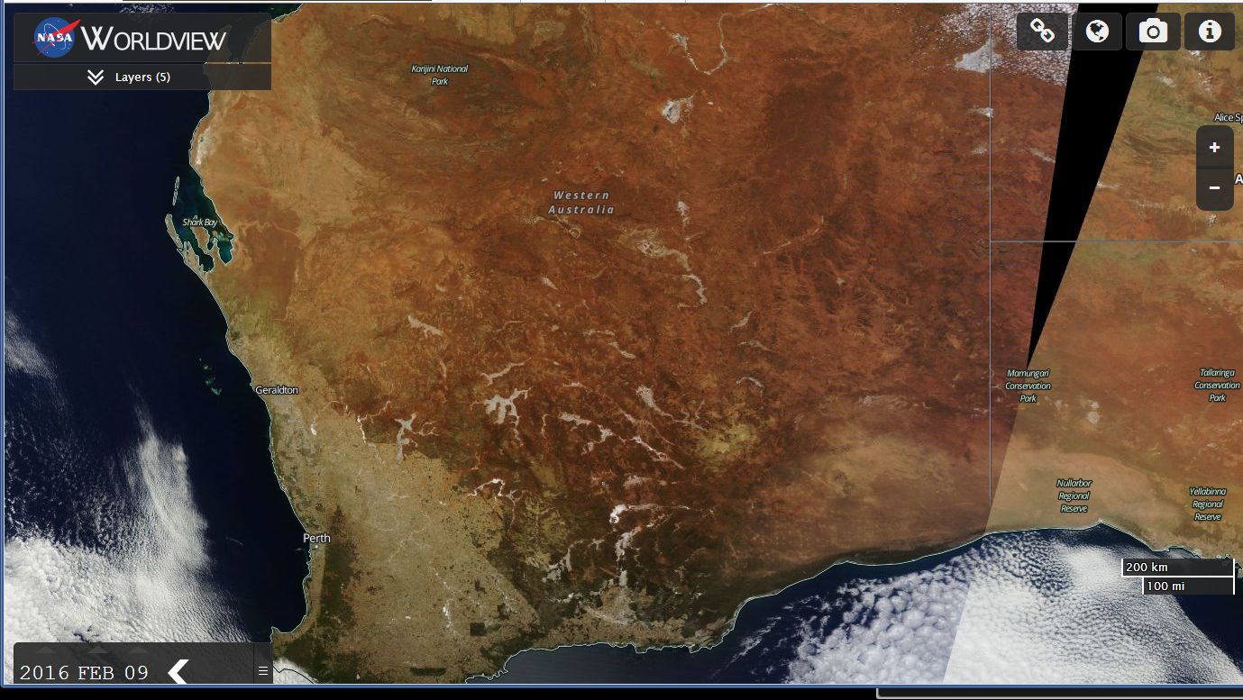
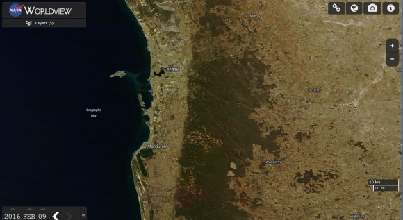
This heatwave is significant and as seen in the satellite photo of Western Australia and a close up view of Perth taken 9/2/2016, there is a lack of cloud cover across the state to provide relief. A close up view of the Perth region shows how dry it is in that area and a sizeable burn scar from a recent bush fire is visible south east of Mandurah.
Authorities are on alert for heat related illness and bush fires given how dry it is.
The high pressure cell is at a location where hot dry easterly winds are blowing towards the west sending heat towards the west coast.
While Perth is affected by the heat, the Freemantle Doctor (The known sea breeze along the coast of Perth) does provide relief for coastal suburbs during the afternoons. That sea breeze has provided relief for the coastal suburbs but its impact weakens further inland.
Some very high maximum temperatures reached during the period 7 to 9 February 2016 include:-
Shark Bay reached 45.5C at 1 pm on the 8/2/2016.
Shark Bay has reached 45.5C at 11.45 am 9/2/2016.
Learmonth on the north west coast of the Pilbara reached 44.7C at 3.23 pm 9/2/2016.
Mardie has reached 45.6C at 12.13 pm 9/2/2016.
Northam has reached 44C at 3.30 pm 9/2/2016.
In Perth City, it has reached 40C on three consecutive days of Sunday, Monday and Tuesday with 40.4C, 42.5C and 41.2C being recorded respectively across the period.
Western Australia is a large state and this heatwave is sizeable in area. Hence the 40C maximum temperatures are covering large areas of the state.
Forecast maximum temperatures for the period Wednesday to Saturday at selected locations include:-
Kalgoorlie - (Wed 40C), (Thu 42C), (Fri 42C), (Sat 33C).
Marble Bar - (Wed 47C), (Thu 48C), (Fri 48C), (Sat 47C).
Murchison - (Wed 45C), (Thu 46C), (Fri 46C), (Sat 44C).
Paraburdoo - (Wed 46C), (Thu 46C), (Fri 47C), (Sat 45C).
Paynes Find - (Wed 44C), (Thu 45C), (Fri 44C), (Sat 39C).
Perth City - (Wed 40C), (Thu 38C), (Fri 35C), (Sat 33C).
Telfer - (Wed 45C), (Thu 47C), (Fri 47C), (Sat 47C).
This provides an idea what is occurring. Some relief is expected in Perth but there are regions where the heat will continue for many days.
One interesting feature of this heatwave is that 40C temperatures are being reached relatively early in the day. At Shark Bay 9/2/2016, 41C was recorded at 10.30 am.
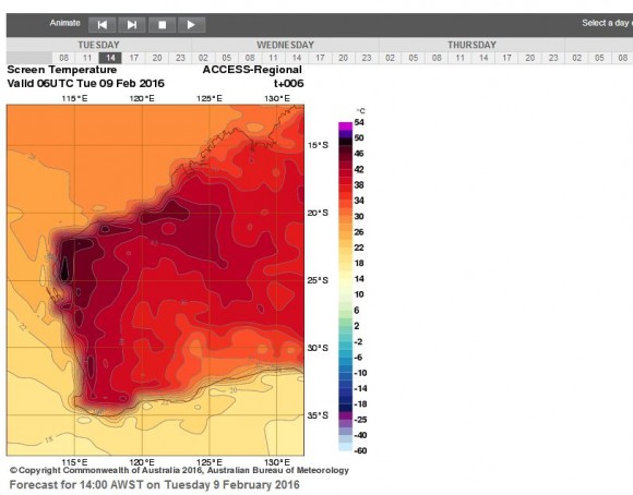
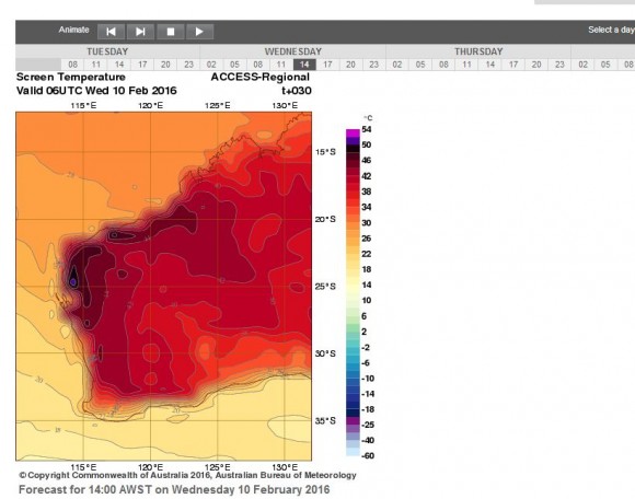
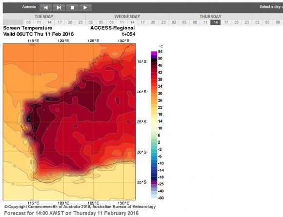
The extent of the heat is shown on the attached Bureau of Meteorology temperature plots (ACCESS MODELS) for 2 pm for Tuesday, Wednesday and Thursday. The plots show significant build up of heat across the north west and Pilbara region extending southwards. Only the exposed coastline along the Great Australian Bight is spared the worst of the heat.
CREDITS
1 - Bureau of Meteorology (Temperature records) and Water and the Land Temperature Plots.
2 - NASA (MODIS Worldview) - Images of Western Australia and Perth acquired 9/2/2016.