https://www.extremestorms.com.au/rain-and-storm-events-for-eastern-australia-25-to-30-april-2025/
As expected, a more significant weather event has unfolded across southeast Australia generally consistent with the forecast models. Some highlights of this event include:
1 - Rainfall affects Central West and Central North Victoria including large parts of Western New South Wales during Friday. However, areas further to the east and west completely miss out.
The initial event affects a narrow corridor stretching from Broken Hill then southeast towards Melbourne with some reasonable totals falling including:
Victoria
- Canary Island (Southwest of Kerang) - 42 mm.
- Kerang - 38 mm.
- Ultima - 37 mm.
- Swan Hill - 35 mm.
- Bendigo Airport - 27.2 mm.
While not drought breaking, the event would certainly assist with the present dry conditions.
New South Wales
- Booligal - 48 mm.
- Trevallyn - 43 mm.
- Pooncarrie - 42 mm.
- Wilcannia - 35 mm.
Again, areas further east or west missed out entirely.
2 - A separate event impacted the Tweed River region of New South Wales where a few localities received over 100 mm of rain for the 24 hours to 9 am Saturday including:
- Burringbar North Arm - 126 mm.
- Uki - 121 mm.
Such totals are limited to a small locality.
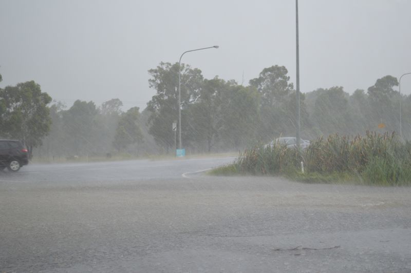
3 - Late afternoon and early evening, a convective thunderstorm developed over parts of southwest Sydney. Given the time of the year, this was not a strong storm and after sunset, the storm weakened. The storm affected areas of Penrith and outer southwest regions (Well to the southwest of Blacktown).
4 - Overnight and into early morning Sunday, much heavier rainfall totals occurred including:
Sydney region
- Badgerys Creek - 30.4 mm.
- Sydney Airport - 35.8 mm.
- Observatory Hill - 38mm.
- Marrickville Golf Club - 53 mm (Highest total across Sydney).
This does not represent all of Sydney because there are areas that had less than 10 mm for the 24 hours to 9 am Sunday morning including areas around Liverpool and Campbelltown where totals were very low:
My home rain gauge recorded only 9.8 mm.
Other significant totals include:
Kempsey region
- Aldavilla - 104 mm.
- Seven Oakas - 120 mm
- Collombatti - 146 mm.
- Turners Flat - 154 mm.
Falls of 50 to 99 mm fell inland from the coast between Coffs Harbour and Kempsey including 99 mm at Bowraville.
Other reasonable totals include:
- Cumnock - 54 mm.
- Cudal Post Office - 57.4 mm.
(Southwest of Wellington Central west New South Wales)
- Barraba - 58 mm (North west slopes of New South Wales).
For the 24 hours to 9 am Monday morning, some significant rainfall totals occurred within Newcastle and some areas just to the north and south of the city including:
- Wyee - 126 mm.
- Mt Barrington - 134 mm.
- Lake Macquarie - 135 mm.
- Crawford - 142 mm.
- Mandalong (Near Morisset) - 154 mm.
Newcastle 102 mm to 139 mm with some instances of flooding as a result.

On the New South Wales South Coast, there were falls of 82 and 83 mm around Ulludulla and Lake Conjola.
For Sydney Observatory Hill, it has been a wet week. In particular, rainfall has been recorded on every single day since Tuesday 22 April 2025 (12 days in total including to May 3). Daily totals have not been excessive but during this time, cumulative totals have topped 168.8 mm which is significant.

Attached to this post are:
- A radar image (Newcastle at 9.44 am Sunday morning) showing an interesting rainfall circulation over Newcastle which pinpoints a small low pressure cell hugging the coastline.
- The weekly rainfall plot for southeast Australia to 9 am Tuesday 28 April 2025. It is interesting to note that the rainfall that fell largely followed the forecast models described within the previous post.