http://www.extremestorms.com.au/storm-chase-north-west-slopes-and-plains-wednesday-29-november-2023/
Another significant weather event impacted large areas of Southern and eastern Australia during the period which in some respects, was a continuation of the conditions experienced during the previous week.
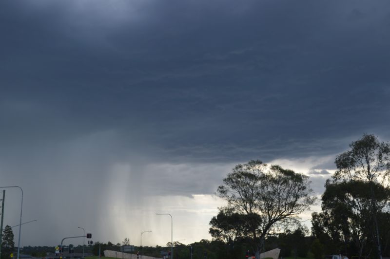
The new week commenced in Sydney with an afternoon shower and storm passing over parts of Western Sydney as shown in the featured image and the attached photo. This storm was relatively small and while there was not a significant amount of lightning, it did provide interesting contrasts across the sky as it passed over.

The photos attached were taken at Doonside looking west Sunday afternoon 26 November 2023.
A stronger event developed over large parts of New South Wales during Tuesday and significant rain and storm activity impacted areas just to the south of Sydney.
Goulburn received 97.2 mm of rain to 9 am Wednesday but much of this fell Tuesday afternoon and evening. The same system crossed over to the South Coast of New South Wales where isolated rainfall totals exceeded 200 mm resulting in flooding.
Such totals were recorded at the following locations to 9 am Wednesday morning:
- Point Perpendicular - 227 mm.
- Jervis Bay - 225 mm.
- Fishermans Repeater - 206 mm.
- Broman - 204 mm.
The heaviest total occurred at Porters Creek located north west of Ulludulla where 351 mm fell.


The whole of the New South Wales South Coast was drenched Tuesday and Wednesday from this event and localized flooding was commonplace.
In addition to this, an area around Wagga Wagga also received substantial falls including 49 mm at Kapooka and 41 mm at Wagga Wagga from separate thunderstorms.


During this period, Jimmy and myself undertook a storm chase to the north west slopes and plains of New South Wales which is covered in a separate report. The images attached to this post were taken during that storm chase.
During Wednesday, significant thunderstorm activity impacted much of Eastern New South Wales. An afternoon thunderstorm passed over Sydney that brought heavy rainfall of 33.8 mm to Sydney’s Observatory Hill, small hail at some locations plus peak wind gusts to 69 km/h at Holsworthy. The storm produced an extensive shelf cloud across the city as it passed over.
Other significant rainfall totals occurred at:
- Bega - 102 mm.
- Hornsby - 32 mm.
- Moruya - 28 mm.
- Goulburn - 27.2 mm.
It should also be pointed out that parts of the Hunter Valley also received high rainfall totals which was evident during our storm chase of Wednesday throughout the region.
During Friday, the focus of the rainfall shifted to south east Victoria where isolated 100 mm totals fell. This included:
- Balook - 167 mm.
- Mt Moornapa AWS - 112 mm.
- Reeves Knob - 102 mm.
Flood warnings were also issued for minor to moderate flooding along rivers including the Mitchell River at Bairnsdale.
Notwithstanding the events of Wednesday to Thursday, late Friday, a series of thunderstorms swept over South East Queensland impacting Brisbane. The system brought widespread 10 to 29 mm rainfall totals across the whole of Brisbane and peak wind gusts of 83 km/h at Gatton and 80 km/h at Amberley(West of Brisbane).


Conditions are now easing following up to 2 weeks of rainfall, shower and storm activity across the region.
I have attached the cumulative weekly rainfall for the New South Wales South Coast and Southern and Eastern Australia for the week ending Saturday 2 December 2023. As shown, there are some remarkable cumulative totals for November which explains why there is flooding across some regions and river systems.