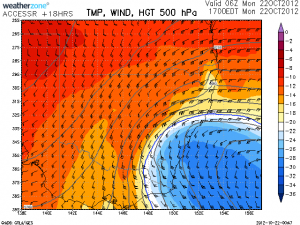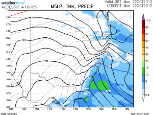
 Looks like another brief cold pool racing up the NSW coast this afternoon with some showers or rain. Perhaps some storms along the coastal fringe! -28C is almost as cold as the other system! Again limiting low level moisture.
We'll see what happens. Does anyone think there will be snow along the coastal ranges on the South Coast?

Snow will likely fall on the highest peaks but probably only lightly and I can't see it settling.
Could there be a possibility of a hailstorm that drops tons of small hail causing flooding and road chaos? There is certainly potential there.
Hi Jeff I was thinking that waterspouts are likely not that lightning is required but I know what you mean stronger cells.
Cold pool coming up the coast – nice!
Does anyone think there will be snow along the coastal ranges on the South Coast?
Amazing though to have two particularly cold snaps in succession! I anticipate thunderstorms along the coast this afternoon near Sydney. Probably some light hail with such cold air aloft. Got my cameras ready.
I am thinking Jeff hail drifts are possible. Apparently that was the case in the last cold outbreak in the Wollongong region.
I can confirm hail drifts from a line of storms I was on at 4am in the morning during the last cold outbreak Jimmy, Gerringong and Gerroa bore the brunt of it
Good on you Stephen that shows passion at the time if the morning!
The cold air activity can be seen off the South Coast on 256km extended radar as I type 12:16pm. This is expected to impact the sydney region about 5pm period. The first 'warm' sector cloud band and associated activity is venturing north from Sydney. There may be a developing cell near Bilpin.
12 years still chasing can never get sick of it! I'd like to add on that cold pool getting the odd bit of intracloud activity showing on the tracker too
I would also think that there is a very good chance of waterspouts. Cells down the coast are already producing lightning.
There are unofficial reports of hail at Rooty Hill – an other reports from anywhere else?