While technically not an extreme weather event, the current weather event impacting coastal New South Wales is interesting due to its longevity and persistence.
With a few exceptions, daily rainfall totals have generally not been high but since May 1, it has rained at some point during the past 11 days which does make this event interesting and noteworthy.
Where I live at Doonside, rainfall has been recorded on every single day this month to date although cumulative totals are not excessive.
The heaviest rainfall total so far during the current event is only 32.5 mm to 9 am Monday morning 6 May. This can be used as a guide as I have a rain gauge available showing what is occurring.
For the whole period at Doonside, the cumulative rainfall total is only 61.4 mm to 9 am Saturday morning 11 May. There have been days when only light showers have occurred and where falls have been less than 1 mm. As such, there have been long dry spells between the showers.
There have also been brief heavy showers boosting rainfall totals further with one such event occurring late Friday evening.
As such, the cloud and showers are persistent and continue at the time of writing.
This is repeated right across Sydney where if one looks at the official observations as follows:
Observatory Hill – May 1 to May 10 – Rainfall has occurred across the first 10 days of May with cumulative totals topping 149.4 mm to 9 am Friday (Or an average of 14.94 mm per day).
Parramatta – May 1 to May 10 – Rainfall has occurred across the first 10 days of May with cumulative totals topping 84.8 mm to 9 am Friday (Or an average of 8.48 mm per day).
Penrith – May 1 to May 10 – Rainfall has occurred across the first 10 days of May with cumulative totals topping 40.6 mm to 9 am Friday (Or an average of 4.06 mm per day).
My rain gauge is generally showing similar results consistent with what is occurring elsewhere.


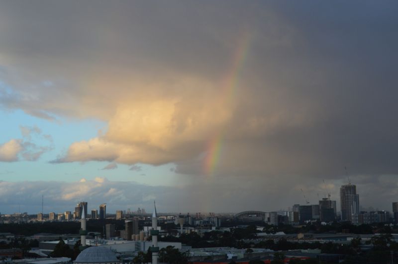
I have taken photos from Auburn with wide expanse views across Sydney. Images show a consistent stream of cloud with coastal showers of varying intensity occurring which is typical with constant onshore winds.
The heaviest falls have occurred along the coastal areas with lighter falls inland.
There are a few exceptions where heavier totals have occurred and there are two areas that generally stand out being:
Sunday 5 May 2024
Isolated 100 mm totals fell at limited locations along the New South Wales coastal strip around the Illawarra region including:
- Point Perpendicular – 155 mm.
- Currarong – 118 mm.
- Foxground – 101 m.
There were several nearby locations that received 70 to 90 mm from this individual event.
Monday 6 May 2024
Some 100 mm plus totals occurred north of Sydney extending into the Newcastle area including:
- Hamlyn Terrace Public School – 165 mm.
- Mardi Dam – 140 mm.
- Whiteman Ridge – 138 mm.
- Erina Heights – 130 mm.
- Nobbys Head – 107 mm.
Areas northeast of Sydney and the Northern Beaches of the city did receive totals of 37 – 80 mm during this individual event. These are not exceptional figures but part of the broader weather system that is impacting the coast.
An inland rain bearing system did form during Saturday and Sunday 4 and 5 May which reinforced what was occurring along the coast and this event brought falls of up to 50.2 mm to 66 mm across parts of Western New South Wales around Cobar, Hillston and Trangie.
Another system has done the same during Friday and Saturday 10 and 11 May which has brought falls of 50 to 73 mm around Lake Cargelligo, Hay and Griffith. This weather system has also reinforced the rainfall along the coast as it tracked eastwards.
As such, Saturday is already a wet day for Sydney as this cloud has already reached the city producing widespread rainfall.
As part of this post, a cumulative 7 day rainfall plot for the period April 30 to May 6 is provided for:
1 – New South Wales South Coast and Illawarra region where some significant cumulative rainfall totals have occurred during the 7 day period. Cumulative falls topped 252 mm at Currarong and 240 mm at Point Perpendicular. Areas receiving cumulative 100 mm totals are limited to small areas.

2 – New South Wales Central Coast and Newcastle which is the other area where 200 mm plus cumulative totals have occurred during the same period.

Particular references should also be made to 9 am Saturday morning 11 May where the South Wales South Coastal again received moderate to heavy rainfall of 40 to 60 mm including 79 mm at Merimbula.
At the time of writing light rain is falling across Sydney making this day 11 where rain has fallen across the city and thus continuing the persistent shower / rain event that commenced on May 1. However final figures for the day will not be known until 9 am Sunday morning when the official figures are made available.