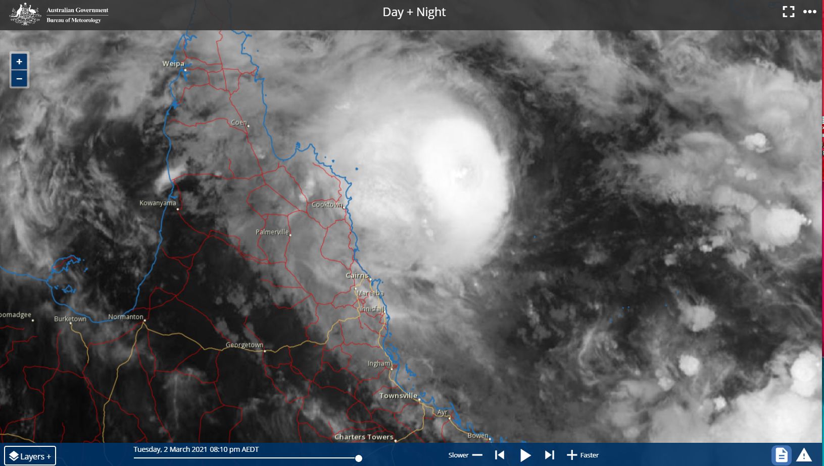
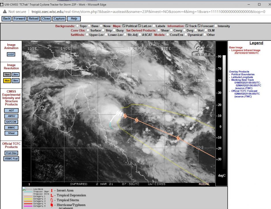
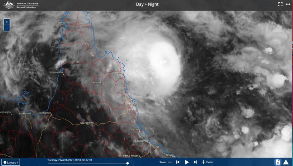
As expected, the tropical depression off the North East Queensland Coast developed into a tropical cyclone late Tuesday and was named Niran.
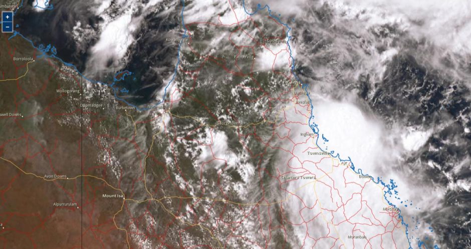
However, the development of the storm has occurred far enough out to sea and as such, its impact onto the coastline has been relatively limited to small areas. Forecast models suggest the storm will now track further to the south east and away from the coastline.
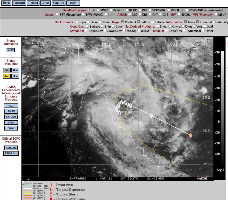
The storm which at the time was a tropical depression and later upgraded to a tropical storm (Tropical Storm 23 by CIMSS) had its greatest impact on the Queensland coastline during the Sunday to Tuesday period. During its development, there were two weather stations that were close enough to the core that recorded the following peak wind gusts:-
1 - Arlington Reef - Peak wind gusts of 117 km/h at 2.50 pm and 2.52 pm - 1/3/2021. This weather station also recorded two additional peak gusts of 115 km/h at 5 pm and 6.30 pm on the same day.
Bougainville Reef - A peak wind gust of 109 km/h occurred at 6 pm and 6.30 pm - 2/3/2021.
Both weather stations are located offshore. While there are reports of banana crops being damaged or lost and some structural damage along the affected coast, the strongest wind gusts occurred mainly offshore and thus damage is much less than what it could have been had the storm been closer to the coast.
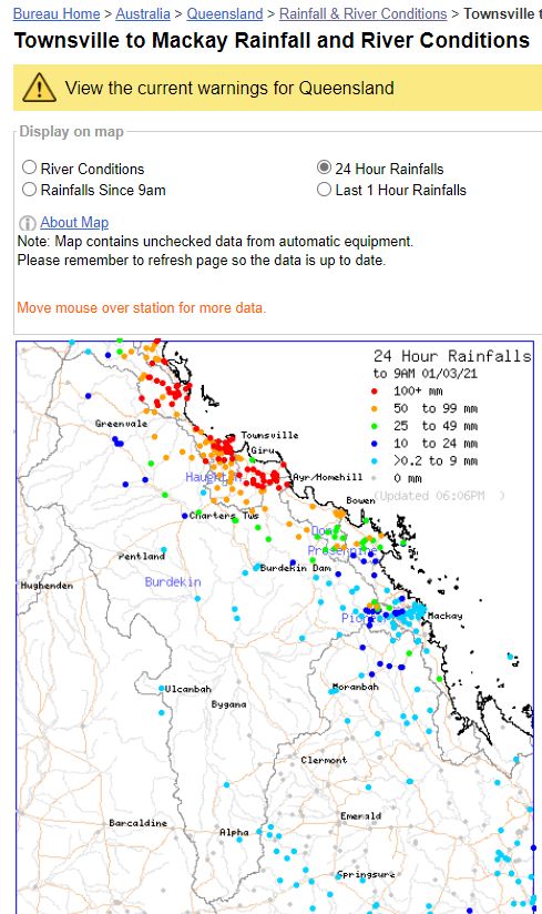
Rainfall - For the 24 hours to 9 am - 2 March 2021
The storm produced significant rainfall along the coastal fringe with the following occurring:-
Clump Point - 276 mm.
Crowley Beach and South Mission Beach - 216 mm.
Clyde - 186 mm.
Saltwater Creek Alert - 177 mm.
Bucklands - 176 mm.
Being the highest totals.
Rainfall - For the 24 hours to 9 am - 1 March 2021
The storm produced significant rainfall along the coastal fringe with the following occurring:-
Alva Beach - 219.4 mm.
Ayr - 196 mm.
Lucinda Post Office - 186 mm.
Groper Creek Alert - 183 mm.
Halifax Alert - 160 mm.
Being amongst the highest totals.
The regions affected by the high rainfall totals are limited to small areas south of Cairns and around Innisfail and Lucinda.
The storm developed into a tropical cyclone late Tuesday afternoon as it slowly moved further from the coast. The CIMSS forecast models shows the storm travelling further towards the south east. It is currently passing over waters around 28C to 29C but will encounter colder waters further south. It is suggested that it will reach maximum intensity as a Category Two system with peak wind gusts at the core of approximately 167 km/h but occurring well out to sea. The storm is expected to weaken once it encounters colder waters.