Radar Imagery
For use with warnings and storm discussion, radar archives and associated links are important and should be used to fascilate further discussion or simply illustrate specific events. The Weather chaser has done a great job in putting such a valuable resource together.
 Latest radar around Australia
Latest radar around Australia Courtesy of the The Weather Chaser Radar Archives
Further Radar Resources
Latest radar around Australia Courtesy of the Bureau of Meteorology
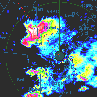
The Bureau of Meteorology has an ever-expanding network of radar around Australia - particularly in the major cities and larger regional towns and cities. In recent years, doppler radars have become the latest types of radar implemented given their ability to track wind changes and boundaries as well as rain fall intensities. Because of their design, they are able to scan at great frequencies with return times of about 6 minutes between radar scans and associated images.
The United States has an extensive nexrad radar network covering a majority of the country.
Latest National Weather Service radar imagery
Courtesy of the National Weather Service and NOAA