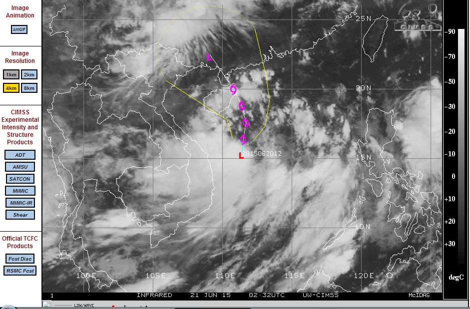
An active low pressure cell off the coast of Vietnam has intensified into a tropical depression over the past 24 hours and is now being watched more closely.
The active low pressure cell is producing heavy rain and thunderstorms and is well supported by warm seas of 30C to 31C. According to the model by CIMSS acquired 21 June 2015, this storm should track northwards towards Hainan Island (China) and Guangdong Provence (Southern China). According to the model, this storm is expected to make landfall in approximately 3 days potentially passing over or near the cities of Haikou, Wuchuan, Zhanjiang and other centres across that region.
The tropical depression is currently located at Latitude 15.4 degrees north and 111.4 degrees east. A typhoon is not suggested but wind speeds are forecast to reach 45 knots at its centre as it traverses north.
The National Centre for Hydro Meteorological (Based in Vietnam) is tracking the tropical depression along its coastline and a Forecasting Numerical Model Prediction produced by the meteorological department is suggesting the following rainfall at 6 hour intervals from the storm:-
12 hours - Maximum rainfall of 30 to 40 mm.
18 hours - Maximum rainfall of 30 to 40 mm.
24 hours - Maximum rainfall of 30 to 40 mm.
30 hours - Maximum rainfall of 40 mm.
36 hours - Maximum rainfall of 40 mm.
42 hours - Maximum rainfall of 40 mm.
48 hours - Maximum rainfall of 40 mm.
54 hours - Maximum rainfall of 20 to 30 mm.
60 hours - Maximum rainfall of 40 mm.
As the storm reaches Hainan Island, the forecast model is suggesting much heavier rainfall of 60 mm for the 6 hour period to 66 hours then dropping back to 40 mm as it makes landfall by 72 hours.
Another model (GFS) is suggesting daily rainfall totals at any location in its path of 50 mm to 100 mm with maybe 150 mm for Tuesday.
Much of the rainfall is suggested to remain out to sea until it approaches the southern coastline of China (Hainan Island).
The GFS is also suggesting large monsoonal type rainfall for Vietnam for Monday and Wednesday of 20 to 40 mm (Monday) and up to 100 mm per day for Tuesday and Wednesday for Central Vietnam as the storm traverses northwards towards the Chinese southern coastline.
The model acquired by CIMSS is attached showing its predicted movement over the next 3 days.